Tāwharanui Point via North and South Coast Tracks might be a mouthful, but this coastal loop delivers some seriously scenery.
It’s not as well-known as other Auckland trails, but think rolling hills, ocean panoramas, and more sheep than people and you’ll get a fair idea of why it should be on your Auckland must-do list.
Keen to explore it yourself? Below you’ll find everything you need to know–from where to start to what you’ll see along the way.
This post may contain affiliate links. Your purchase through these links supports me with a commission, at no added expense to you.
TĀWHARANUI POINT TRACK LOCATION
The trailhead to the Tāwharanui Point via North and South Coast Tracks is located in Tāwharanui Regional Park. This is a protected peninsula 80km north of Auckland. Close enough for a day trip but just far enough to feel like an escape from the city.
HOW TO GET TO TĀWHARANUI
Driving is hands-down the best way to get there.
From Auckland, take State Highway 1 north to Warkworth, then follow signs toward Matakana and Tāwharanui Regional Park. The final stretch into the park is a narrow gravel road, so drive carefully and expect a few bumps.
As of 2025 there’s no public transport directly to Tāwharanui. That said, you can take a bus to Warkworth, transfer to Matakana, then catch a shuttle or taxi the rest of the way. To plan your journey in a little more detail, head to the Auckland Transport Journey Planner.
Hot tip: The Matakana Farmers Market runs every Saturday from 8am–1pm and it’s well worth a visit if you’re passing through.
Parking tips
Tāwharanui operates a gated system to help protect local wildlife. Gates are open from 6 am to 9 pm in summer, and 6 am to 7 pm in winter.
The main car park is around 2km past the entrance, right near the beach. The lot fits about 140 vehicles, but it fills fast on sunny weekends. We arrived just before 9 am on a Saturday and had no trouble finding a space. But by the time we left at 2 pm, cars were overflowing into the Tāwharanui Marine Reserve. Parking is free, but be prepared for a longer walk if you’re arriving later in the day.
KEY INSIGHTS FOR HIKING TĀWHARANUI POINT VIA NORTH AND SOUTH COAST TRACKS
Distance: 9.5 km | 6 miles
Elevation: 370 meters
Duration: 2 hours 15 minutes
Difficulty: Easy
Trail Type: Loop
Open: Year-round
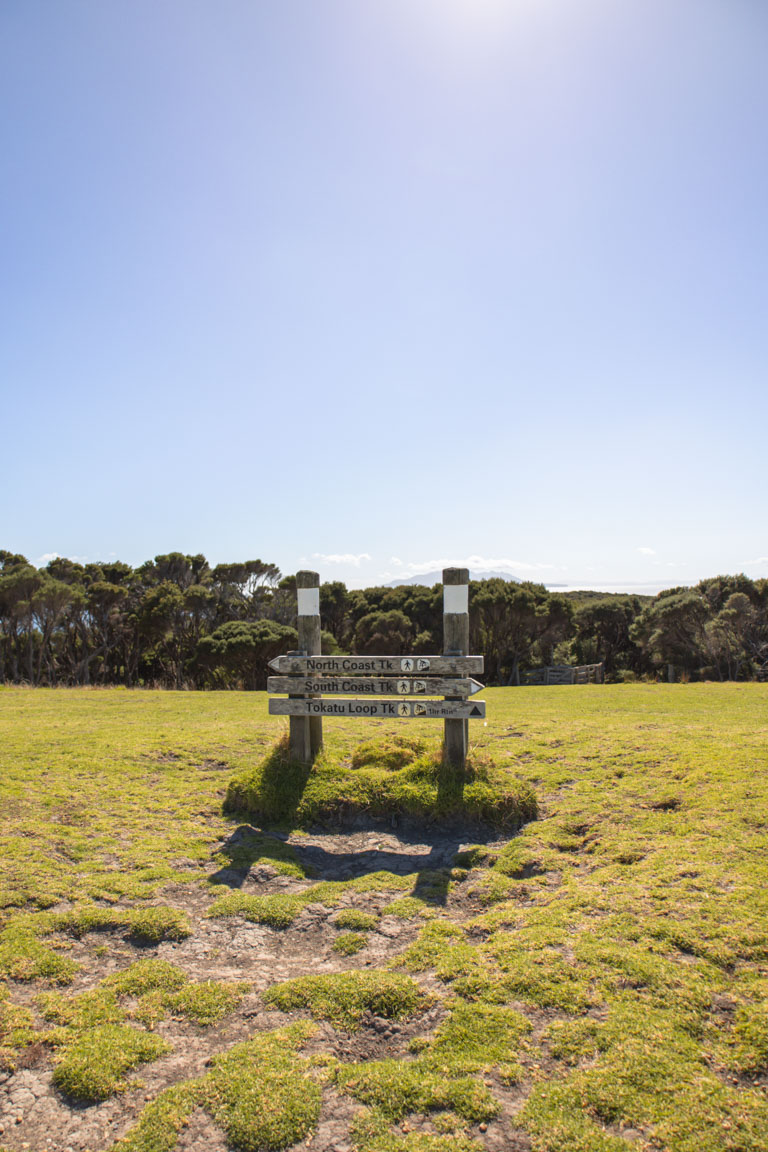
There are a few trail options here, but we wanted to see both sides of the peninsula—so we looped together the North and South Coast Tracks to explore Tāwharanui Point in full. The route connects at the head of the peninsula, making a scenic, varied circuit.
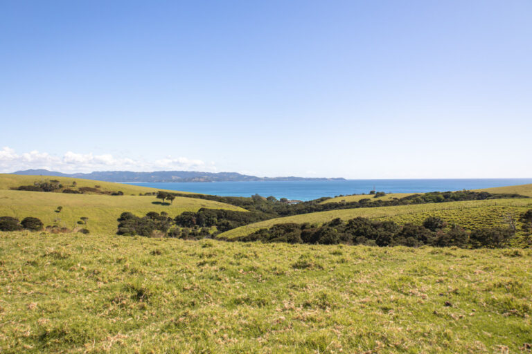
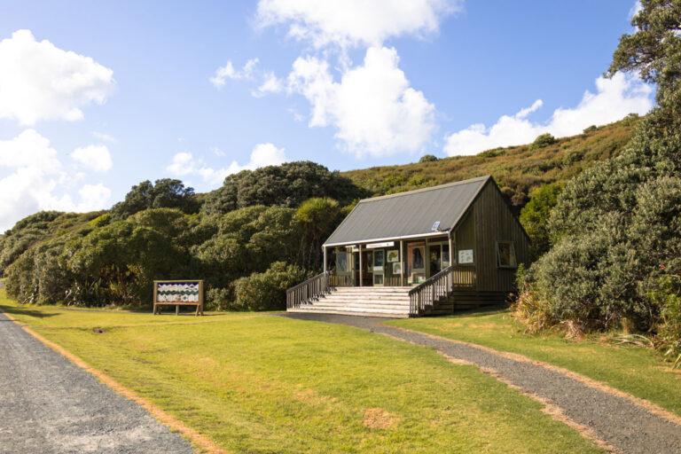
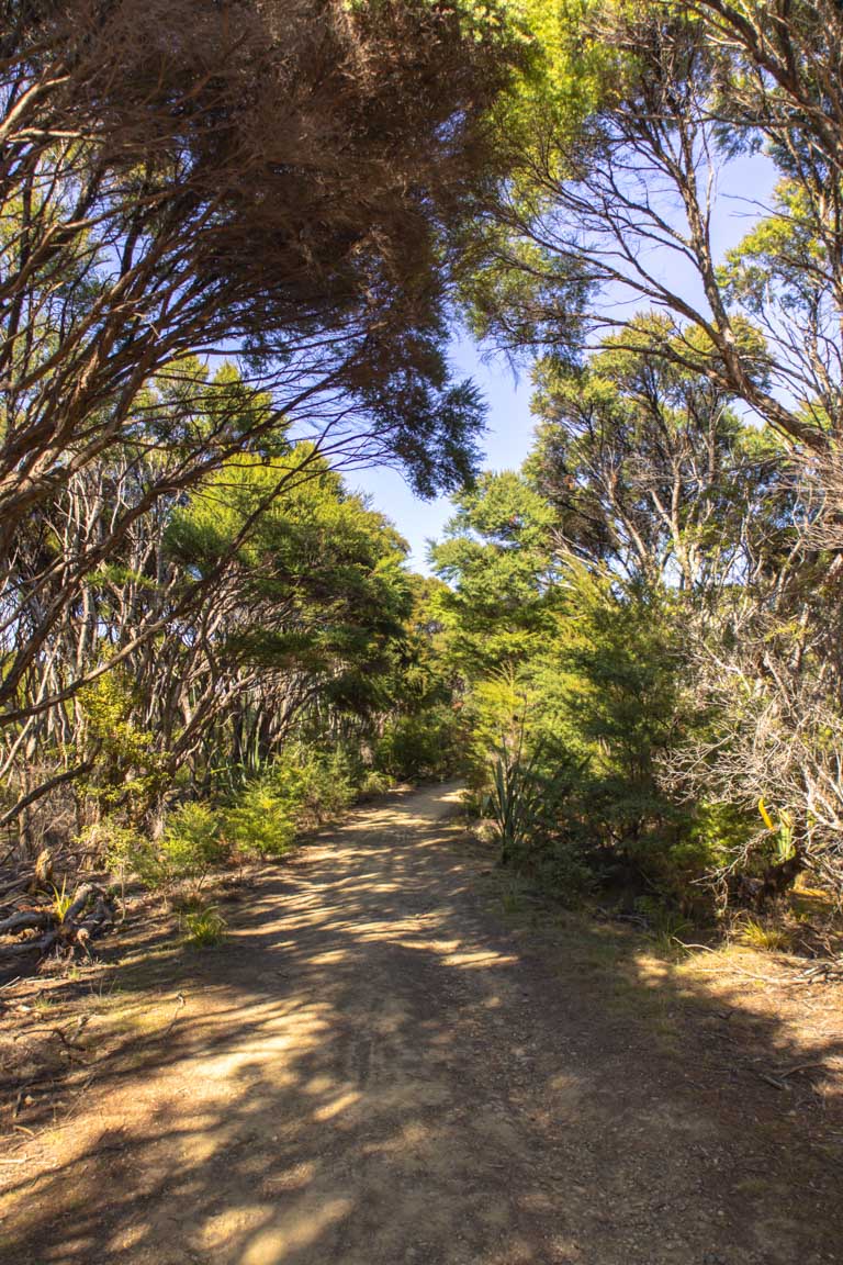
We started our hike clockwise, heading right from the car park where the trail begins on a gravel road. It skirts alongside the beach before passing the information centre and shifting into the South Coast Track, leading you through open, rolling farmland.
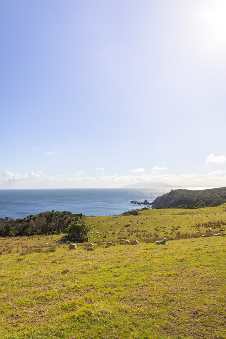
There’s no shortage of farm life out here. On our visit, sheep were everywhere–just make sure to watch your step, because there’s plenty of droppings along the way.
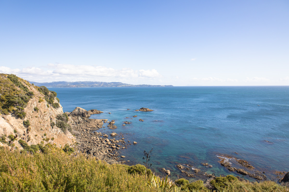
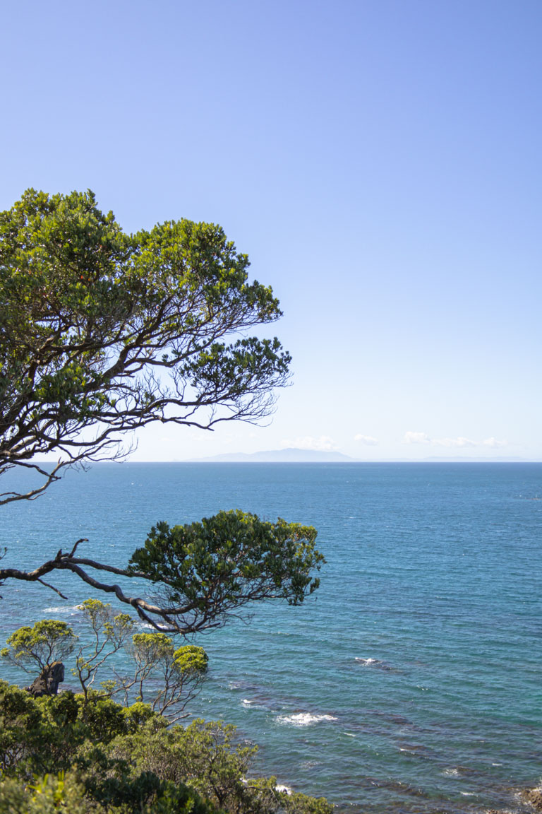
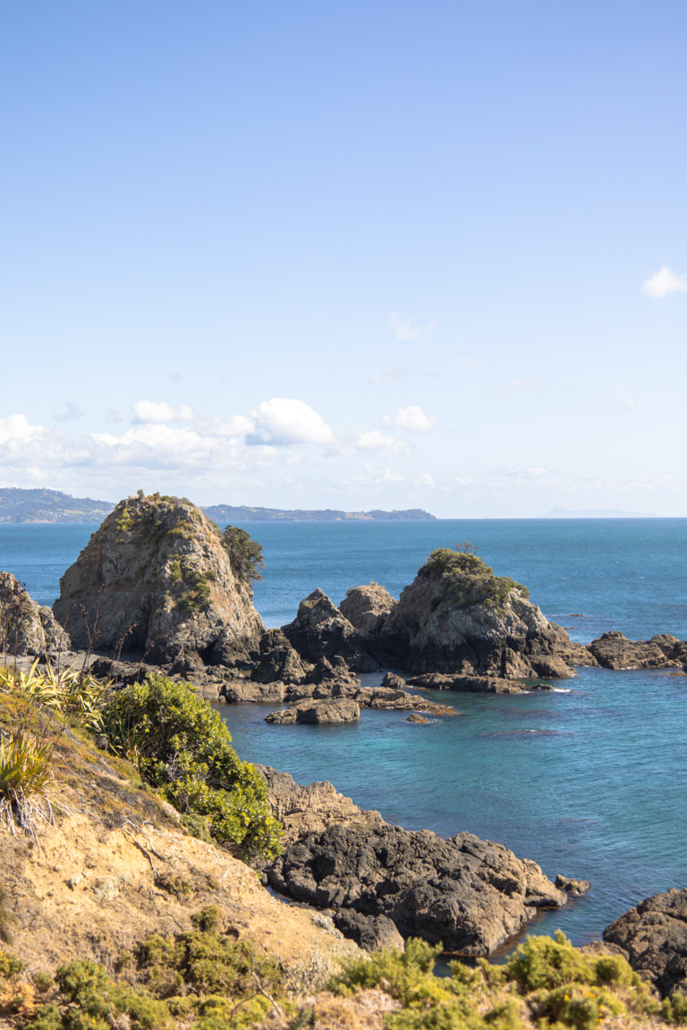
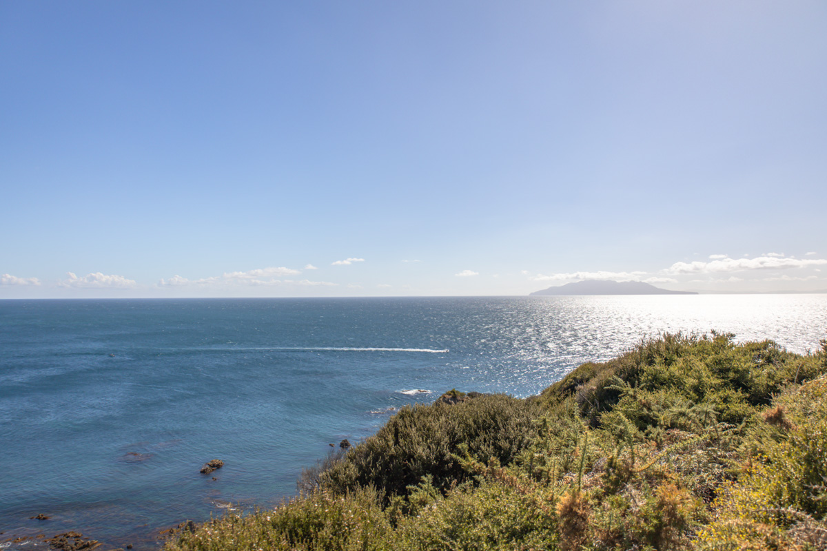
The trail itself is well-marked and easy to follow, with a mostly gentle gradient. That said, there are a couple of solid hills. However, the reward? Sweeping views across the Hauraki Gulf that makes the sweat worthwhile.
At the tip of the peninsula, you’ll reach Tokatū Point Lookout and Tokatū Point Lookout 2 (how fitting), which are both worth pausing at. From there, the track connects to the North Coast Trail. Elephant Point, tucked along this northern stretch, ended up being my favourite lookout of the day.
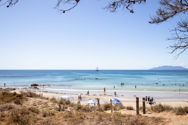
The loop finishes back near the car park, and if you’ve got time, I’d highly recommend wrapping it up with a swim at the beach.
Just make sure to bring a hat and sunscreen on those blue bird days as the trail is exposed, with little to no shade.
BEST TIME TO VISIT TĀWHARANUI
Tāwharanui is stunning in every season, but November to April offers the best weather. You’ll get long days, warm temps, and better chances for a swim post-hike.
In winter, expect cooler, stronger winds and muddy patches, but fewer crowds.
In terms of what time of day, early mornings are definitely the least crowded times to visit. Alternatively, try visit on a weekday–you’re much more likely to have a quieter experience with everyone else at work.
HOW CROWDED IS HIKING THE TĀWHARANUI POINT TRACKS
Like most places, the crowds really do depend on what time you go. The trails in Tāwharanui Regional Park can get a little busy, especially on weekends and public holidays in the summer but people mainly show up for the beach rather than to hike.
If you’re someone who prefers a bit of solitude, I’d highly recommend starting your walk along Tāwharanui Point via North and South Coast Tracks early in the morning (before 9am) or on a weekday.
IS IT SAFE TO HIKE SOLO
Hiking Tāwharanui Point via North and South Coast Tracks is definitely safe to do solo. You’ll usually find people out and about during the day and you’ll be close enough to help if needed. That said, I’d still suggest to take precautions when travelling solo and always let someone know your plans.
It’s also worth noting that there are no lifeguards at Tāwharanui. It’s a pretty safe beach to swim in but always best to prioritise water safety too.
PHOTOGRAPHING TĀWHARANUI BEACH
The views along Tāwharanui Point via North and South Coast Tracks are nothing short of epic–especially if you arrive early.
Morning light not only means fewer people on the trail, but also softer conditions for photography. The golden hour glow highlights the deep blues of the ocean and the vibrant greens of the surrounding hills. Later in the day, the sun can create harsh contrast, making it a bit trickier to shoot. There is also for the most part, no shade on the trail so your photos will be at the mercy of the sun–so be sure to choose your timings wisely.
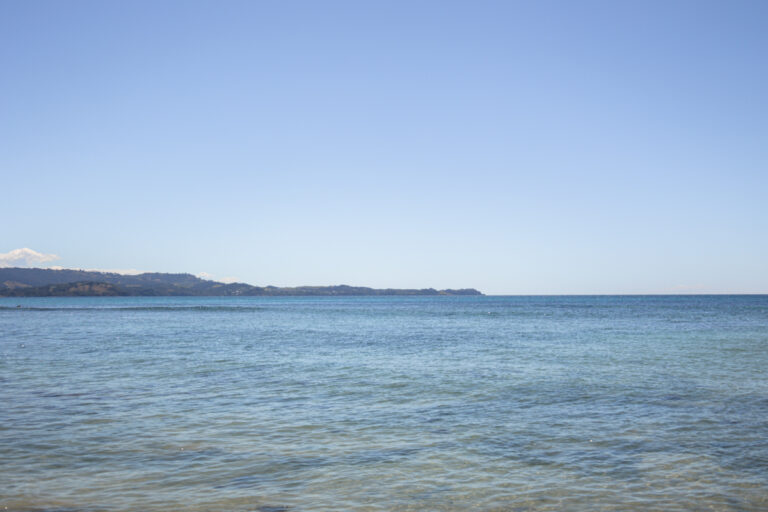
From the Southern track, you’ll also spot Te Hauturu-o-Toi (Little Barrier Island) on the horizon. It makes a beautiful natural backdrop for wider landscape shots. And don’t forget to look out for wildlife! Tāwharanui is a protected marine reserve with loads of native birds, so bring a zoom lens if that’s your thing.
OTHER ACTIVITIES NEARBY
Tāwharanui isn’t just about the hike, there’s plenty more to do once you’ve ticked off the trail.The swimming here is incredible, with clear blue water that’s perfect for a post-walk dip. If you’re into water sports, the area’s also great for surfing, paddle boarding, and even jet skiing on calm days.
Beyond the beach, the park doubles as a pest-free wildlife sanctuary, so it’s a brilliant spot for birdwatching.
Just outside the park, Matakana village is worth a stop. Think boutique wineries, local art galleries, and the famous Matakana Farmers Market if you’re visiting on a Saturday. And if you’ve got more time, Goat Island Marine Reserve is only a short drive away and offers fantastic snorkelling and diving, too.
There’s honestly no shortage of things to do, whether you’re here for a day or a full weekend.
OTHER COASTAL WALKS IN THE NORTH ISLAND
If you like this kind of hike, you may also enjoy my list of the top coastal hikes in the North Island. They all offer stunning views and you can take your pick of the easier or more difficult trails.
SUMMARY
In this post, we explored everything you need to know about hiking Tāwharanui Point via North and South Coast Tracks. From where to start, what to expect, and how to make the most of it.
This trail is a chance to soak up some pretty incredible views, spot native wildlife, and enjoy a peaceful part of the region that’s perfect for a day trip from the city.
If you’re planning more hikes around Aotearoa, check out our ultimate New Zealand destinations for detailed itineraries, tips, and hidden gems or to explore further, our comprehensive worldwide travel guides will have you covered.
FAQs
What does Tāwharanui mean?
Tāwharanui is a Māori word meaning “the abundant edible bracts of the kiekie vine”.
Can you swim at Tāwharanui Beach?
Absolutely! Swimming is popular and encouraged at Tāwharanui Beach, but be aware that there are no lifeguards on duty.
How long is the Tāwharanui walk?
There are several walking tracks, ranging from short 30-minute strolls to longer hikes. We opted to walk to Tāwharanui Point via North Coast and then South Coast Track on our return. This took us just over two hours.
What is there to do in Tāwharanui?
Activities like swimming, surfing, hiking, birdwatching, snorkelling, and enjoying a picnic are all worthy of your time in Tāwharanui. The park’s predator-free sanctuary makes it a haven for native wildlife.
What time do the gates close at Tāwharanui?
The park gates are open from 6am to 9pm in summer and from 6am to 7pm in winter.
Is Tāwharanui a surf beach?
Yes, Tāwharanui Beach has consistent surf breaks. It’s more of a swimming beach than a surf beach but you’ll definitely find surfers out enjoying the waves.
Top Travel Resources to Plan Your Next Trip
Finding the Best Flights
Skyscanner: A great platform for comparing flight prices across airlines and routes.
Omio: Perfect for comparing not just flights but also trains and buses, especially for European travel.
Booking Your Stay
Hostelworld: Ideal for those specifically looking to budget on their travels and seeking hostels, guesthouses, or shared accommodations.
Booking.com: With a massive selection of hotels, apartments, and unique stays, this platform additionally has deals for frequent travellers.
Trivago: A powerful search engine for comparing hotel prices across multiple booking sites to find the best deals for your stay.
Discovering Amazing Activities
GetYourGuide: My go-to for booking tours, tickets, and activities in New Zealand and worldwide.
Everything New Zealand: A must for anyone traveling to New Zealand. This platform offers a curated selection of tours, activities, and adventures to make your Kiwi trip epic.
G Adventures: For small-group tours with a focus on sustainable and authentic travel, G Adventures is unbeatable.
Capturing Your Memories
MILK Books: Create stunning photo books to preserve your travel memories. Expect high-quality prints and customisable designs.
These links are affiliate links. If you book through them, I earn a small commission at no extra cost to you. Your support helps me keep sharing guides like this. Thanks for helping fuel the next adventure!
LATEST FROM THE BLOG
LIKE THIS POST? PIN IT HERE
QUICK SUMMARY OF TĀWHARANUI POINT VIA NORTH AND SOUTH COAST TRACKS
- Tāwharanui Point Loop Hike Auckland: Scenic 9.5 km coastal walk in Tāwharanui Regional Park
- Key Stats: 370m elevation, 2-2.5 hrs, easy loop, year-round
- Highlights: Ocean views, rolling farmland, sheep, native birds, beaches, lookouts (Tokatū, Elephant Point)
- Location & Access: 80km north Auckland; drive via Warkworth-Matakana; gated park (6am-9pm summer)
- Best Time: Nov-Apr warm/swim; early mornings/weekdays for quiet
- Tips: Sunscreen/hat (exposed), post-hike swim, Matakana market stop
- Nearby: Surfing, birdwatching, Goat Island snorkel