Ready to explore some of the best day hikes in NZ? This guide rounds up 18 of the best trails across both the North and South Islands, from wild coastal cliffs to alpine lakes.
Whether you’re after a casual walk with big views or a heart-pumping climb to a panoramic summit, there’s something here for every kind of hiker.
Each track in this list has been personally explored and chosen for its one of a kind scenery, and sheer wow-factor–because let’s face it, if you’re only doing one walk in a region, it better be a good one. I’ve included key details like distance, difficulty, and local tips to help you plan, plus links to my full guides for deeper dives and photography advice.
Without further ado, let’s get into the best day hikes in NZ.
This post may contain affiliate links. Your purchase through these links supports me with a commission, at no added expense to you.
NORTH ISLAND HIGHLIGHTS
MOUNT TAUHARA
Location: Taupō
Distance: 7.3 km | 4.5 miles
Elevation: 520 meters
Duration: 2 hours
Difficulty: Medium
Trail Type: There-and-back
Open: Year-round
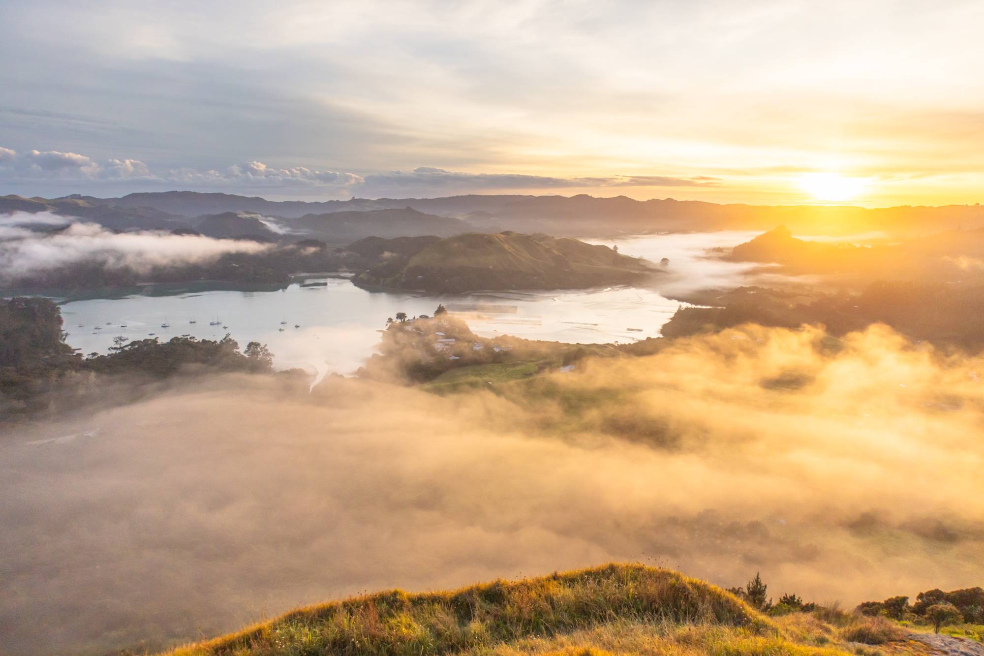
If you’re after a rewarding summit hike without the crowds, Mount Tauhara delivers. This 7.3km return track takes you over farmland and through native bush to panoramic views over Lake Taupō and the central North Island. I’ve recently hiked this trail and it’s definitely a 2025 favourite.
It took us a little over two hours return, but we spent quite a bit of time at the top. The summit view is one of the best, and surprisingly quiet for sunset. Aside from one other couple we were the only ones up there enjoying the view.
If you’re road-tripping the Central Plateau, this underrated trail is a no-brainer. My full Mount Tauhara guide has directions, tips, and photography advice to help you make the most of it. I’d highly suggest to add this one to your North Island must-see list.
OMANAWA FALLS
Location: Tauranga
Distance: 2.7km | 5 miles (full track)
Elevation: 175m
Duration: 1 hour
Difficulty: Easy – Medium (depending on the route you decide to take)
Trail Type: There-and-back
Open: Year-round
Just outside Tauranga, Omanawa Falls is a manageable one hour walk that rightfully earns a spot among the best day hikes in NZ.
After being closed for several years, the trail reopened in December 2023 with thoughtful upgrades and now anyone can visit. You’ll stroll through rich native forest, with multiple lookouts of the falls. Wairere Tapu is one of them and for a bit more effort, take on the 750 steps (yes, 750!) split between the ascent and descent to Te Harikoa Lookout. I’d say that the extra steps are worth it for the closer view of the falls and surrounding greenery.
The Tauranga City’s website has a detailed map which outlines the trail if you’d like to research in advance. Alternatively, my full Omanawa Falls guide has all the insider tips to help you plan your visit.
MOUNT PAUANUI
Location: Pauanui, Coromandel
Distance: 5 km | 3.1 miles
Elevation: 400 meters
Duration: 2 hours
Difficulty: Medium
Trail Type: There-and-back
Open: Year-round
Mount Pauanui is the kind of hike that punches above its weight making it an absolute must for the list of best day hikes in NZ. It’s a 5km trek with about 400m of elevation gain, making for a solid two hour climb through lush native bush. But the payoff? A summit view that shows off Pauanui and the Coromandel Peninsula in all its coastal glory.
Heads up that this trail can get quite busy during the day. You’ll have some company on the track no matter what, but if you’re up for an early start, sunrise is the best. You’ll have incredible soft light and a much cooler climb.
For the full lowdown, check my Mount Pauanui guide.
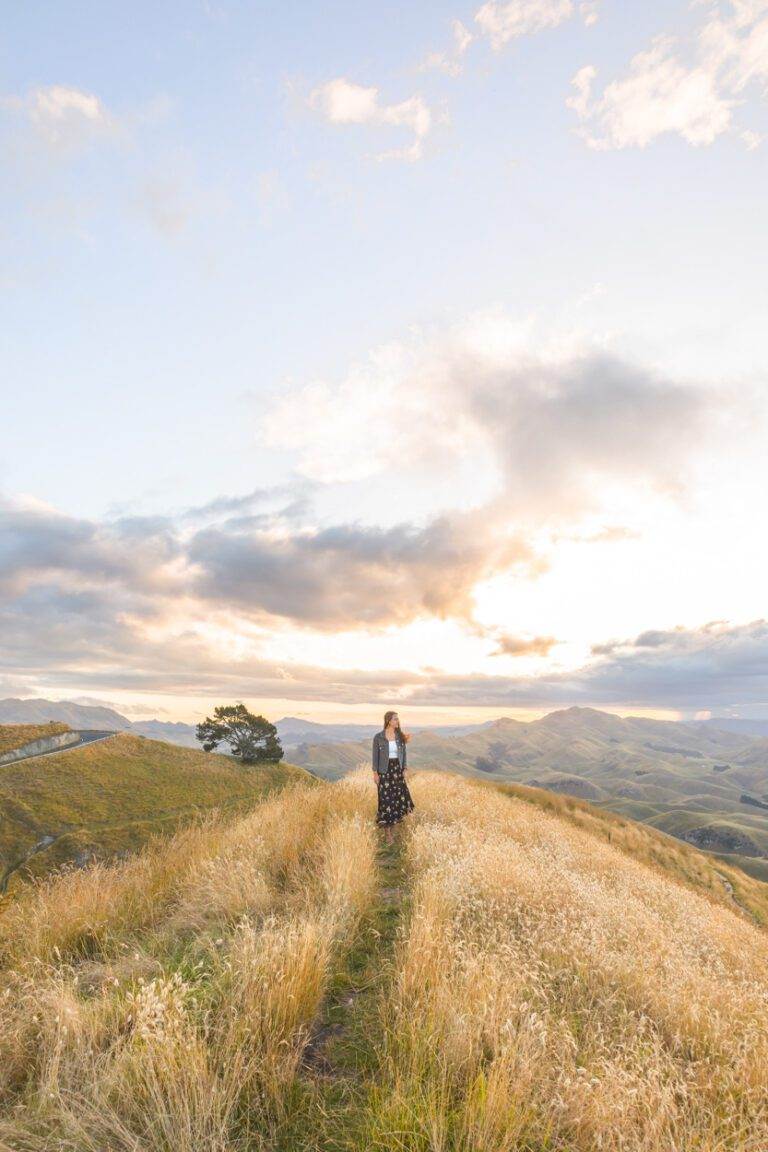
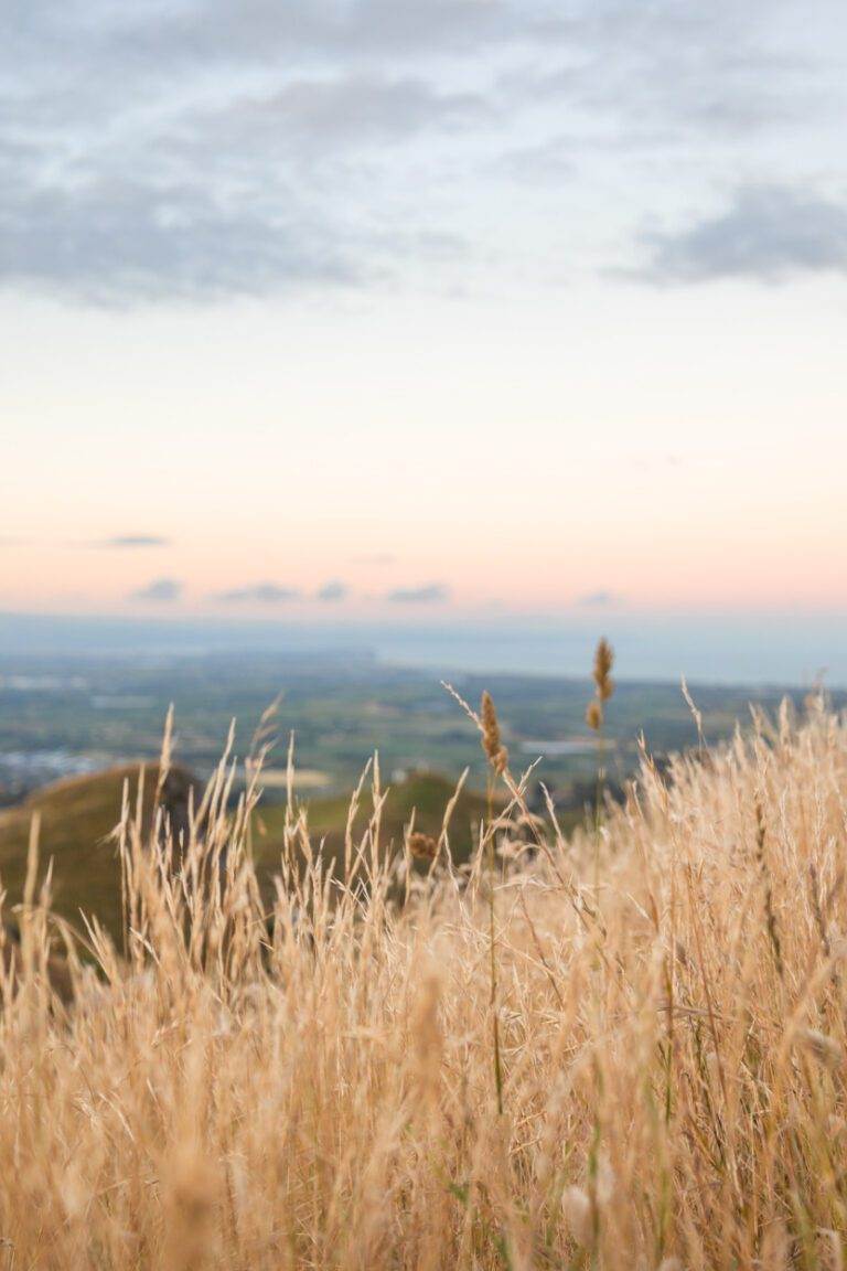
TE MATA PEAK
Location: Hawkes Bay
Distance: 4.3km | 2.7 miles
Elevation: 206 meters
Duration: 1 hour 30 minutes
Difficulty: Easy
Trail Type: There-and-back
Open: Year-round
Te Mata Peak is the perfect sunset spot for anyone visiting the Hawkes Bay. The hike which will take you roughly an hour and a half, starting from the Te Mata Peak Road capark, will give you time to soak in all the views as you slowly progress up the mountain.
The views of rolling hills and coastline from the top? Chef’s kiss. You can drive or bike if you’re not feeling up to walking, but parking can be quite tight.
Whenever I have visited Te Mata Peak, it’s been for sunset. I’ve heard sunrise is equally beautiful but there is something about that afternoon glow. Unfortunately, this is quite the popular time so expect company but know that there are many different spaces to roam so plenty of room for everyone.
For more tips and route options, check out this guide.
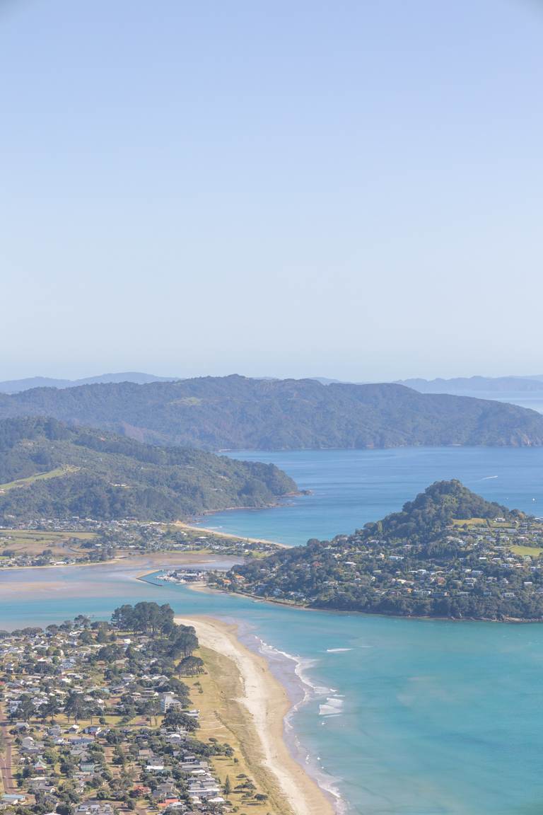
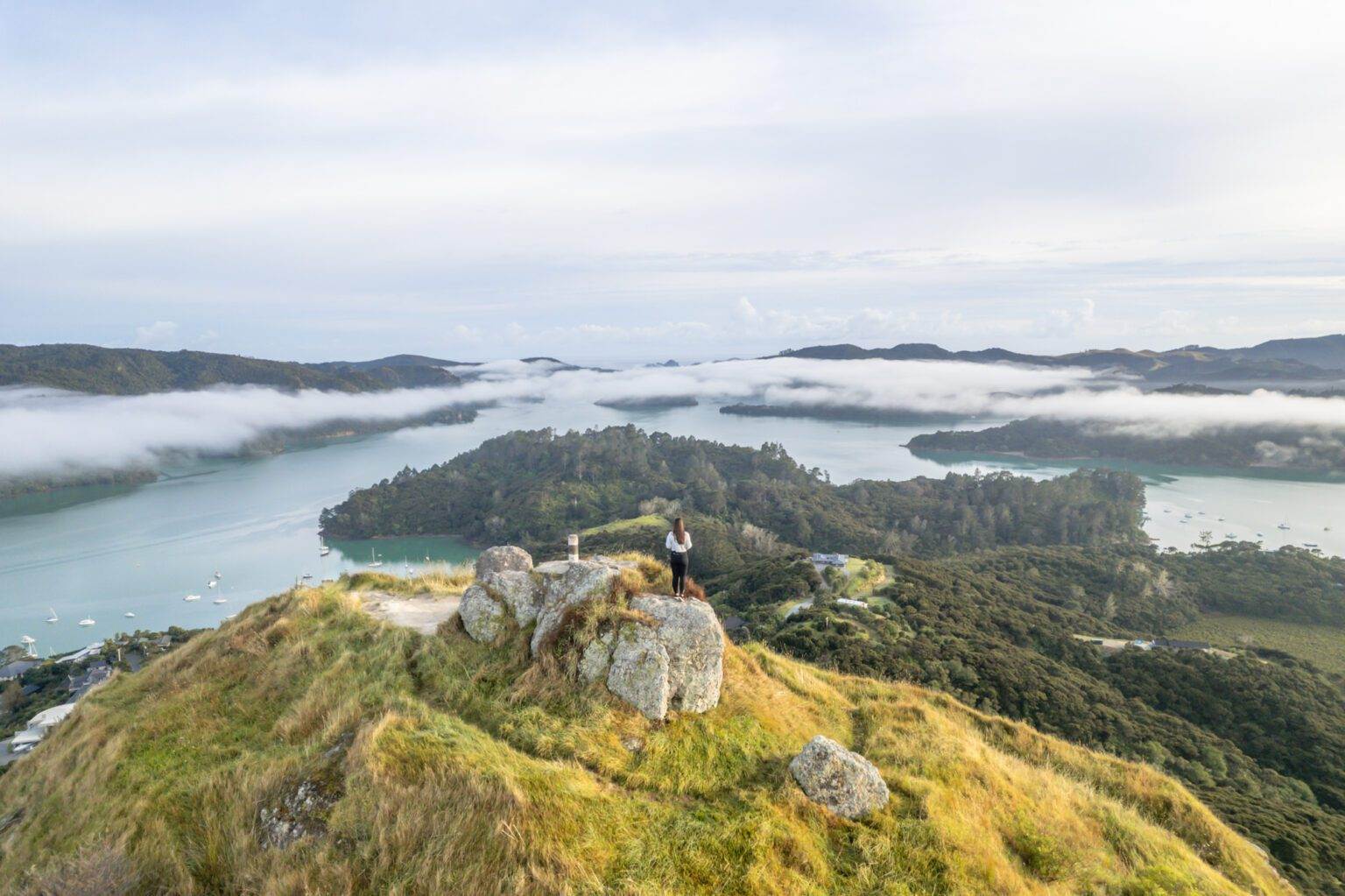
ST PAULS ROCK
Location: Bay of Islands
Distance: 1.1 km | 0.7 miles
Elevation: 100 meters
Duration: 30 minutes
Difficulty: Easy
Trail Type: There-and-back
Open: Year-round
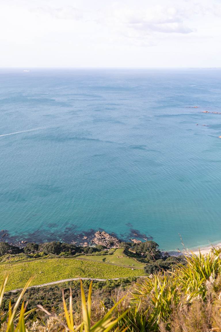
For a short and sweet burst of adrenaline and views, St Pauls Rock is a hike worth exploring, just outside Whangaroa. It’s a steep scramble to the top, aided by chains that leads to a 360° lookout over harbour, hills, and coast. This makes it a perfect quick stop on the list of best day hikes in NZ.
Sunrise here is an incredible time that rewards you with stunning light and we also didn’t come across anyone else on the trail. It’s short but packs a punch, perfect if you’re tight on time.
Being one of the best short hikes with a view, it would be silly not to include it. I’ve kept it short here, but if you’re planning something similar, my full write-up has all the information you need.
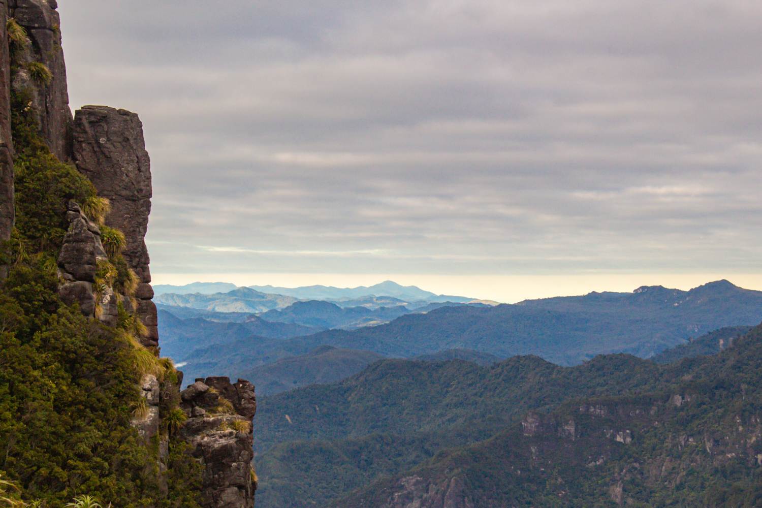
THE PINNACLES (KAUAERANGA KAURI)
Location: Coromandel
Distance: 14.2 km | 8.8 miles
Elevation: 826 meters
Duration: 4 – 5 hours
Difficulty: Medium – Difficult
Trail Type: There-and-back
Open: Year-round
The 14.2km Pinnacles trek is one of the more popular Kiwi day hikes on the North Island. The 826m climb through lush forests, swinging bridges, and ladders will test you but the reward at the summit is incredible. You’ll have panoramic views spanning Coromandel Forest Park and the Waikato region. I caught the sunrise here and I can imagine sunset would be stunning too.
Whilst it is normal to complete within a day, if you want to extend the adventure, snag a spot at Pinnacles Hut near the summit.
Curious to know more? I’ve got you covered in my full blog post here.
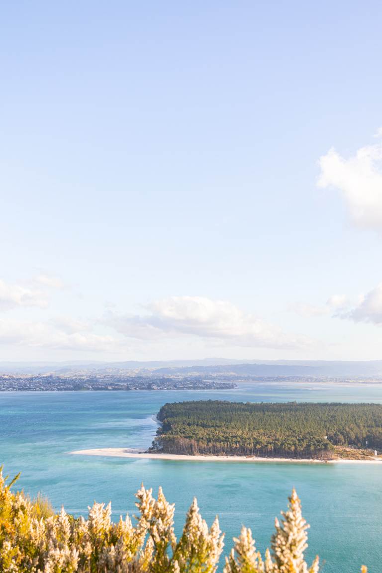
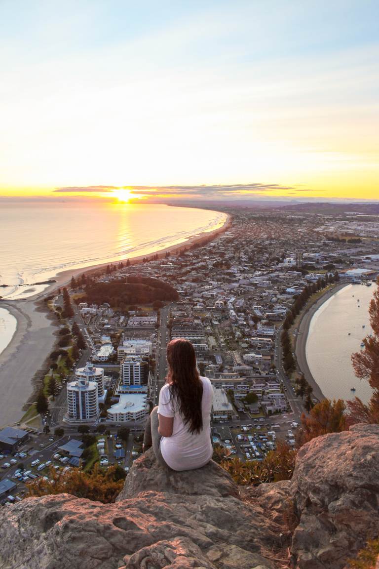
MOUNT MAUNGANUI SUMMIT TRACK
Location: Bay of Plenty
Distance: 3.9 km | 2.4 miles
Elevation: 207m
Duration: 1 hour
Difficulty: Easy – Moderate
Trail Type: Loop or there-and-back
Open: Year-round
Mount Maunganui’s summit track is a Bay of Plenty must-do. This easy-to-moderate hike packs a punch with just 207 meters of elevation.
The most popular trails which provide you with some incredible views cut into the side of the mountain but there’s also internal walking tracks that have more of a forestry type feel. The steep climb up is a legit cardio blast, but once at the summit, you’ll be rewarded with 360° views of Tauranga Harbour, Matakana Island, and the Pacific Ocean.
Sunrise hikes are usually quite busy and with good reason, so prepare for a bit of company but the view makes it all worthwhile, crowds or not.
If you’d like to know more my Mount Maunganui guide has all the juicy details.
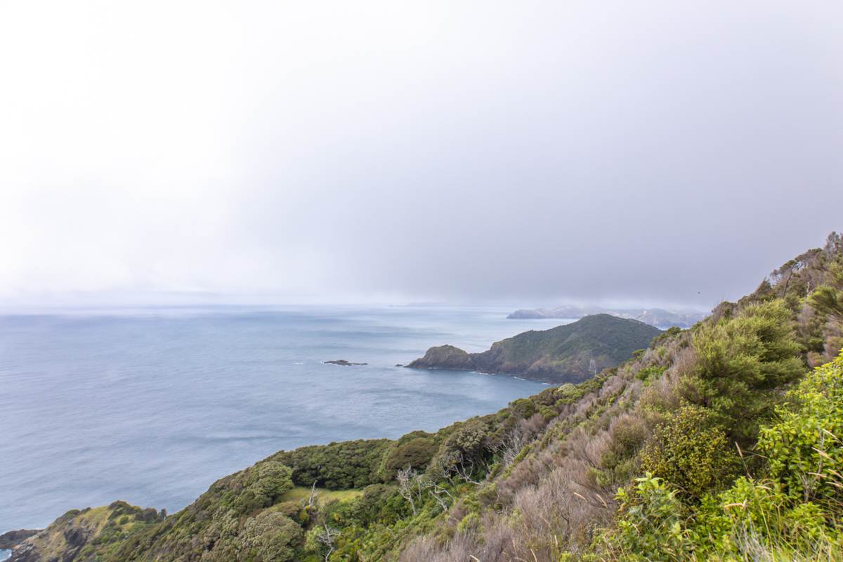
CAPE BRETT
Location: Northland
Distance: 30.3km | 18.8 miles
Elevation: 1791m
Duration: 11 – 12 hours
Difficulty: Difficult
Trail Type: There-and-back
Open: Year-round
Cape Brett is the tough nut for serious hikers with 30.3km over 11-12 hours of rugged coastal terrain, making it one of the best day hikes in NZ for those seeking a true challenge. And yes, it can be done in a day however, I’d highly suggest an overnighter for this one.
The trail carves through native bush, tackles steep ascents, and has you walk mountain ridges. Along the way you’ll have incredible Bay of Island views. Think jagged coastlines, lush native forest, and sweeping ocean panoramas. All of which you’ll see more of at Cape Brett’s historic lighthouse and DOC Hut.
But make no mistake; this is an advanced hike so I wouldn’t underestimate it. However, if you’d like to shorten the distance, there’s the option to take a water taxi to or from Deep Water Cove.
If you’re after a coastal challenge with big rewards, the Cape Brett Track delivers in spades. I’ve written all about my experience and top tips in my full guide here.
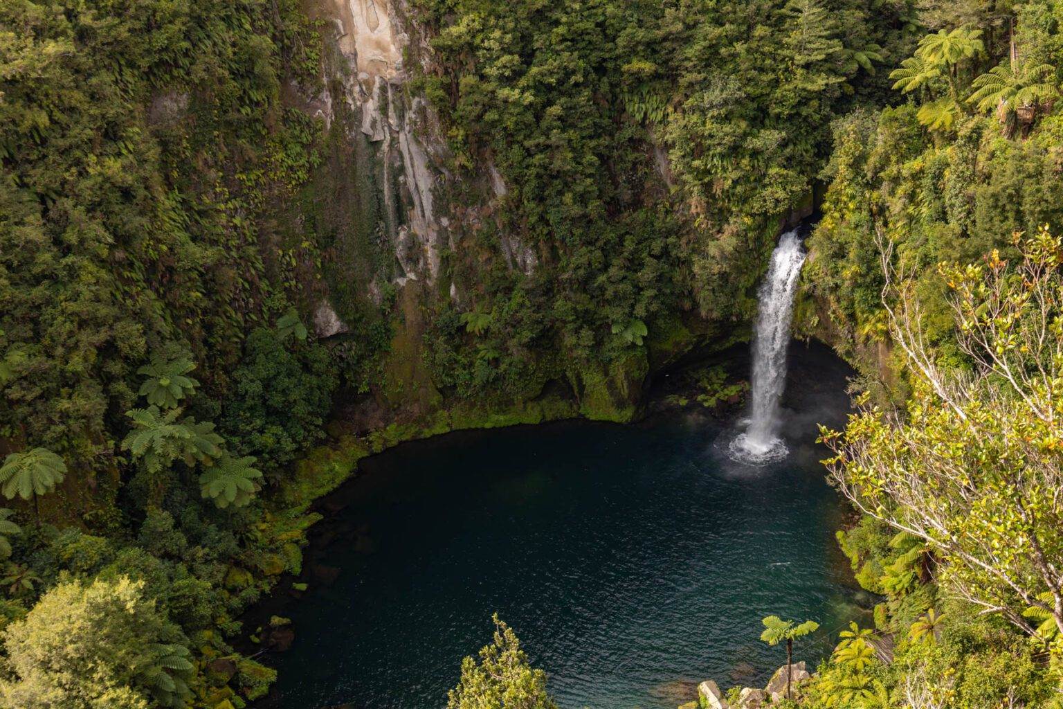
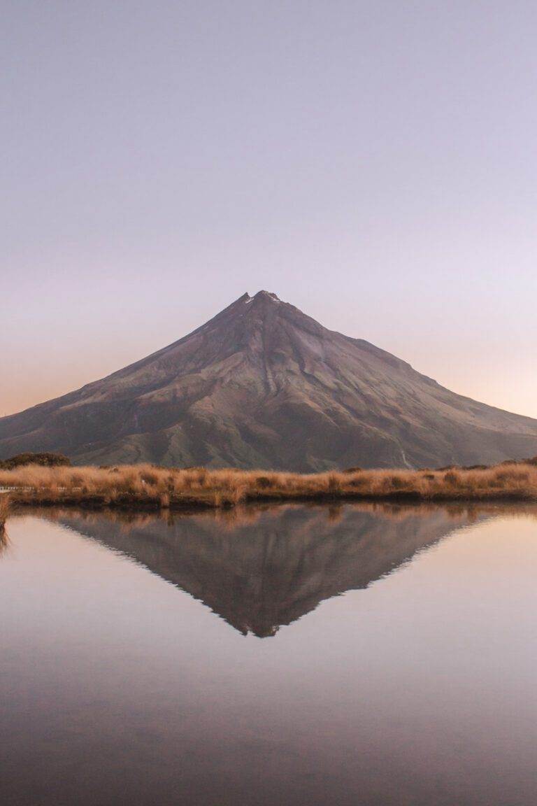
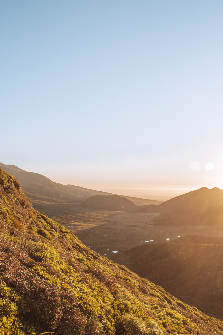
POUAKAI TARNS AND HENRY PEAK LOOKOUT
Location: Taranaki
Distance: 12.4 km | 7.7 miles
Elevation: 777m
Duration: 6 hours
Difficulty: Moderate
Trail Type: There-and-back
Open: Seasonally
If you want one iconic New Zealand shot, Pouakai Tarns is it. This 6 hour hike climbs Mangorei Track to the tarns that perfectly mirrors Mount Taranaki.
The alpine setting with sweeping coastline views is pretty incredible and if you get it on a good day with no wind, even better.
Sunrise or sunset here means the sky can light up in wild colours but remember, the mountain’s notorious for hiding behind clouds, so patience pays off. Staying at Pouakai Hut makes the timing flexible, but book early as it does fill fast. It’s also best to note that it is a tough trail, but it’s well-maintained and has all the best parts of hiking in New Zealand – native bush, incredible views and beautiful mountains.
Henry Peak Lookout is an additional 30 minute hike from the Tarns and requires a final ascent up ladders. It’s steep but worth it as you’ll have an elevated view of the mountain and its surroundings with scenery stretching all the way to Mount Ruapehu.
For the full story and tips, my Pouakai guide is your go-to.
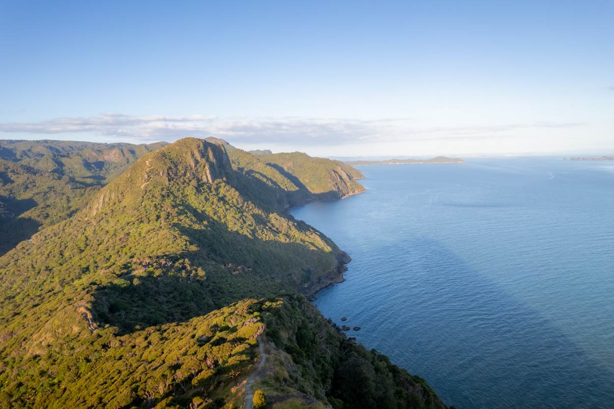
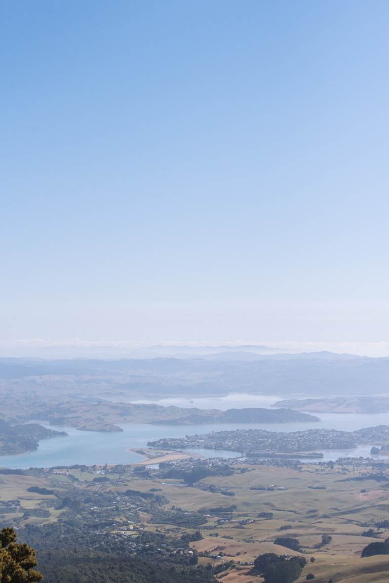
OMANAWANUI
Location: West Coast, Auckland
Distance: 7.7 km | 4.8 miles
Elevation: 347m
Duration: 2 – 3 hours
Difficulty: Moderate
Trail Type: There-and-back
Open: Year-round
Brace yourself for over 2,400 stairs on this 7.7km, 3 hour Auckland classic.
Omanawanui Track is steep and exposed but delivers some of the best views in the Waitākere Ranges, stretching acros Manukau Harbour, Whatipū Beach, and endless coastline. I’ve done this one a few times now and it’s what I would consider a “type 2 fun” hike. The views are literally perfect but the stairs are absolutely brutal.
It’s still on the list of best day hikes in NZ though, because hands down, it’s worth it.
If you’re ready to take it on my Omanawanui guide breaks down everything you need to know.
DUKES NOSE LOOKOUT
Location: Northland
Distance: 10.8km | 6.7 miles
Elevation: 518 meters
Duration: 5-6 hours
Difficulty: Medium–Difficult
Trail Type: There-and-back
Open: Year-round
Just 40 minutes from Whāngarei, the hike to Duke’s Nose rewards you with seriously great views over the Bay of Islands. This is one of the best day hikes in NZ for those looking to combine challenge and stunning scenery.
The track is mostly gentle, but don’t be fooled, it still throws a few challenges your way. Expect stream crossings that require decent balance, and a boggy section where you’ll be navigating across a swamp (yes, swamp). The final stretch? A steep, vertical climb with a handrail to help you haul yourself up.
But trust me, it’s all worth it for that incredible 360 degree summit view across Waitepipi, Te Were, and Pekapeka Bays. I can also highly recommend sunrise for some beautiful and much less crowded views. Also, if you’re keen to turn this into an overnight mission, Lane Cove Hut is a solid option. From there, it’s just a 30 to 45-minute walk to the lookout.
Want all the details? My full Duke’s Nose guide breaks down everything you need to know for this Northland adventure.
MOUNT KARIOI
Location: Raglan
Distance: 7.9 km | 4.9 miles
Elevation: 640 meters
Duration: 3 hours 30 minutes
Difficulty: Medium
Trail Type: There-and-back or loop
Open: Year-round
Mount Karioi’s 7.9km hike packs a punch with 640m of elevation, and depending on what time of year you visit, hip-high grass, sand, chains, and muddy conditions. The terrain can be slippery but the views across the Tasman Sea, the western coastline of the North Island and native bush make it a worthy challenge and a contender on the list of best day hikes in NZ.
When it comes to hiking Mount Karioi, there are a few options to choose from. You can opt for a there-and-back journey, choosing either side of the mountain to explore, or venture across from one side to the other.
We opted for the North trail, there-and-back to dodge transport hassles. Additionally, this route allowed us to incorporate the cliff view walk, which I also highly recommend.
Want the full scoop? I’ve written a deep-dive over here.
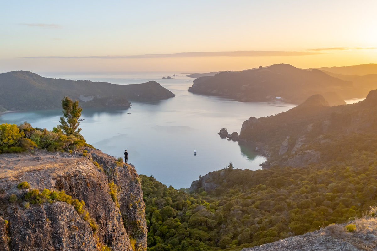
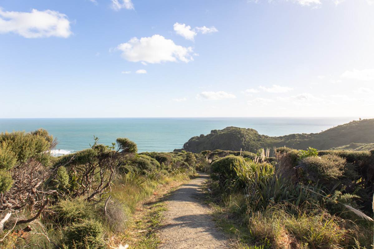
COMANS TRACK AND MERCER BAY LOOP
Distance: 7.2km | 4.5 miles
Elevation: 490m
Duration: 2 hours
Difficulty: Easy
Trail Type: Loop
Open: Year-round
Comans Track, which also includes the Mercer Bay Loop is a two hour gem near Auckland.
The trail initially winds through native bush before linking to the Mercer Bay Loop, which treats you to some of the most dramatic cliffside ocean views in the region. It does get busy during the day as it is one of the more popular trails in the Waitākere Ranges so early mornings, late afternoons and off peak seasons are definitely the best time. I’d make a point to visit during golden hour as it takes the view to the next level.
It’s also beginner-friendly and well maintained, making it an ideal intro to Auckland’s wild West Coast.
This is just skimming the surface–head over to the full post on Comans Track or take a look at my Mercer Bay Loop post for all the details.
SOUTH ISLAND HIGHLIGHTS
BOB'S COVE
Location: Queenstown
Distance: 10.8 km | 6.7 miles
Elevation: 270 meters
Duration: 2 hours 30 minutes
Difficulty: Easy
Trail Type: There-and-back
Open: Year-round
Need a quick nature fix that doesn’t chew up your whole day? Bob’s Cove is your spot.
The journey to Bob’s Cove is fast and incredibly scenic. It’s a 15 minute drive from Queenstown, making it a no-brainer for anyone short on time but still chasing views. Since you don’t need to dedicate an entire day to this one, it makes a perfect option for a relaxed morning or late afternoon walk.
The trail itself is easy. It’s mostly flat, well-marked, and loops gently around the edge of Lake Wakatipu. Expect a mix of forest, open clearings, and glittering lake views framed by dramatic peaks (how could it not be on a list for one of the best day hikes in NZ?!) Depending on the season you’ll likely share the track with a few others though.
Even if you don’t do the full track, dipping into just a portion of the walk is worth it. There’s a jetty and small sections along the way, perfect for a quiet break or a spontaneous picnic if the weather plays nice.
This is definitely one of the easier walks near Queenstown, but don’t let that fool you–it still delivers when it comes to scenery.
If you’re keen to know more the full story, you’ll find it here.

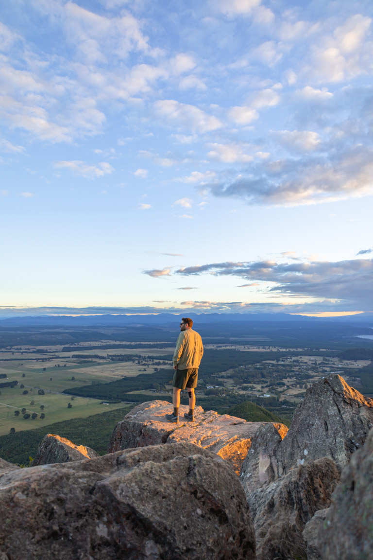
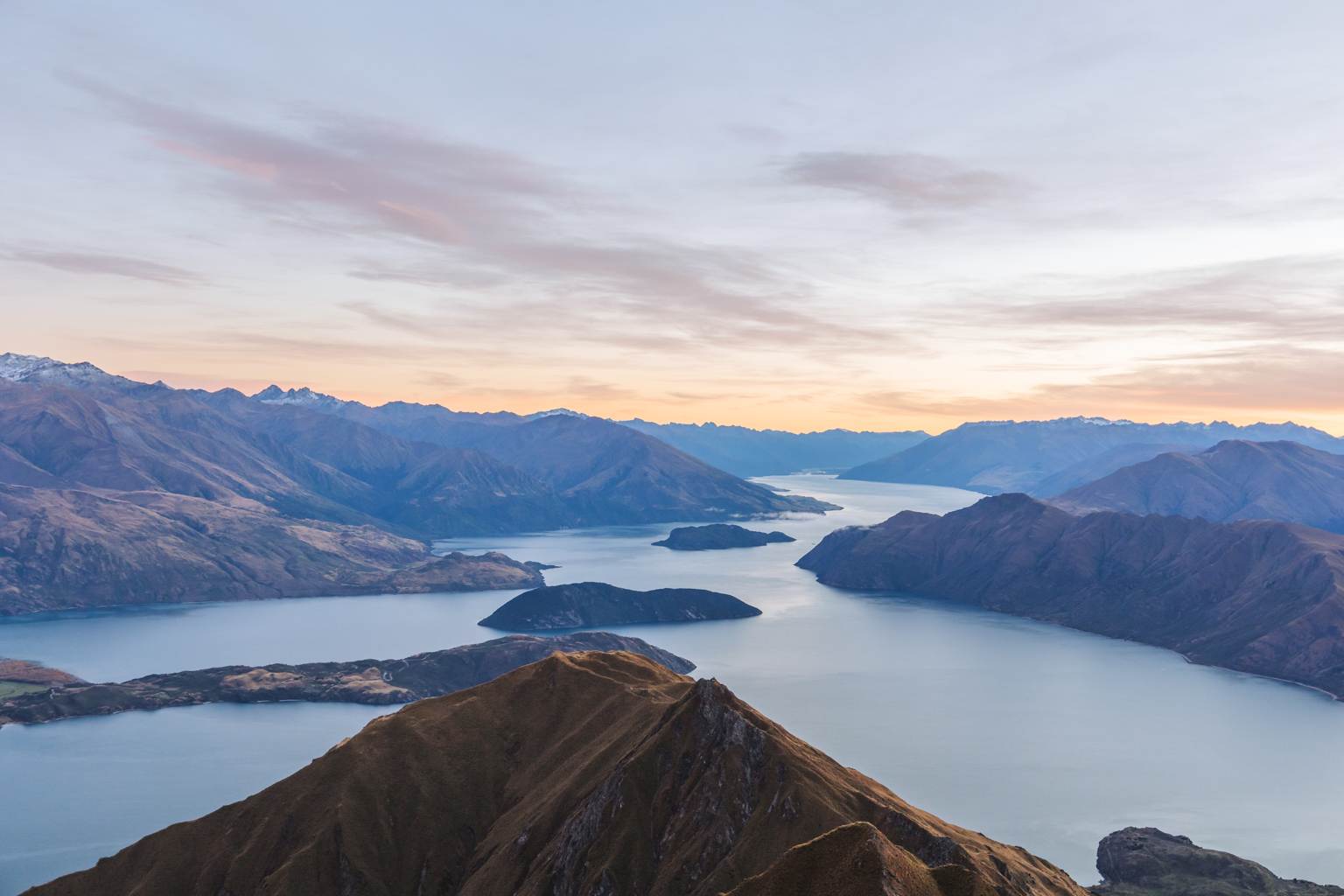
ROYS PEAK
Location: Wanaka
Distance: 15.9 km | 9.9 miles
Elevation: 1,280 meters
Duration: 6 hours
Difficulty: Medium – Difficult
Trail Type: There-and-back
Open: Seasonally
Roys Peak is a challenging climb that’s become the poster child for the best day hikes in NZ. The 1,310m elevation gain offers stunning views over Lake Wanaka and surrounding mountains.
We started our hike before dawn so we could experience sunrise here. You’ll find plenty of others doing the same but it’s a much better option to avoid even more of the crowds and to beat the heat. To be honest, I’m glad we tackled it in the dark–those relentless switchbacks might’ve had me questioning my life choices had they been seen in broad daylight.
You’ll find that the steady ascent is demanding and you’ll work up a sweat instantly but the payoff is absolutely worth it.
If you’d like to know more, my Roys Peak guide gets you fully prepped to own this iconic climb.
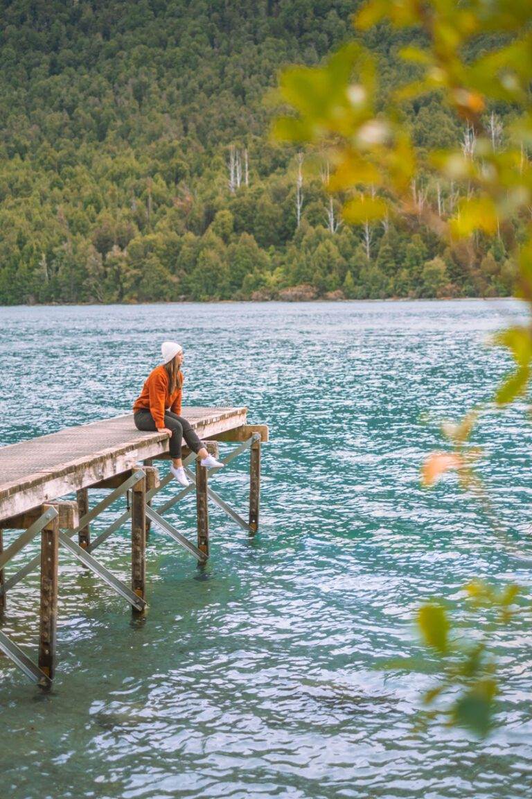
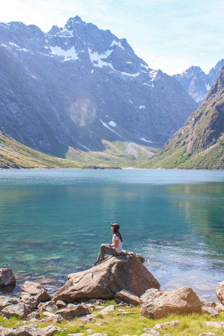
LAKE MARIAN TRACK
Location: Milford Sound
Distance: 6.1 km | 3.8 miles
Elevation: 400 meters
Duration: 3 hours
Difficulty: Medium
Trail Type: There-and-back
Open: Seasonally
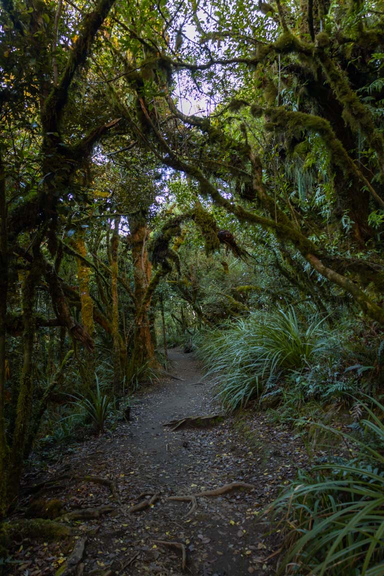
Lake Marian is a 6.1km, 3 hour hike, just 40 minutes drive from Milford Sound. The trail begins with a 400m climb through lush native forest, leading you to a breathtaking alpine lake nestled in the Hanging Valley, surrounded by mountains.
We made our way here in the afternoon, and it turned out to be the perfect time. The lighting on the lake and mountains was stunning, and although there were a few others enjoying the lake, the area is spacious enough to spread out. If you’re feeling brave, you can also take a swim in the alpine waters.
That said, if a cold dip isn’t a part of your plan and you have a bit of time, it’s a great spot to linger for a picnic, too.
Eager to know more about this New Zealand must-do? I’ve got everything you need to know about Lake Marian here.
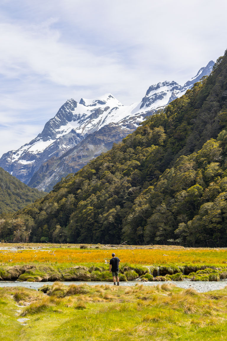
ROUTEBURN TRACK
Location: Mount Aspiring National Park
Distance: 9.7 km | 6 miles
Elevation: 640 meters
Duration: 3 hours
Difficulty: Easy – Medium
Trail Type: There-and-back
Open: Seasonally
Not ready to commit to a multi-day tramp? A Routeburn Track day hike from Glenorchy is the perfect intro to one of New Zealand’s legendary Great Walks.
It’s scenic from the get-go. Think ancient beech forest, swing bridges, crystal-clear rivers, and wide-open alpine views. You also don’t need to do the whole track. From the Routeburn Shelter, you can hike to the Routeburn Flats Hut and back in a half day. It’s an easy-to-moderate walk, and you’ll get a generous dose of the epic Routeburn scenery without carrying a tent or any of the extras – just you and a day pack.
The drive out from Glenorchy is almost as beautiful as the hike itself. Once on the track, you’ll get a taste of what makes this one of NZ’s Great Walks.
Curious about the full three day, two night hike? My Routeburn Track guide breaks it all down.

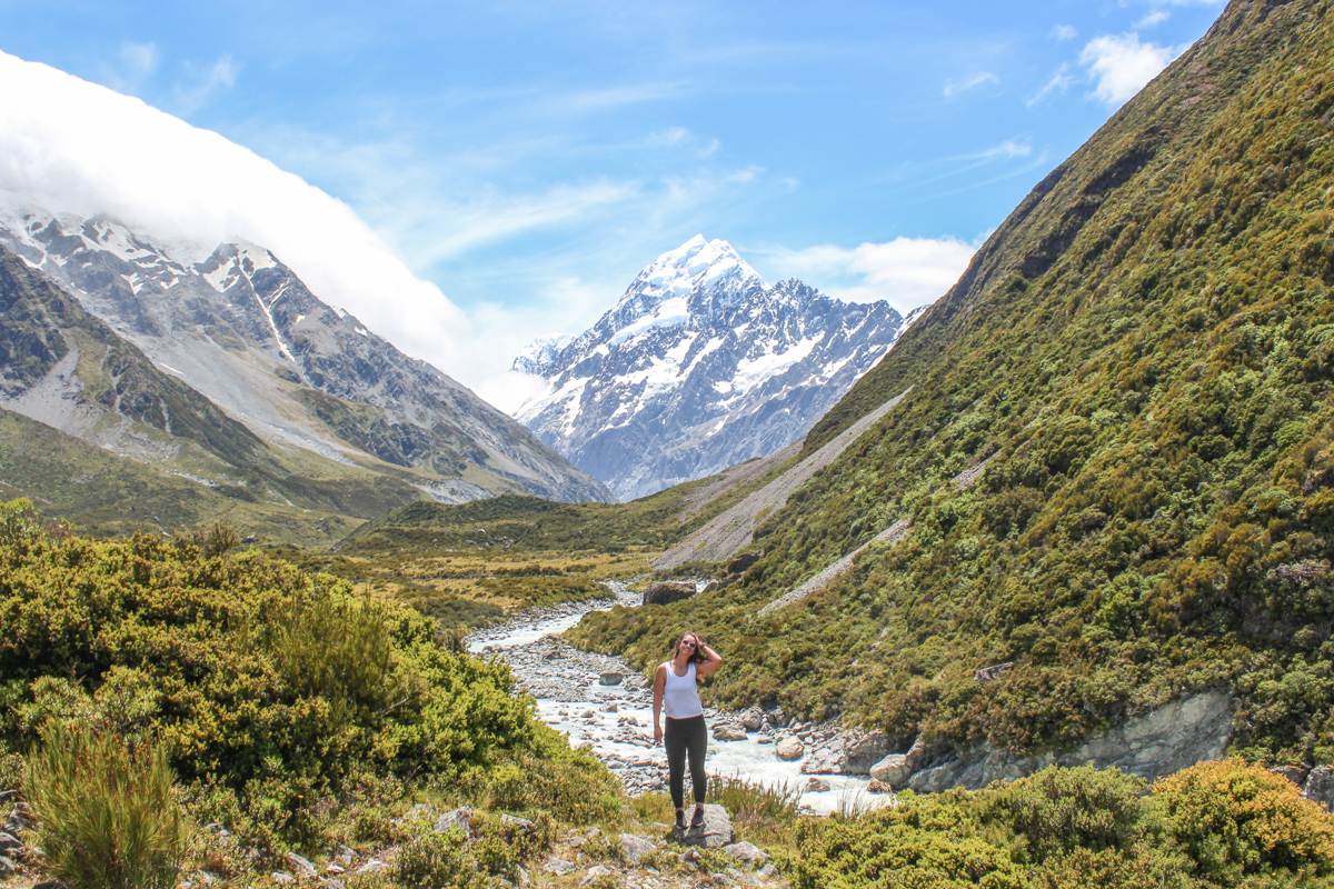
HOOKER VALLEY TRACK
Location: Mount Cook/Aoraki National Park
Distance: 10.9km | 6.8 miles
Elevation: 197 meters
Duration: 2 hours 30 minutes
Difficulty: Easy
Trail Type: There-and-back
Open: Seasonally
Looking for jaw-dropping alpine views without the leg burn? The Hooker Valley Track is one of the best day hikes in NZ and for good reason.
This 10.9km return walk in Aoraki/Mount Cook National Park is flat, easy, and ridiculously scenic. With just 197m of elevation gain, it’s ideal for families, beginners, or anyone craving big mountain drama without the grind.
I tackled it in summer when we were lucky enough to get clear skies. Yes, it was popular but there’s a reason it draws a crowd. The glacial rivers, swing bridges, and the grand finale at Hooker Lake (complete with floating icebergs and that iconic Aoraki backdrop) make every step worth it.
Want all the details? My full Hooker Valley Track guide has you covered.
* Please note: A large section of the Hooker Valley Track is closed due to maintenance. For more information check out the DOC website. *
SUMMARY
In this post, we’ve explored the best day hikes in NZ, from hidden lookouts and coastal cliffs to steep summit climbs. You’ve got practical tips on trail difficulty, route options, and the best times to visit, all of which I hope help you to plan your own day hike.
Whether you’re chasing panoramic views across the Bay of Islands at Duke’s Nose, rugged coastal beauty on Cape Brett, or alpine lake reflections at Lake Marian, these hikes span both islands and all offer something unique.
Looking for more epic hikes? Dive into New Zealand’s ultimate destinations or for more of a broader scope, check out all of our comprehensive travel destination guides.
FAQs
What are the best day hikes in NZ for beginners?
St Pauls Rock, Te Mata Peak, Mount Maunganui , Bob’s Cove, Comans Track/Mercer Bay, Hooker Valley.
Which NZ day hikes are the most challenging?
Cape Brett (30.3 km, 11-12 hrs, 1791m elevation, advanced, so better as overnight), Roys Peak (15.9 km, 6 hrs, 1280m), The Pinnacles (14.2 km, 4-5 hrs, 826m with ladders), Duke’s Nose (10.8 km, 5-6 hrs, swamp/streams/vertical climb).
Are there any multi-day hikes that can be done as day trips?
Yes, Cape Brett (long day or overnight at DOC hut), The Pinnacles (day or hut stay), Routeburn Track (9.7 km day section to Flats Hut), Duke’s Nose (day or Lane Cove Hut).
What’s the best time of year for day hikes in New Zealand?
Summer (Dec-Feb) for clear skies/beaches; shoulder seasons (spring/fall) for fewer crowds.
Do I need permits or bookings for these NZ hikes?
Most trails are free, but Cape Brett requires permit.
Which day hikes offer the best views in NZ?
Standouts are: Pouakai Tarns, Roys Peak, Hooker Valley, Duke’s Nose and Te Mata Peak.
Are these NZ day hikes family or kid-friendly?
Yes, there are plenty that are family friendly like, Bob’s Cove, Hooker Valley, Te Mata Peak, Mount Maunganui and Mercer Bay Loop.
How do I get to these day hikes from major cities?
Most require a drive to get to as they are at the very least over an hour away from an airport. I would highly recommend hiring a car in New Zealand so you are able to experience all of these amazing day hikes.
What should I pack for a day hike in New Zealand?
Sturdy shoes, water, layers, sun protection, snacks, headlamp, camera and insect repellent. Make sure to check in advance for current conditions.
Any short NZ day hikes under 2 hours with big rewards?
Definitely, yes! St Pauls Rock , Mount Maunganui, Te Mata Peak, Omanawa Falls.
Top Travel Resources to Plan Your Next Trip
Finding the Best Flights
Skyscanner: A great platform for comparing flight prices across airlines and routes.
Omio: Perfect for comparing not just flights but also trains and buses, especially for European travel.
Booking Your Stay
Hostelworld: Ideal for those specifically looking to budget on their travels and seeking hostels, guesthouses, or shared accommodations.
Booking.com: With a massive selection of hotels, apartments, and unique stays, this platform additionally has deals for frequent travellers.
Trivago: A powerful search engine for comparing hotel prices across multiple booking sites to find the best deals for your stay.
Discovering Amazing Activities
GetYourGuide: My go-to for booking tours, tickets, and activities in New Zealand and worldwide.
Everything New Zealand: A must for anyone traveling to New Zealand. This platform offers a curated selection of tours, activities, and adventures to make your Kiwi trip epic.
G Adventures: For small-group tours with a focus on sustainable and authentic travel, G Adventures is unbeatable.
Capturing Your Memories
MILK Books: Create stunning photo books to preserve your travel memories. Expect high-quality prints and customisable designs.
These links are affiliate links. If you book through them, I earn a small commission at no extra cost to you. Your support helps me keep sharing guides like this. Thanks for helping fuel the next adventure!
LATEST FROM THE BLOG
LIKE THIS POST? PIN IT HERE
QUICK SUMMARY OF THE BEST DAY HIKES IN NZ
- 18 Best Day Hikes NZ: Personally tested trails across North & South Islands
- Trail Types: Easy alpine walks, coastal cliffs, summit climbs, waterfall tracks
- North Island Highlights: Mount Tauhara (Taupō views), Pinnacles (Coromandel), Cape Brett (Northland), Pouakai Tarns (Taranaki reflection)
- South Island Highlights: Roys Peak (Wanaka), Hooker Valley (Aoraki icebergs), Lake Marian (Milford Sound), Routeburn day section
- Key Stats Included: Distance, elevation, duration, difficulty, trail type, seasonal access
- Best For: Beginners, families, sunrise/sunset chasers, advanced hikers
- Insider Tips: DOC bookings, crowd avoidance, weather prep, transport from cities