Wanting to know some of the best locations for landscape photography in the South Island? In this blog post we have 20 destinations with insights and recommendations, providing you with a comprehensive guide to experience the breathtaking beauty of this region.
This post may contain affiliate links, which means I’ll receive a commission if you purchase through my link, at no extra cost to you.
The South Island is renowned for its dramatic scenery, from towering mountains to serene lakes and everything in between. Whether you’re exploring iconic landmarks like Milford Sound or discovering hidden gems like Bobs Cove, there’s no shortage of wonderful sights to see and photograph.
OTAGO
The Otago region is where I have spent most of my time when exploring the South Island. The landscape photography opportunities here are abundant and no matter what time of year you visit, there is so much to experience.
Make sure you give yourself enough time as there are plenty of stunning sites to capture. Bobs Cove, Glenorchy, Arrowtown, Arrow Junction and Crown Range are just to name a few. These alongside adding some amazing walks (this one is an absolute must) and a few wineries won’t go amiss.
BENNETT'S BLUFF LOOKOUT
When visiting the South Island, trust me when I say you should definitely add Bennett’s Bluff Lookout to the list. You will find this picturesque lookout a short 30 minute drive towards Glenorchy from Queenstown. Recently updated the path is super clear and is only a five minute walk. Once at the top you will have views over Lake Wakatipu and the stunning surroundings of Queenstown peaks. Parking is located just off the main stretch of Glenorchy-Queenstown Rd, making it quick to spot.
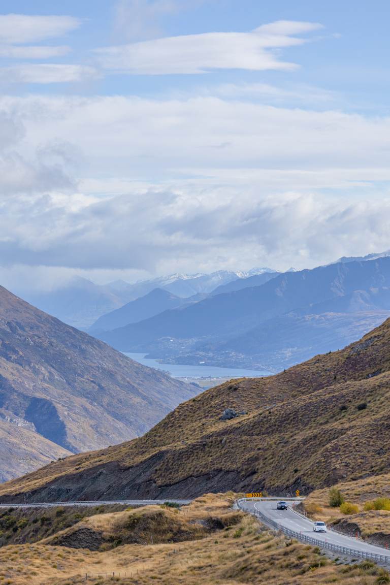
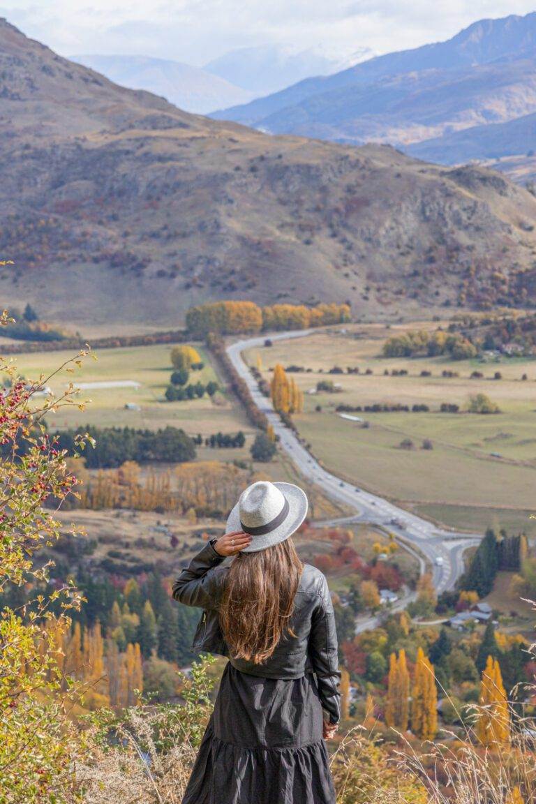
CROWN RANGE SUMMIT LOOKOUT
The Crown Range Summit Lookout is a stunning vantage point that offers panoramic views at 1,121 metres above sea level. The lookout is the highest road in New Zealand, making it a unique stop for any road-trip. Even though windy, the view from the top is well worth the effort as you’ll see through the valley to Queenstown and on a clear day, to the edge of Lake Wakatipu.
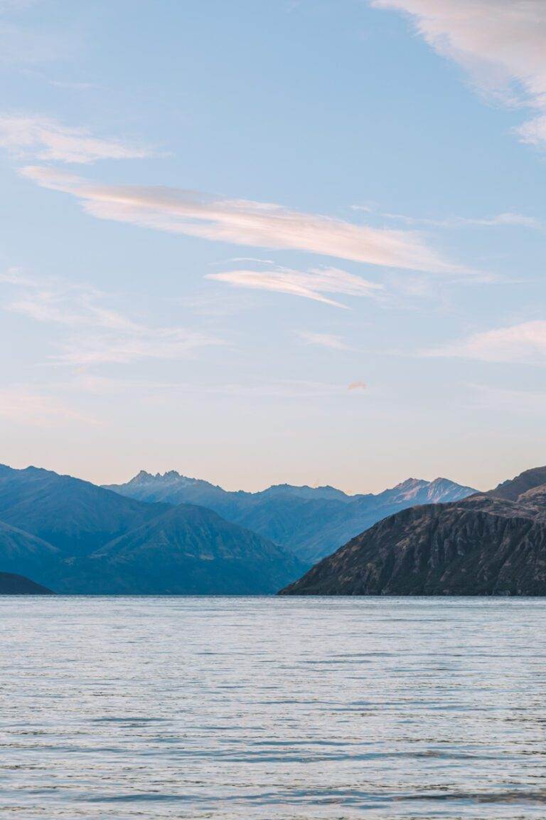
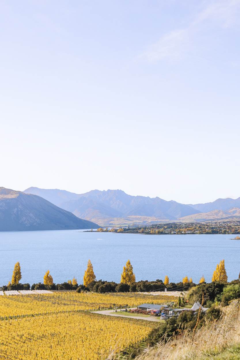
WANAKA LAKE
Nestled in the heart of the alps, Wanaka boasts one of New Zealand’s most stunning lakes. It’s a hot spot in the South Island, well-liked by locals and visitors. Personally, I found it especially charming in autumn, when the trees explode in vibrant hues of red, orange, and yellow. Set against the backdrop of towering mountains, provides some incredible photo opportunities.
For first-timers, checking out the famous Wanaka Tree is a must. It’s a favourite spot for photographers, capturing the essence of South Island landscape photography. And don’t miss a stroll through Wanaka Station Park—it’s a great way to soak in even more of the area’s beauty.
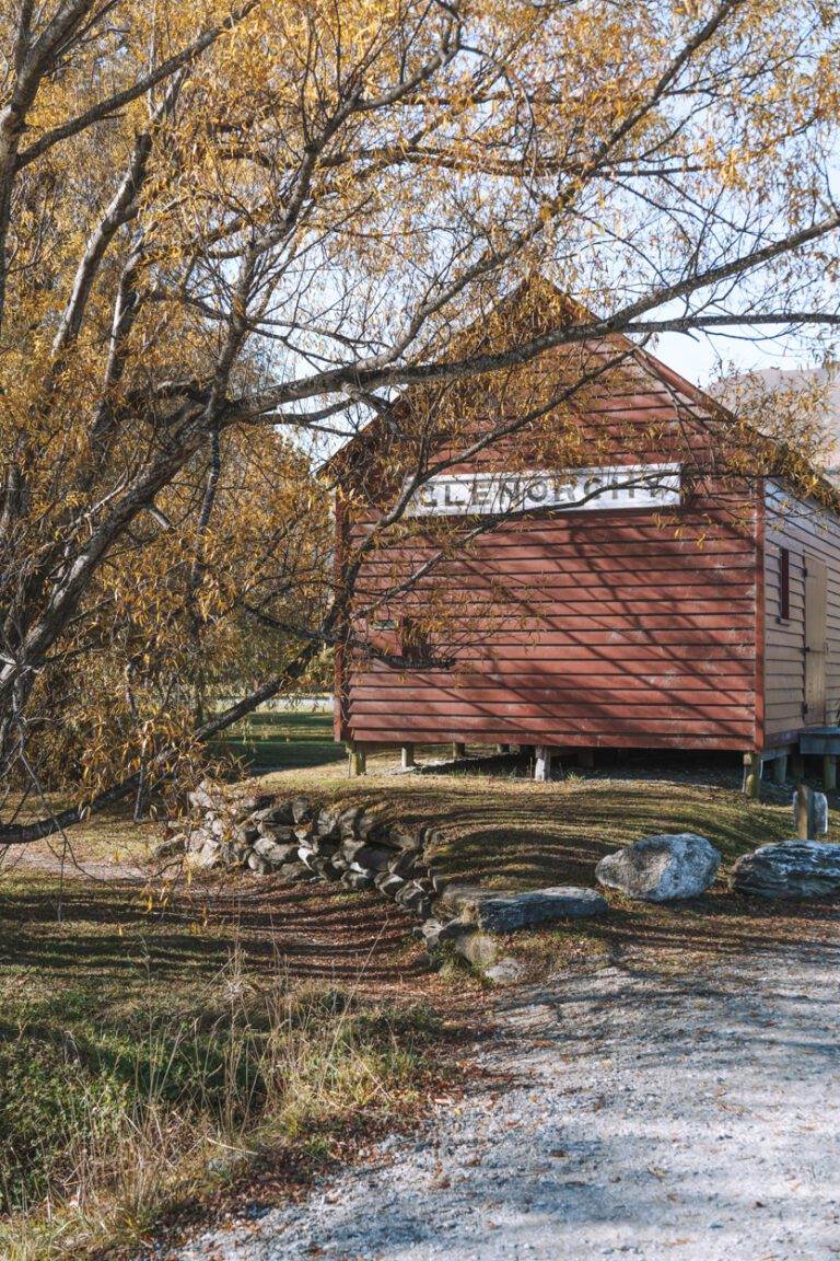
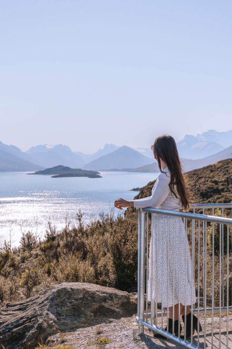
GLENORCHY
After you’ve visited Bennetts Bluff Lookout continue along the same road to Glenorchy. Glenorchy is a quaint little town located on the northern shores of Lake Wakatipu, a destination that’s surrounded by mountains and pristine forests. It’s particularly beautiful during autumn when the leaves change colour, making it a great destination for photographers.
The town also serves as a gateway to some of the most beautiful hikes in the area, including the Routeburn Track and the Greenstone Track. As this was also a filming location for Lord of the Rings, there are guided tours available, too. If you’re a fan of the iconic trilogy I would highly recommend this tour.
BOB'S COVE
Bob’s Cove is a hidden gem located just a stone’s throw away from the vibrant Queenstown. This cove, referred to as Te Puna-tapu in Māori (‘sacred pool’ in English), has a rich history that dates back centuries. I talk more about this in my full post about the Cove here.
The journey to Bob’s Cove is a short one from town, just a 14km drive or roughly 15 minutes. It’s also a scenic one, winding through the valley along the stunning Lake Wakatipu and the surrounding mountains. The loop itself will take you around the Cove and take roughly half an hour. It’s quite flat but towards the middle section you can expect more uphill. This is the ultimate spot to get out the camera for some South Island landscape photography.

ROYS PEAK
Key Insights
Location: You can find the trailhead a short, 10 minute drive from Wanaka town centre
Duration: 6 hours (fitness and posing for the gram dependant)
Elevation: 1,310 meters
Difficulty: Medium-Hard
Need to have: Water, hat, sunblock and snacks
Roys Peak is an iconic viewpoint that has breathtaking vistas of Lake Wanaka and the surrounding mountains, making it an essential stop for those who love hiking and landscapes. Starting the hike before dawn meant an experience away from the crowds and the heat, too which is always ideal. It’s a moderately challenging trail that takes around 5-6 hours round trip but is more than worth it. For everything you need to know about this hike click here.
CANTERBURY WINERIES
If you’re a wine lover then the Canterbury wineries are not to be missed. There are a variety to choose from, each offering a unique selection. Some of my favourites in the area include Amisfield Bistro and Cellar, Wet Jacket Wines, Rippon Winery, Mt Rosa, Kinross Cellar Door and Bistro, and The Winery (Arrowtown). Many of the wineries also have stunning views of the surrounding mountains, making for a perfect backdrop with a wine in hand. Rippon Winery in particular, has an incredible view, looking out over Lake Wanaka and the Southern Alps.
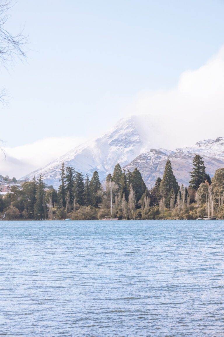
QUEENSTOWN
Queenstown is a South Island landscape photography spot that I feel needs to be mentioned, but also goes without saying. It’s an incredibly picturesque place to visit in the South, no matter when you visit. From snow-capped mountains to beautiful lookouts, the landscapes is breathtaking. I’d list a few specific spots but you really can’t go wrong with a simple walk along the waterfront, through either Queenstown Gardens or Saint Omar Park.
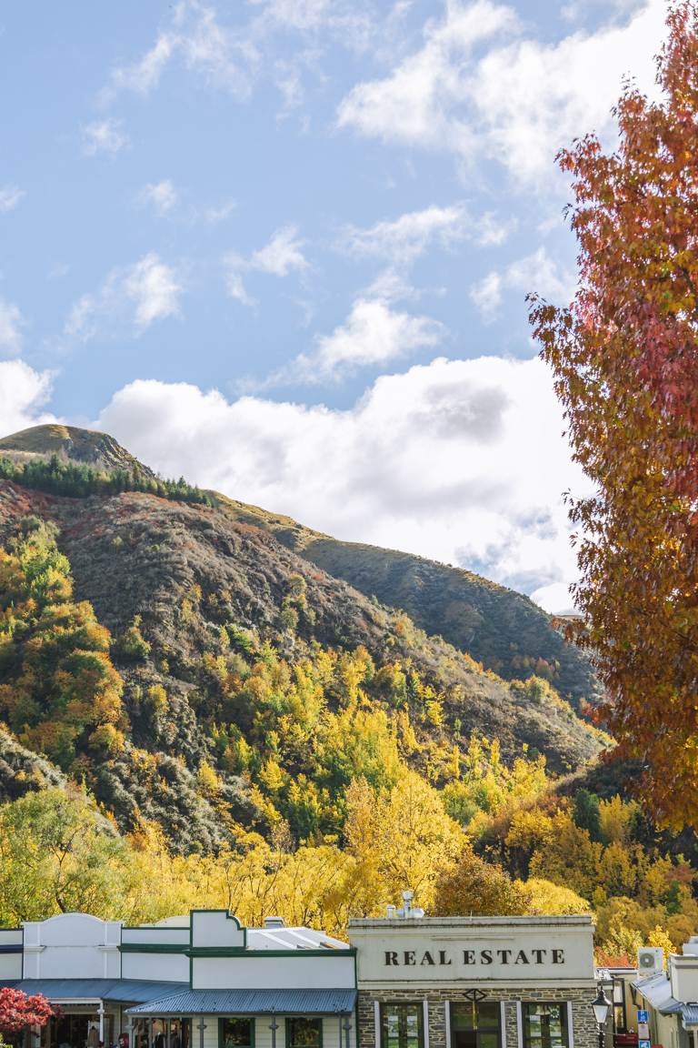
ARROWTOWN
Situated just a stone’s throw away from Queenstown, this charming old gold-mining town effortlessly whisks you back in time. From its preserved building facades to its quaint streets, it’s evident that this is a historic gem in New Zealand. If you’re aiming to capture the essence of this place through photography, autumn is the prime time to visit. This is when the foliage turns the streets into a riot of colour.
For some stellar photographic opportunities, be sure to check out the Old Police Station (known as Police Camp on Google Maps) and Wilcox Green Park.
ARROW JUNCTION LOOKOUT
The Arrow Junction Lookout is located on the Crown Range Road between Wanaka and Queenstown. While the road to reach it can be winding, planning your stop in advance ensures you don’t miss this gem. From this lookout there is a stunning panoramic view of the mountains which is a must for some South Island landscape photography. I’ve been lucky enough to stop here a few times on my trips to the South and with fewer crowds, it’s an ideal spot to pause and capture some snaps.
CANTERBURY
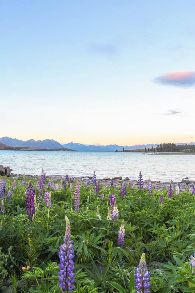
Canterbury is the largest region of the South Island which covers a majority of the East Coast. This includes Christchurch city, Timaru, Lake Pukaki and Lake Tekapo, alongside a favourite of mine, Aoraki/Mount Cook National Park. There is so much to experience here. From stargazing at Chameleon Stargazing to Hooker Valley track or seeing the lupins in full bloom during summer. It’s a region you really don’t want to miss.
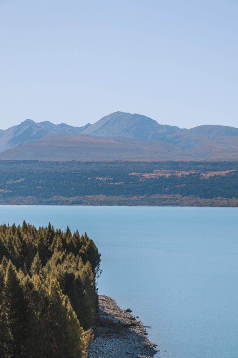
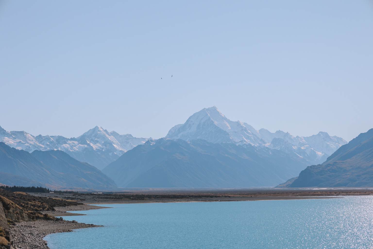
LAKE PUKAKI
Located in the Mackenzie Basin, Lake Pukaki is one of the most beautiful lakes in New Zealand. The lake is famous for its turquoise waters, which are caused by the glacial silt that is carried into the lake by the surrounding rivers. There are a variety of different hiking trails in the area, which offer incredible views of the lake and mountains.
Take in the stunning vistas from one of the many lookout points dotted around the lake. On a blue bird day, you can’t beat it to experience some South Island landscape photography.
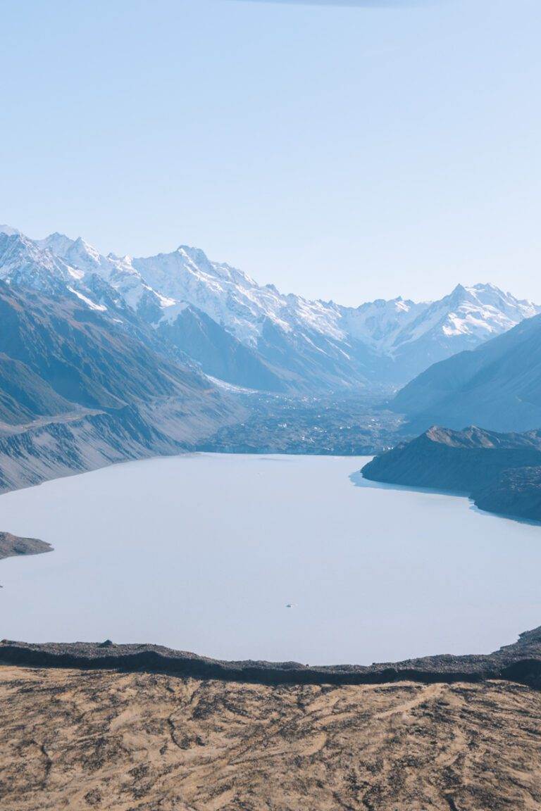
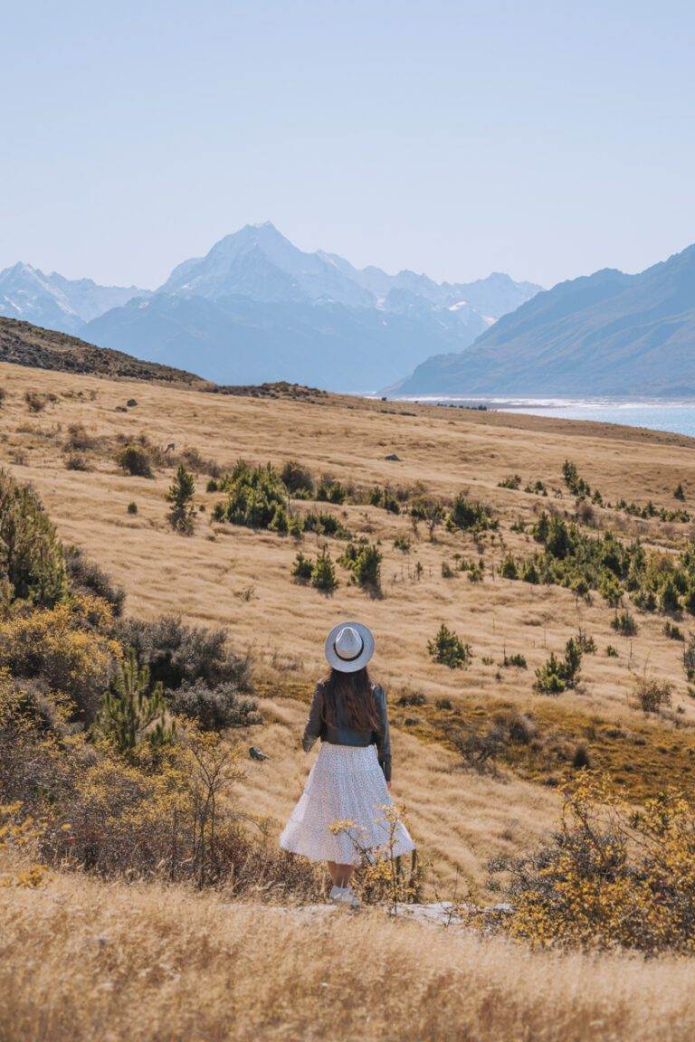
AORAKI/MOUNT COOK NATIONAL PARK
Aoraki/Mount Cook National Park is home to New Zealand’s highest mountain, Aoraki/Mount Cook. The park is a popular destination for hikers and mountaineers, with a variety of different trails to explore.
Hooker Valley Track is one of the most popular hikes here. I had previously walked this track in summer and even though it gets busy, I would highly recommend. The scenes you see on this trail are absolutely stunning. However, if you are looking for a more boujee alternative, I can suggest a heli tour. We went with Mount Cook Ski Planes & Helicopters and it was once of the best experiences I’ve ever had.
LAKE TEKAPO
Lake Tekapo, located 30 minutes from Lake Pukaki is a perfect destination for a peaceful stroll or a picnic. This rocky based lake is surrounded by snow-capped alps and is great to visit for sunset. We were lucky enough to have a very still night, with the water almost like glass.
Also be sure to check out the famous Church of the Good Shepherd and the nearby bronze statue of a sheepdog–famous icons in these parts.
MOUNT COOK ROAD
Mount Cook Road stretches 55 kilometres, treating travellers to uninterrupted views of New Zealand’s highest mountain, Mount Cook and the breathtaking Lake Pukaki. Whether you’re coming from Lake Tekapo or elsewhere, every viewpoint along this road is worth the detour for its scenery. One spot that is quite popular is Tapataia Mahaka/Peter’s Lookout, famous for its picturesque road shot. If you are attempting this please remember to prioritise safety, as traffic on this road can be traveling at speed.
This road is also where you will travel to get to many of the amazing walks in the Aoraki/Mount Cook National Park. Hooker Valley Track is the most popular as it is an easy, flat track so perfect for all ages and fitness types. Other hikes in the area, you can explore here.
SOUTHLAND
As you venture further South, you’ll be welcomed with more incredible views. In this region of New Zealand you’ll find Fiordland National Park which is home to the remarkable Milford Sound and the challenging yet rewarding Lake Marian Track. You also have Invercargill which is the bridge between the South Island and Stewart Island. Although I haven’t explored much of Southland the following parts were my favourites.
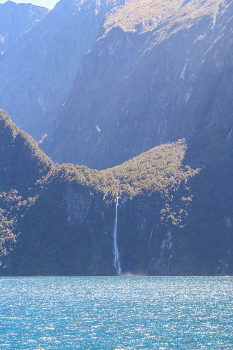
MILFORD SOUND
If you’ve spent time researching South Island landscape photography, chances are you’ve heard of Milford Sound. Despite its name, Milford Sound isn’t actually a sound; it’s a fiord and being a renowned UNESCO World Heritage site it’s a destination that you won’t want to miss.
There are several ways to reach Milford Sound, with driving or joining a group tour being the most common choices. For those seeking a more luxurious experience, there are options to combine tours with cruises or flights from Te Anau and Queenstown.
Personally, I’ve found self-driving tours to be a great option. They offer flexibility and the chance to stop at fantastic destinations along the way, like Mirror Lake, Devil’s Staircase Lookout, Te Anau, Eglinton Valley, and Lake Gunn.
If you’re considering an overnight stay, the Milford Sound Lodge comes highly recommended.
A tip: don’t hesitate to visit Milford Sound in the rain. It’s when the waterfalls are at their most spectacular.
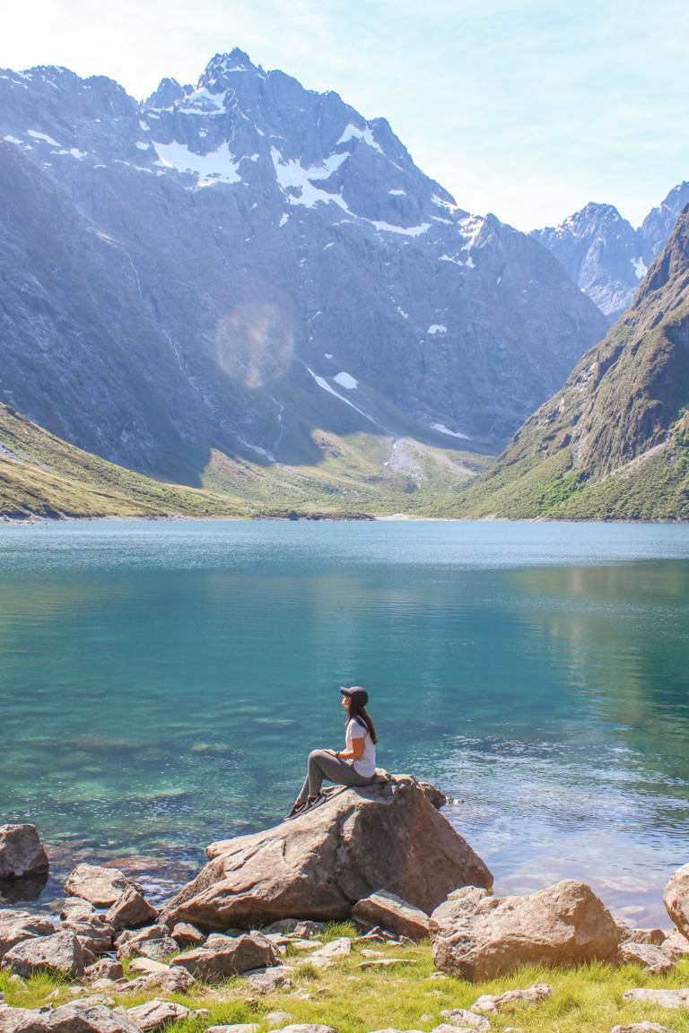
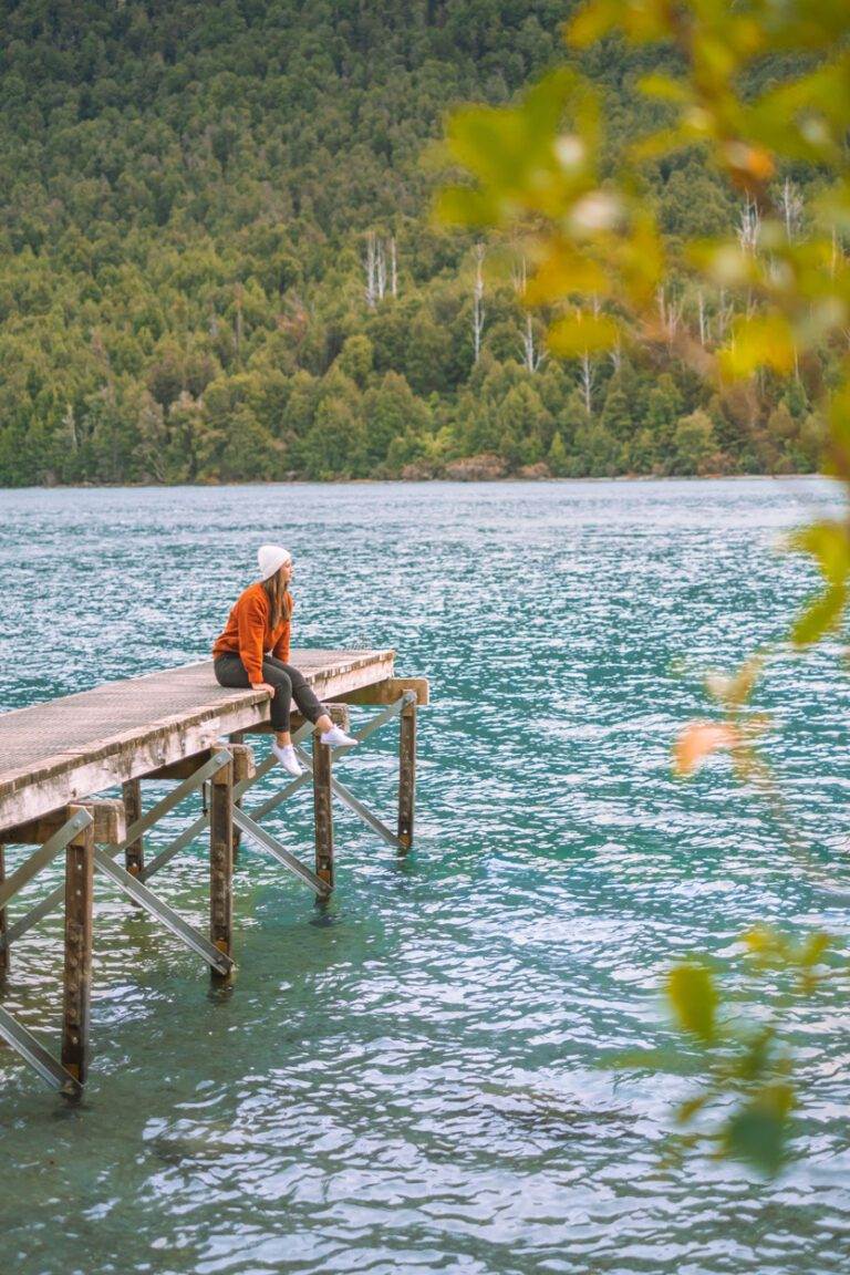
LAKE MARIAN TRACK
Key Insights
Location: You can find the trailhead 40 minutes from Milford Sound
Duration: 3 hours
Elevation: 400 meters
Difficulty: Medium
Need to have: Water, hat, sunblock and snacks
When traveling to Milford Sound, don’t forget to include a stop at Lake Marian.
This 6.1-kilometer out-and-back trail offers a steady climb through New Zealand native bush, leading to a stunning alpine lake nestled in Hanging Valley. Surrounded by mountains, the lake offers an incredible view.
We made our way here in the afternoon, and this was a perfect time to get out the camera. With the sun dipping behind the mountain ranges, the harsh lighting typically experienced during the day softened, allowing us to capture the beauty of the lake in a more detail.
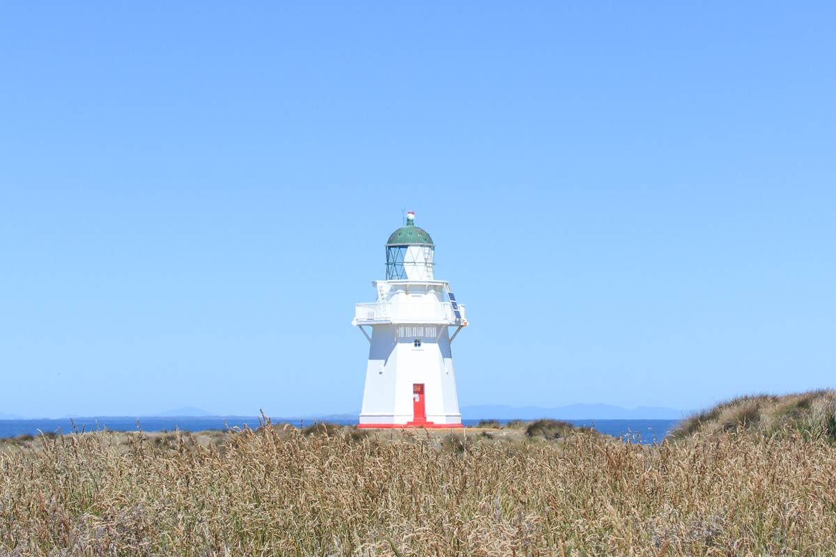
WAIPAPA POINT LIGHTHOUSE
When visiting Invercargill we had a day to explore so we decided to visit the Waipapa Point Lighthouse in the Catlins.
First lit on 1 January 1884, this lighthouse stands as one of the last two wooden lighthouses constructed in NZ. One of its distinctive features is its standout red door, adding to the lighthouse’s charm.
Just a short ten minute walk from the parking area leads you to views across the Foveaux Strait, where sea lions and fur seals are often spotted lounging nearby. We spent our time here walking around the dunes and taking photographs.
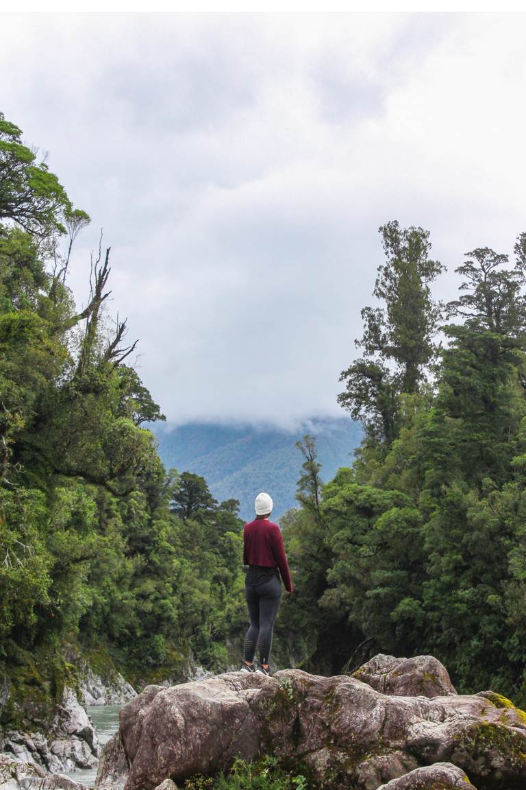
WEST COAST
The rugged West Coast of the South Island holds treasures like Haast Pass, Hokitika Gorge, and Fox Glacier, perfect for photography. However, even in summer, we encountered unpredictable weather. Embracing the moody atmosphere has its own charm, but pack extra layers just in case.
HOKITIKA GORGE
Key Insights
Location: 30 minutes outside of Hokitika
Duration: 45 minutes
Elevation: 50m
Difficulty: Easy
Hokitika Gorge boasts an easy 2.1km loop track, located just a short 30 minute drive from Hokitika township. While the trail is relatively easy-going, don’t let that fool you—the views are nothing short of breathtaking. The striking turquoise hue of the waters is a result of the glacial flour found in the water.
As you make your way along the trail, you’ll encounter a 90-meter swing bridge spanning the river, alongside numerous viewpoints which offering different perspectives of the gorge.
One notable feature is where you can get close to the water’s edge. It’s a beautiful sight but this area tends to attract a fair share of mosquitoes. So, make sure to bring along some insect repellent to keep these pesky bugs at bay.
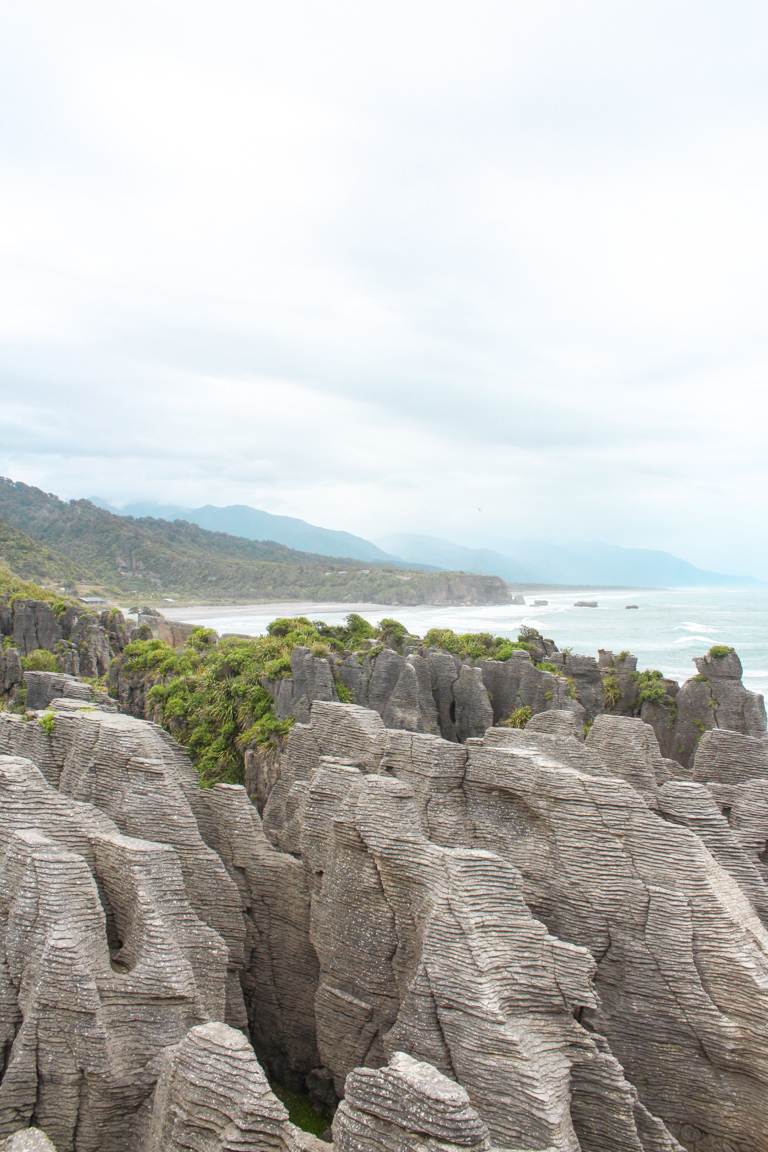
PANCAKE ROCKS, PUNAKAIKI
Key Insights
Location: 40 minutes from Greymouth
Duration: 15 minutes
Difficulty: Easy
Located about 40 minutes south of Greymouth, the Pancake Rocks in Punakaiki are an absolute must-see. These formations, dating back approximately 30 million years, are the result of limestone erosion by the relentless Tasman Sea. Over time, this erosion has sculpted the rocks into ‘pancake’ shapes, also resulting in the creation of vertical blowholes.
Even though the walk is only 15 minutes, make sure you allow time for plenty of stops as you will want to experience the blowholes in action.
NELSON-TASMAN AND MARLBOROUGH
Although I haven’t personally visited the Nelson-Tasman and Marlborough regions, I have heard many positive things and received some great suggestions. From amazing vineyards to exploring Nelson Lakes National Park, there is much to choose from. There is also Waikoropupū Springs, and if you have a longer period of time, conquering the Abel-Tasman hike or going full send with a heli tour are equally good choices. Nelson-Tasman’s charming landscapes and Marlborough’s renowned vineyards make for a delightful combination. Fingers crossed I am able to experience these two places for myself, soon.
To conclude, I hope this post has provided valuable insights into the stunning landscapes of the South Island. From majestic mountains to pristine lakes, the South Island never fails to provide landscapes to admire. Don’t forget to check out my blogs, Part One and Part Two which explore Autumn, along with my winter post for more suggestions on where your explorations can take you.