If you’re looking to explore some trails within a beautiful region of New Zealand, I highly recommend adding some Northland hikes to your list. Located above Auckland, Northland offers an array of trails that showcase some of the North Island’s most incredible views.
From short hikes lasting a couple of hours to full-day treks and even one of my favourite multi-day adventures, the five trails below offer something for everyone.
* Updated February 2026
This post may contain affiliate links. Your purchase through these links supports me with a commission, at no added expense to you.
KEY TAKEAWAYS
- This post dives into five must-do Northland hikes (with a bonus extra), from quick summit climbs with epic harbour views to longer coastal treks through lush native forests, all highlighting the region’s stunning North Island scenery just north of Auckland.
- It’s perfect for nature enthusiasts seeking variety: breathtaking panoramas, waterfall swims, challenging terrain for fitness buffs, or easy loops for casual explorers. All accessible without multi-day commitments, ideal for a weekend escape or road trip reset.
- You’ll discover essential details like trail stats, access tips, best viewing times, safety advice, nearby activities, and how to prepare, plus links to in-depth guides for planning your adventure seamlessly.
MOUNT MANAIA
Distance: 3.9km | 2.5 miles
Elevation: 340m
Duration: 1 hour 30 mins
Difficulty: Medium
Trail Type: There-and-back
Open: Year-round
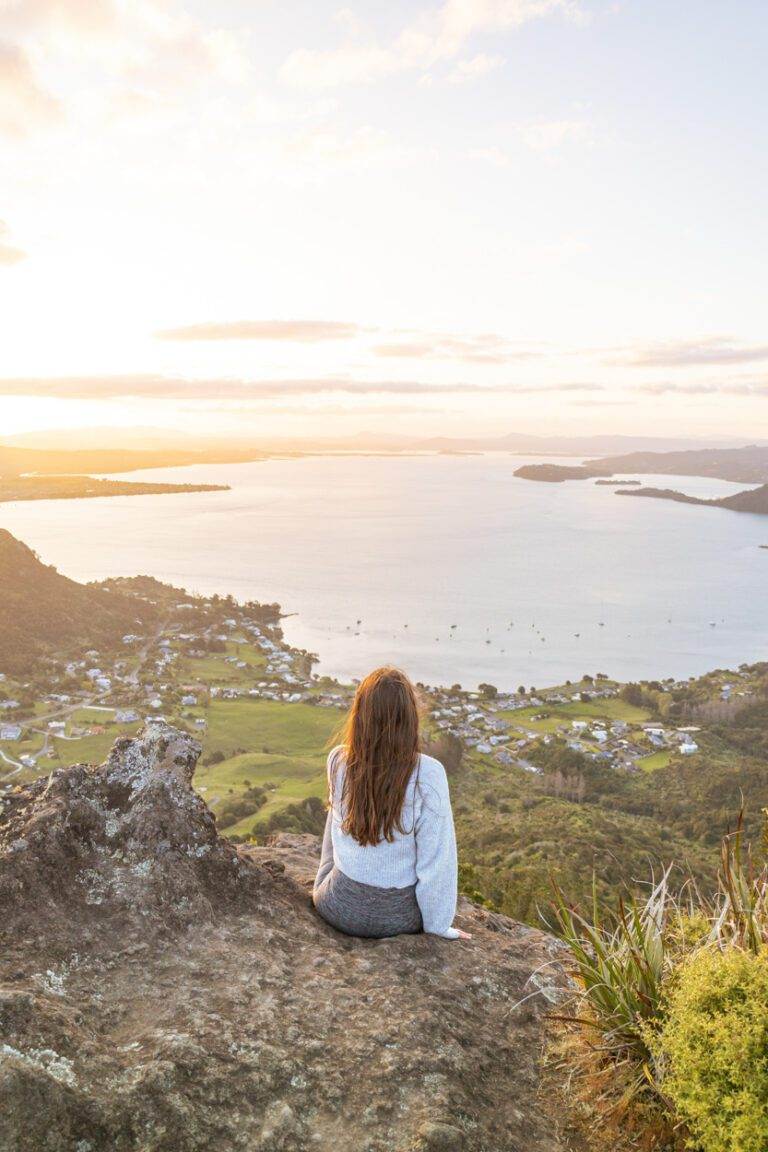
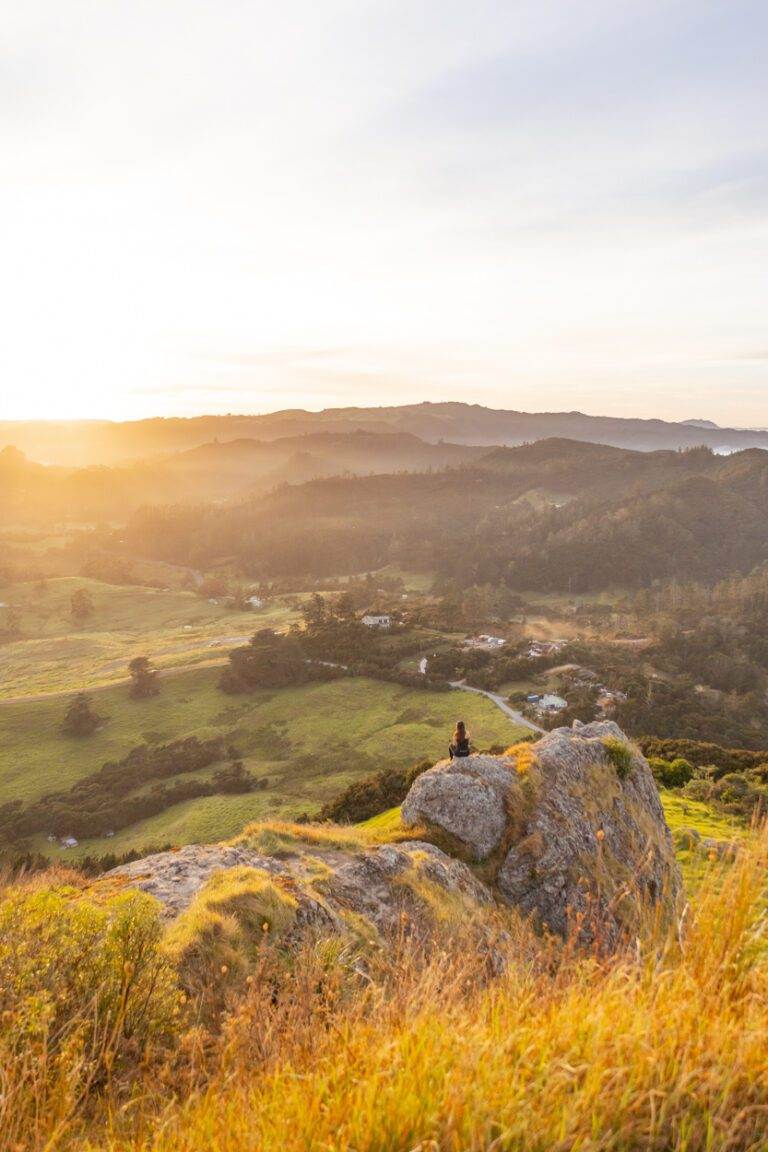
Mount Manaia is located in Whangārei Heads just over 30 minutes (30km) from Whangārei. It’s one of the shorter hikes in this post as it is roughy 45 minutes one way but still sits 420 meters above sea level, so plenty of swoon-worthy views.
I’ve personally hiked this well-maintained path twice now, and both times were well worth it. Sunrise was wonderful for its peace and quiet, but sunset was definitely my favourite as watching the sun dip over Whangārei Harbour, casting an incredible glow, was pretty incredible.
There is also plenty to do in and around Whangārei Heads. The well-known Beam Head Track is nearby and there is also other activities like kayaking and enjoying some of the local fish and chips.
To make your visit even better overall, I’ve gathered some more information on Mount Manaia. Here you’ll find plenty of tips, including the best parking spots and nearby accommodation options.
DUKES NOSE LOOKOUT
Distance: 10.8km | 6.7 miles
Elevation: 518m
Duration: 5-6 hours
Difficulty: Moderate
Trail Type: There-and-back
Open: Year-round
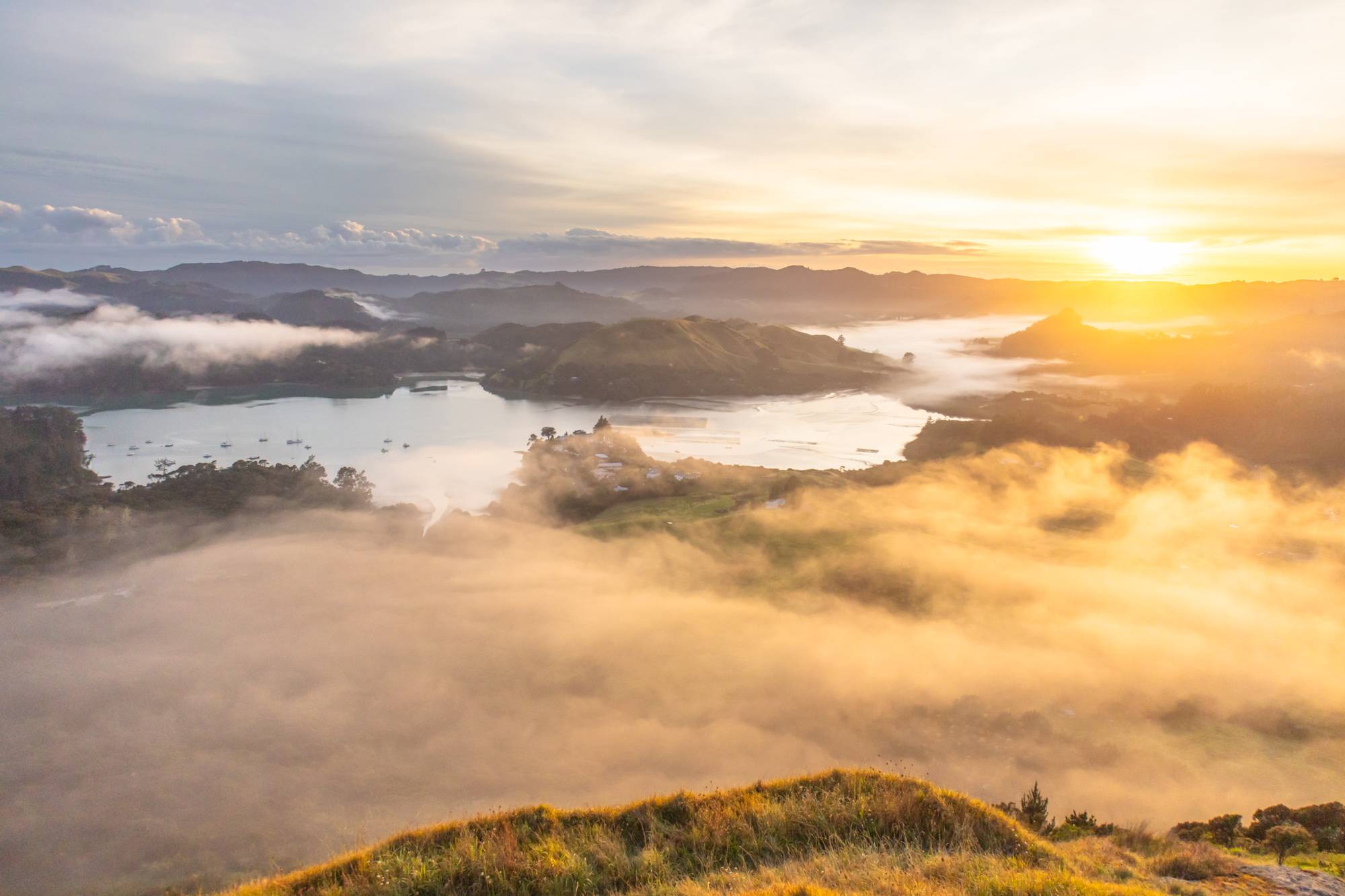
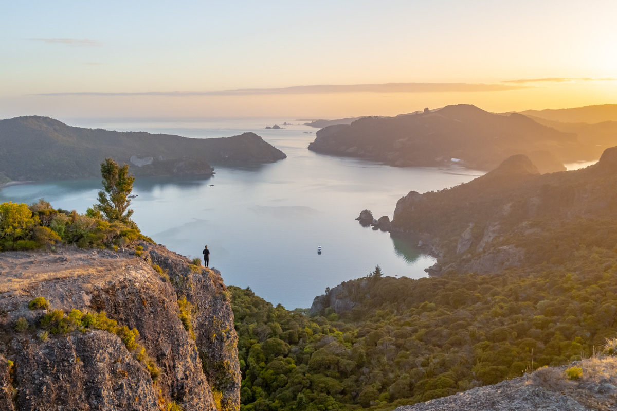
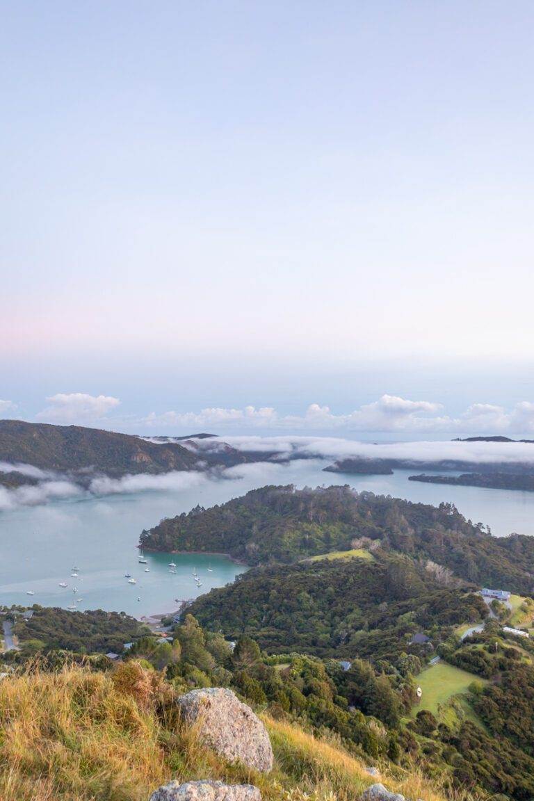
Dukes Nose is a gem that has grown in popularity over the last couple of years, as it’s no surprise. It’s one of my favourite Northland hikes, and I think the photograph below speaks as to why.
Located 40-minutes from Whāngarei, the track begins on gravel road, which quickly changes to being immersed in native New Zealand bush. The hike involves a gentle climb for most of the way, but don’t underestimate it – the duration and the final ascent can be brutal. Using a handrail to get to the top is the only way to reach the summit. Undoubtedly if you’re on the shorter side, a little help from a taller buddy doesn’t hurt. The ascent is well worth it once you get to the summit as you’ll have stunning 360 views of Waitepipi, Te Were, Pekapeka Bays and beyond.
If you would like to make this an overnight hike, there is also the option of staying at Lane Cove Hut. It’s roughly a 30 to 45 minute walk to the lookout from here.
I can also highly recommend sunrise. If you want the full scoop, I’ve written a deep-dive in my Dukes Nose guide.
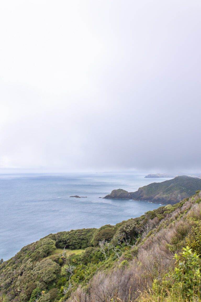
CAPE BRETT
Cape Brett is probably the most difficult of the Northland hikes in this post.
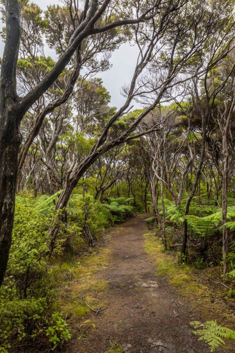
Don’t get me wrong, the journey is stunning. You’ll find yourself immersed in unquestionably some of the lushest forest with incredible lookouts across the Bay of Islands. But in terms of the track, Cape Brett is considered ‘advanced’ and in my experience, this isn’t due to its length but for its challenging terrain. There are a lot of up-and-downhill sections and we also hiked this route shortly after rain so many sections were quite muddy.
However once at the lighthouse or if you opt to stay in the local hut, it’s definitely worth the slog, with incredible views along the coast.
One last tip is that it is essential to obtain a walkway permit before hiking Cape Brett. However, if you’re entering from Deepwater Cove a permit isn’t required.
For more tips I’ve written all about my experience hiking Cape Brett here.
WHĀNGAREI FALLS HATEA WALKWAY TRACK
Distance: 4.8 km | 3 miles
Elevation: 145m
Duration: 1 hour 20 minutes
Difficulty: Easy
Trail Type: Loop + there-and-back
Open: Year-round
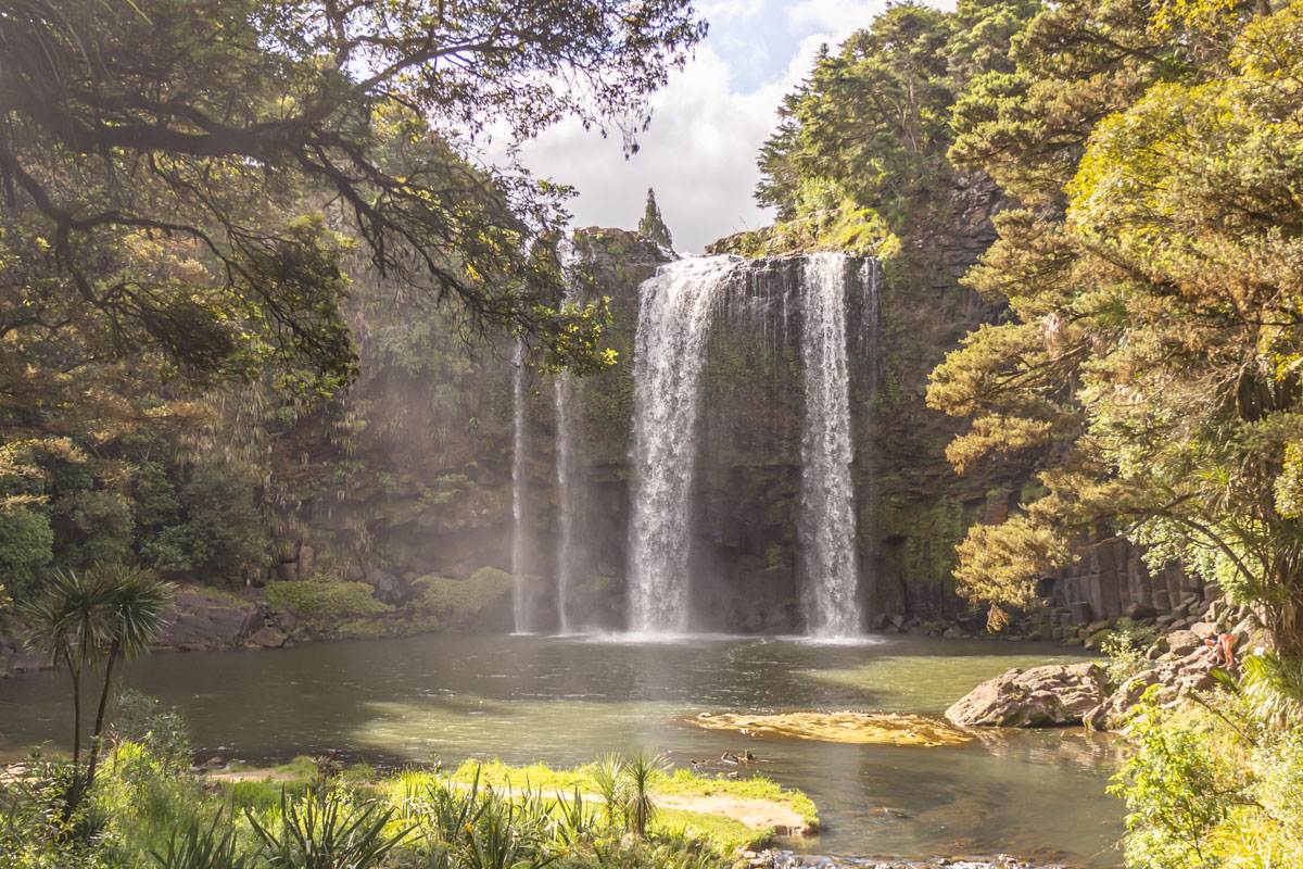
Whāngarei Falls is definitely the easiest of the Northland hikes on this list.
This incredible waterfall stands at 26 meters high and is just minutes outside of Whāngarei town centre. There are many spot to take in the views but from the base is my favourite, as it really gives you a sense of the waterfall’s impressive scale.
Whāngarei Falls in its most basic form is a loop track but if you’d like to extend your walk, you can also explore the Whāngarei Falls Scenic Reserve. Following the same loop, it also includes the Hātea Walkway, a there-and-back track to A.H Reed Memorial Kauri Park.
Being in central Whāngarei also means that you have access to many other walks and activities so it’s a great one to have on the list.
Additionally, if you’re needing any more info, I have everything you need to know here.
ST PAULS ROCK
Distance: 1.1 km | 0.7 miles
Elevation: 100m
Duration: 30 minutes
Difficulty: Medium
Trail Type: Out-and-back
Open: Year-round
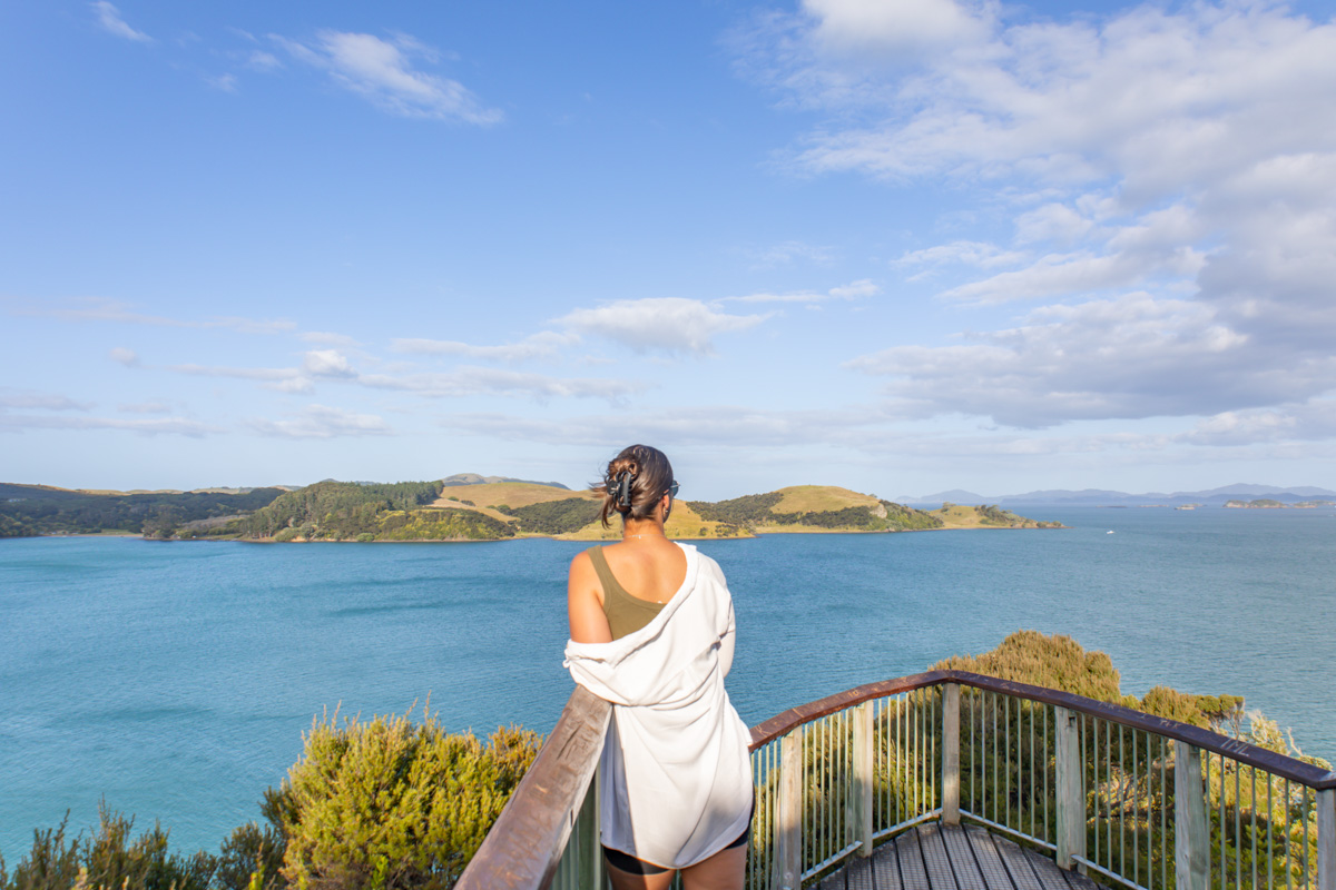
St Paul’s Rock is a unique natural rock formation located about 40 minutes from Kerikeri.
The trail to St Pauls Rock is relatively easy. It generally only takes roughly 20 minutes to get to the top and the views from the summit look out over the surrounding coastline and countryside. However there is a small section where chains are required to get to the top. Don’t worry, if I can do it, so can you.
Additionally, if you have a drone, St. Pauls Rock is also a great spot to take flight. The views from the top are even more incredible with a bit of elevation.
A small tip: If you are looking for scenery that is similar to Dukes Nose that doesn’t require such a long hike, St Pauls Rock is your best alternative. However, if you want to know more I have a comprehensive blog post here.
BONUS: OPITO BAY
Distance: 2 km | 1.2 miles
Elevation: 46 meters
Duration: 30 minutes
Difficulty: Easy
Trail Type: Loop
Open: Year-round
The Opito Bay Walk, located in Northland’s Akeake Historic Reserve, is a scenic 2km loop trail, just a 15-minute drive from Kerikeri. This easy 30 minute hike through native bush leads to Tareha Point Scenic Lookout, boasting breathtaking views of Moturoa Island and the Bay of Islands. Perfect for all fitness levels, it also offers access to secluded Lizard Bay Beach. Summer is great for combining the hike with a swim, though crisp, clear days in any season will deliver on views. Parking is also available near the boat ramp, but just to note, that it is limited and can get quite busy in summer.
For more details on the Opito Bay Walk, including parking tips, the best times to visit, check out the full guide here.
CONCLUSION
In this blog post, we’ve explored some of the best Northland hikes, each offering unique experiences and breathtaking views. Not only the serene sunrise at Mount Manaia but also the challenging terrain of Cape Brett, there’s something for everyone.
Whether you’re looking for a short hike or a multi-day adventure, these trails will not disappoint.
Looking for more epic hikes? Explore my guides to New Zealand’s ultimate destinations or if you’re looking for great Auckland locations, feel free to browse. And for even more adventures continue to all of my comprehensive travel guides.
LIKE THIS POST? PIN IT HERE
FAQs
What is the best time of year to hike in Northland?
Northland hikes are accessible year-round, but summer (December-February) offers the best weather for swimming and clear views, though trails can be busier and hotter. Winter (June-August) is cooler and less crowded, but expect more rain and muddy sections, especially on trails like Cape Brett. Always check local weather forecasts via Metservice or DOC for slips or closures.
Are these Northland hikes suitable for beginners or families with children?
For these Northland hikes it depends on the trail. Whāngarei Falls Hatea Walkway and Opito Bay are easy and family-friendly, with short durations and minimal elevation (suitable for kids aged 8+ with supervision). St Pauls Rock and Mount Manaia are medium difficulty with steep sections and chains/stairs, manageable for older children but not toddlers. Dukes Nose and Cape Brett are moderate to advanced, with steep climbs and handrails, so they’re better for fit hikers; not ideal for young kids or beginners.
Do I need permits or bookings for these hikes?
Most are free and open-access, but Cape Brett requires a walkway permit as it crosses private land. No permits for the others, but for overnight options like Lane Cove Hut on Dukes Nose or Cape Brett Hut, book in advance. Always check for updates on kauri dieback restrictions, which require cleaning shoes before/after hikes.
How difficult are the hikes, and what gear do I need?
Difficulty varies: Easy (Whāngarei Falls, Opito Bay) for casual walkers; medium (Mount Manaia, St Pauls Rock) with stairs/chains; moderate-hard (Dukes Nose, Cape Brett) with steep terrain and mud after rain. Bring sturdy shoes, water (1L+ per person), snacks, sunscreen, rain gear, and insect repellent. For chains on St Pauls Rock or handrails on Dukes Nose, gloves can help. No special gear otherwise, but a headlamp for early/late hikes.
Is parking available, and how do I get to the trailheads?
Parking is free but some spaces are limited so best to arrive early if you can (especially in summer). All hikes have a carpark at the trailhead or have on road parking available.
Are dogs allowed on these trails?
Dogs are generally not permitted on DOC-managed tracks in Northland to protect wildlife and prevent kauri dieback spread. Check specific signs. Leashed dogs may be okay on council paths like parts of Whāngarei Falls, but make sure to confirm this through DOC.
What safety tips should I follow?
Check weather and track conditions as rain makes paths slippery/muddy (e.g., Cape Brett). Stay on tracks to avoid cliffs/drop-offs and protect kauri trees. Register intentions for longer hikes. Carry water, tell someone your plans, and watch for tides if near coasts. Altitude sickness isn’t an issue, but fatigue on steep trails like Dukes Nose is common.
Are there toilets or facilities along the trails?
Facilities are minimal. No toilets on most, so go before starting. Basic ones at Whāngarei Falls carpark and Opito Bay. Cape Brett Hut has amenities if staying overnight. Pack out all rubbish.
What nearby attractions can I combine with these hikes?
In Whangārei Heads (near Mount Manaia): Bream Head Track, kayaking, fish and chips. Near Dukes Nose: Whangaroa Harbour cruises. Cape Brett: Bay of Islands boat tours. Whāngarei Falls: Town Basin loop, A.H. Reed Kauri Park. St Pauls Rock: Kerikeri activities. Opito Bay: Explore the Bay of Islands.
Are the views worth the effort, and any tips for the best experience?
Absolutely—hikers rave about 360° panoramas (Dukes Nose, St Pauls Rock), coastal vistas (Cape Brett), and sunrises/sunsets (Mount Manaia).
Top Travel Resources to Plan Your Next Trip
Finding the Best Flights
Skyscanner: A great platform for comparing flight prices across airlines and routes.
Omio: Perfect for comparing not just flights but also trains and buses, especially for European travel.
Booking Your Stay
Hostelworld: Ideal for those specifically looking to budget on their travels and seeking hostels, guesthouses, or shared accommodations.
Booking.com: With a massive selection of hotels, apartments, and unique stays, this platform additionally has deals for frequent travellers.
Trivago: A powerful search engine for comparing hotel prices across multiple booking sites to find the best deals for your stay.
Renting a Car
Europcar: Offers a wide range of vehicles for hire in New Zealand and worldwide, perfect for exploring at your own pace.
AVIS: A trusted car rental service with a variety of vehicles and locations, ideal for seamless travel adventures.
Travel Essentials & Gear
Amazon.com: Your one-stop shop for travel gear, gadgets, packing essentials, and last-minute trip must-haves.
Discovering Amazing Activities
GetYourGuide: My go-to for booking tours, tickets, and activities in New Zealand and worldwide.
Everything New Zealand: A must for anyone traveling to New Zealand. This platform offers a curated selection of tours, activities, and adventures to make your Kiwi trip epic.
G Adventures: For small-group tours with a focus on sustainable and authentic travel, G Adventures is unbeatable.
Capturing Your Memories
MILK Books: Create stunning photo books to preserve your travel memories. Expect high-quality prints and customisable designs.
These links are affiliate links. If you book through them, I earn a small commission at no extra cost to you. Your support helps me keep sharing guides like this. Thanks for helping fuel the next adventure!
LATEST FROM THE BLOG
A SUMMARY OF NORTHLAND HIKES
Post Overview: Comprehensive guide to five standout Northland hikes plus a bonus trail, showcasing diverse landscapes in New Zealand’s North Island. Ideal for day trips or short adventures, with options for all fitness levels.
Key Stats: Mount Manaia (3.9km, 340m elev., 1.5hr, medium); Dukes Nose Lookout (10.8km, 518m elev., 5-6hr, moderate); Cape Brett (30.3km, advanced, full-day/multi-day); Whāngarei Falls Hatea Walkway (4.8km, 145m elev., 1hr20min, easy); St Pauls Rock (1.1km, 100m elev., 30min, medium); Opito Bay (2km, 46m elev., 30min, easy). All year-round access; free entry except Cape Brett permit.
Best For: Scenic seekers wanting panoramic coastal views (Dukes Nose, Cape Brett), short rewarding climbs (Mount Manaia, St Pauls Rock), easy family outings (Whāngarei Falls, Opito Bay), or sunrise/sunset photography. Great for solo hikers, couples, or groups mixing adventure with relaxation like beach swims.
Access & Logistics: Trails start near Whangārei (Mount Manaia, Dukes Nose, Whāngarei Falls) or Kerikeri/Paihia (St Pauls Rock, Opito Bay, Cape Brett). Drive times: 30-40min from Whangārei/Kerikeri; water taxi options for Cape Brett/Dukes Nose. Limited parking—arrive early. No public transport; car recommended. Check DOC for kauri dieback protocols.
Tips: Hike at sunrise/sunset for best light and fewer crowds; carry water/snacks. Clean shoes to prevent disease spread. For Cape Brett, get permit in advance. Pair with swims in summer or extend walks.
Nearby Attractions: Whangārei Heads kayaking/beaches (near Mount Manaia); Whangaroa Harbour cruises (Dukes Nose/St Pauls Rock); Bay of Islands tours (Cape Brett/Opito Bay); Town Basin cafes/waterfalls (Whāngarei Falls); Kerikeri historic sites.
Safety & Practicality: Well-marked tracks but watch for mud/slips after rain; stay on paths near cliffs. Moderate fitness for most; advanced for Cape Brett. Download AllTrails app for offline maps. No camping on most, but huts available for overnights. Inform someone of plans; check weather/tides.