The Mount Pleasant Loop Trail is one of those underrated gems right on Christchurch’s doorstep.
Perched on the Port Hills above Lyttelton, it delivers some incredible views of the South Island in just a half-day outing. From the summit of Tauhinukorokio / Mount Pleasant, you’ll get panoramas across Lyttelton Harbour, Pegasus Bay, the Banks Peninsula, and across the Canterbury Plains.
It’s steep in places, but the payoff is huge. For everything you need to plan your own hike, here’s the full guide below.
This post may contain affiliate links. Your purchase through these links supports me with a commission, at no added expense to you.
KEY TAKEAWAYS:
- This guide covers the Mount Pleasant Loop Trail, an underrated 7.4 km loop in Christchurch’s Port Hills. It has epic 360 degree views in just a half-day adventure.
- It’s worth your time if you’re looking for an accessible, crowd-free adventure that is a challenge, with WWII history, and stunning South Island panoramas.
- You’ll get all the planning essentials: trail stats, tips on how to get there, and best times, among other things to make your hike seamless and memorable.

MOUNT PLEASANT LOOP TRAIL LOCATION
The Mount Pleasant Loop trail is located in the Port Hills on the Banks Peninsula, near Lyttelton Harbour. Just a short drive from central Christchurch in the Canterbury region of New Zealand’s South Island.
HOW TO GET TO MOUNT PLEASANT LOOP TRAILHEAD
The main trailhead on Somes Road is accessible by car from either Christchurch or Lyttelton, making it super convenient for locals and visitors.
From central Christchurch, it’s about 20-30 minutes; from Lyttelton township, even quicker at 5-10 minutes. There is also the option of starting on Summit Road, which would mean descending first before tackling the uphill.
Public transport options exist but add time. Most buses from Christchurch drop at Lyttelton Wharf (check the Metro timetable here for routes). From the wharf, it’s roughly a 30 minute uphill walk to the trailhead – doable but steep.
If you’re coming from Diamond Harbour on the Banks Peninsula, the ferry is a scenic option. But, similar to the above, you will then need to add 30 minutes to your hike in order to get to the start of the trail.
Parking tips
The small parking area at the main trailhead fits only 2-3 cars, and it can fill up quickly. We arrived mid-afternoon and had it to ourselves, but that’s not guaranteed.
As mentioned earlier there is access to the trail along Summit Road. This has more reliable parking, with more spaces and it’s easy to jump straight on the trail from here.


KEY INSIGHTS FOR HIKING MOUNT PLEASANT LOOP TRAIL
Distance: 7.4 km | 4.6 miles
Elevation: 420 meters
Duration: 2 hours 30 minutes – 3 hours
Difficulty: Medium
Trail Type: Loop
Open: Year-round
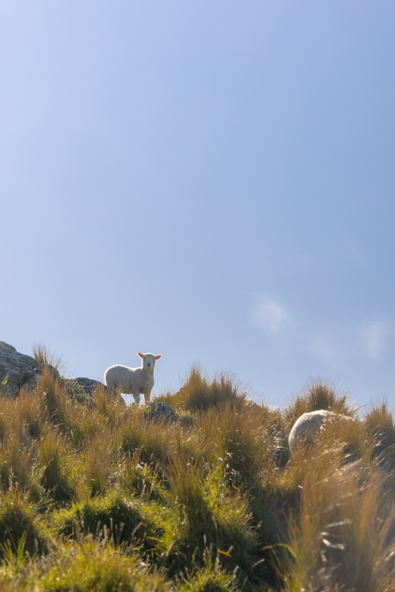
The Mount Pleasant Loop trail doesn’t ease you in. From the trailhead, the climb kicks off immediately, heading straight uphill through Lyttelton Reserve on steps and a well-formed track.
The payoff comes quickly though. Within the first stretch, you’ll have wide open views over Lyttelton Harbour. This continues through the middle section of the Mount Pleasant Loop trail, with an addition of open bluffs, rocky ground, and a bit of light boulder-hopping. Don’t worry, the track stays clear and easy to follow, with plenty of excuses to stop for photos.
Finally at the summit, Lyttelton Harbour glints below, Pegasus Bay stretches north, the Banks Peninsula folds away to the southeast, and on a clear day, you may even see the Kaikōura Ranges.
On the descent, you’ll pass remnants of WWII anti-aircraft gun sites, with concrete bunkers clinging to the ridgeline. Just make sure to watch your footing here, the downhill can get slippery with loose gravel, so good grip on your shoes is essential.
If walking feels like too much, you could take the nearby Christchurch Gondola instead. But honestly? The loop hike gets you to the best spots, fewer crowds, and that ‘earned it’ feeling the Gondola just can’t match.


BEST TIME TO VISIT
We tackled this loop in the afternoon, and the softer light made a noticeable difference.
The trail is mostly exposed, with very little shade. Midday summer hikes can be hot, and wind is common.
Spring and autumn are the sweet spot, with milder temperatures and clearer skies. Winter is doable, but expect strong winds and the occasional icy section, so checking conditions beforehand is a smart move.
HOW CROWDED IS HIKING THE MOUNT PLEASANT LOOP TRAIL
On the trail, we passed very few people. Even on a weekend afternoon – it felt peaceful and uncrowded. The loop’s length and having more than one starting point definitely helped spread everyone out, so it never felt busy.
Early starts or weekdays would make it even quieter.

OTHER POSTS YOU MIGHT LIKE
IS IT SAFE TO TRAVEL SOLO
Absolutely. The Mount Pleasant Loop trail is well-marked, popular enough that you’re not truly isolated, and close to civilisation.
However, as always, share your plans, carry water/snacks, check the weather, and stick to the path – especially near the bluffs and rocky sections.
PHOTOGRAPHING THE MOUNT PLEASANT LOOP TRAIL
As mentioned earlier, the views along the Mount Pleasant Loop trail are pretty incredible, so it’s perfect if you’re bringing your camera along. But it is largely exposed so bring along a polarising filter to cut through the glare.
If you’d like to avoid the harsh light completely, early morning or late afternoon light will be magic. With softer tones on the harbour, fewer harsh shadows on the cliffs, and that warm glow, you’ll get plenty of content.


ACCOMMODATION NEAR MOUNT PLEASANT
You have the quaint town of Lyttelton just below the track – great for a relaxed, artsy vibe with cafes, galleries, and harbour views. Options range from boutique B&Bs to holiday homes (plenty on AirBnBs or Booking.com).
Over the hill in Christchurch, there’s endless choice: central hotels, motels in Sumner or Cashmere for easy access, or AirBnBs with incredible outlooks. If you’re combining this with other Banks Peninsula adventures, Lyttelton makes a perfect base.
This was the accommodation we stayed in while in Christchurch – newly renovated, and for a group of 5, it was perfect.

OTHER PINS YOU MIGHT LIKE
CONCLUSION
The Mount Pleasant Loop Trail punches way above its weight. In 3-4 hours, you get steep climbs, historic ruins, and some of the best panoramic views in the Christchurch area.
It’s accessible, rewarding, and blissfully quiet so whether you’re a local looking for a quick escape or a visitor wanting that classic Canterbury outlook without a full-day commitment, this one delivers.
If you’re chasing more South Island gems like this, check out our other New Zealand travel guides for walks, photography tips, and outdoor ideas across the country. To explore all our locations and ideas, head over to our international destination guides.
LIKE THIS POST? PIN IT HERE
FAQs
Is the Mount Pleasant Loop Trail dog-friendly?
Yes, dogs are permitted on a leash in accordance with Christchurch City Council rules for tracks in the Port Hills and reserves.
Owners must keep dogs in check, and remove all waste as no bins are provided.
Is it suitable for kids or families?
The trail is suitable for families with older children who are reasonably fit. It features a steep initial climb with steps and some uneven boulder sections, so it is not stroller-friendly and may require frequent breaks for younger or less experienced walkers. The total distance and duration make it manageable for a half-day family outing.
How difficult is the trail?
The trail is classified as medium difficulty. It includes a steep initial ascent of approximately 420 m elevation gain over 7.4 km, followed by sections of rocky and uneven ground with light boulder navigation. No technical climbing or specialist equipment is required, but the descent can be slippery on loose gravel.
Is there free parking, and does it fill up?
Parking at the main trailhead on Somes Road is free but limited to approximately 2–3 vehicles. Additional free parking is available along Summit Road, from where you can access the trail directly.
Can I access the trail by public transport?
Yes. Metro bus services connect central Christchurch to Lyttelton Wharf. From the wharf, it is approximately a 30 minute uphill walk to the trailhead though. The ferry from Diamond Harbour also arrives at Lyttelton, after which you can walk or arrange a short taxi/ride to the start.
Are there toilets, water, or facilities on the trail?
There are no toilets, water points, or other facilities along the trail. Bring sufficient water and snacks.
Is it safe to hike solo, and what about weather?
The trail is considered safe for solo hiking. It is well-marked, located close to urban areas (Christchurch and Lyttelton), and receives moderate use. As with any outdoor activity, inform someone of your plans, carry adequate water and snacks, monitor the weather forecast, and exercise caution near exposed bluffs and rocky sections, especially in windy or foggy conditions.
Is there an entrance fee, and do I need permits?
There is no entrance fee and no permit required. The trail is managed as part of local reserves and is free to access. Just make sure to follow standard leave-no-trace principles.
Top Travel Resources to Plan Your Next Trip
Finding the Best Flights
Skyscanner: A great platform for comparing flight prices across airlines and routes.
Omio: Perfect for comparing not just flights but also trains and buses, especially for European travel.
Booking Your Stay
Hostelworld: Ideal for those specifically looking to budget on their travels and seeking hostels, guesthouses, or shared accommodations.
Booking.com: With a massive selection of hotels, apartments, and unique stays, this platform additionally has deals for frequent travellers.
Trivago: A powerful search engine for comparing hotel prices across multiple booking sites to find the best deals for your stay.
Renting a Car
Europcar: Offers a wide range of vehicles for hire in New Zealand and worldwide, perfect for exploring at your own pace.
AVIS: A trusted car rental service with a variety of vehicles and locations, ideal for seamless travel adventures.
Travel Essentials & Gear
Amazon.com: Your one-stop shop for travel gear, gadgets, packing essentials, and last-minute trip must-haves.
Discovering Amazing Activities
GetYourGuide: My go-to for booking tours, tickets, and activities in New Zealand and worldwide.
Everything New Zealand: A must for anyone traveling to New Zealand. This platform offers a curated selection of tours, activities, and adventures to make your Kiwi trip epic.
G Adventures: For small-group tours with a focus on sustainable and authentic travel, G Adventures is unbeatable.
Capturing Your Memories
MILK Books: Create stunning photo books to preserve your travel memories. Expect high-quality prints and customisable designs.
These links are affiliate links. If you book through them, I earn a small commission at no extra cost to you. Your support helps me keep sharing guides like this. Thanks for helping fuel the next adventure!
LATEST FROM THE BLOG
A SUMMARY OF MOUNT PLEASANT LOOP TRAIL
Mount Pleasant Loop Trail Overview: Medium 7.4 km (4.6 miles) loop hike in Christchurch’s Port Hills on Banks Peninsula, near Lyttelton Harbour. Features steep climbs through reserves, boulder sections, WWII anti-aircraft ruins, and 360-degree summit views over Lyttelton Harbour, Pegasus Bay, Banks Peninsula, Canterbury Plains, and Kaikōura Ranges.
Key Stats: Distance: 7.4 km. Elevation: 420 m gain. Duration: 2.5–3.5 hours. Difficulty: Medium (steep start, slippery descents, exposed bluffs). Trail Type: Loop. Open year-round; Free entry.
Best For: View seekers, photographers, solo hikers, or anyone wanting a quick, rewarding South Island escape with harbour/city panoramas, history, and minimal crowds. Ideal for half-day outings from Christchurch.
Access & Logistics: Main trailhead on Somes Road (20-30 min drive from Christchurch CBD, 5-10 min from Lyttelton). Public options: Metro bus to Lyttelton Wharf + 30-min walk; Black Cat ferry from Diamond Harbour. Limited parking (2-3 spots)—use Summit Road alternatives. Check MetService for wind/weather.
Tips: Hike afternoon for golden light, but avoid midday heat; wear grippy shoes for gravel/slips. Carry water/snacks (no facilities). Solo-safe but share plans; download AllTrails for navigation. Alternative: Christchurch Gondola for non-hikers.
Safety & Practicality: Well-marked, near-town track; watch for wind/fog on bluffs. Dog-friendly on leash; older kid-suitable with supervision. Check DOC/CCC for closures (e.g., post-rain slips). Accommodation in Lyttelton (B&Bs) or Christchurch (Airbnbs/hotels).