If you’re searching for a quiet, underrated hike in the Bay of Plenty, the Latham Track ticks all the right boxes.
The Latham Track loop might not get the same hype as big-name hikes, but don’t let that fool you. It’s scenic, peaceful, and easy to reach with your own wheels. Plus, it’s open year-round, making it a solid pick no matter the season. So if you’re into native bush, sweeping summit views, and barely another soul in sight, this track is perfect for you.
For everything you need to know, I’ve got you covered below.
This post may contain affiliate links. Your purchase through these links supports me with a commission, at no added expense to you.
LATHAM TRACK LOCATION
You’ll find the Latham Track tucked into the rural outskirts of Whakatāne, in the Bay of Plenty, on New Zealand’s North Island.
It’s not a trail that pops up on many “best hikes” lists but on this hike you’ll get a genuine escape into nature, minus the crowds and chaos.
The area around the track is mostly farmland and forest with pockets of geothermal charm (looking at you, Awakeri Hot Pools). This hike feels quietly wild and completely off the tourist radar.
HOW TO GET TO LATHAM TRACK
You’ll need your own transport for this one. No public buses come close to the trailhead.
From Whakatāne, take State Highway 30 West. You’ll follow this highway till you reach the trailhead of the hike.
Parking tips
You’ve got two solid options for parking and starting this hike. The first is Awakeri Hot Pools car park which is the main starting point. There’s plenty of room to park, and it sets you up for a full clockwise loop.
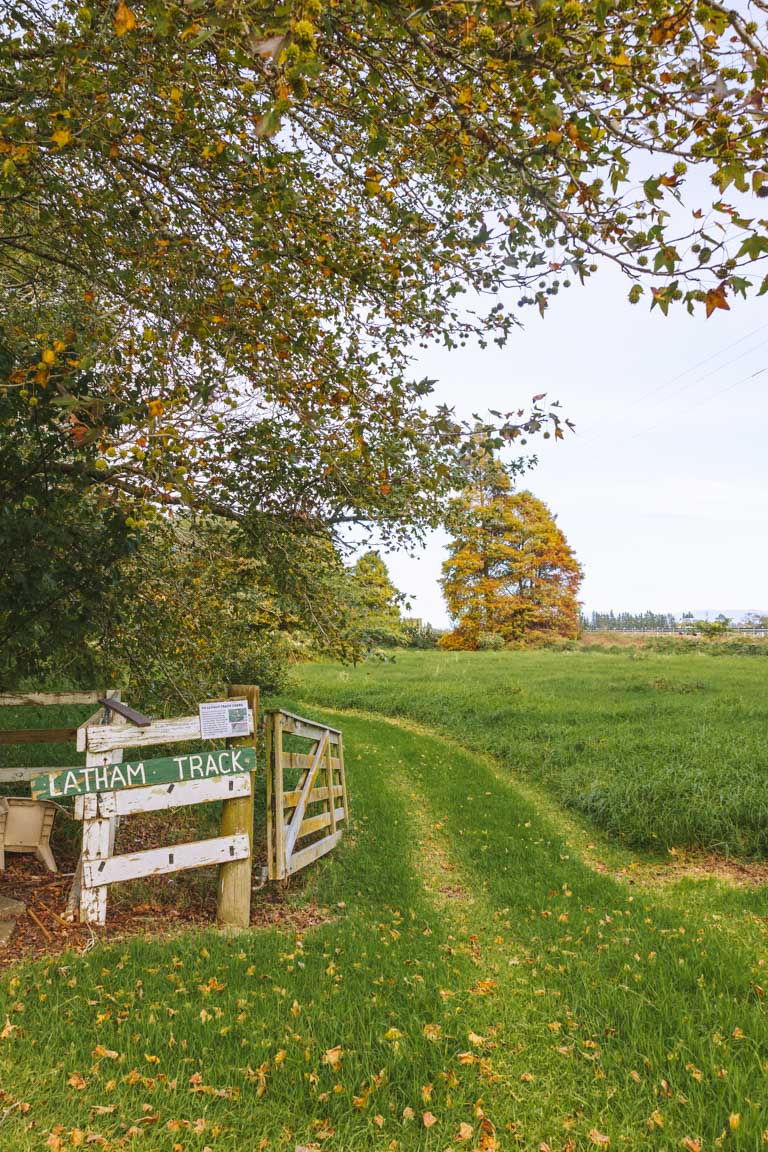
The other is the small lay-by on SH30, located here. This is technically the trailhead for the Te Tiringa Peak Track, which is a shorter section of the Latham loop.
Just note: this roadside parking is extremely limited – maybe 3 to 4 cars max. If you’re not arriving early, or just want to avoid stressing over parking, the hot pools are your best bet.
KEY INSIGHTS FOR HIKING LATHAM TRACK
Distance: 6.1 km | 3.9 miles
Elevation: 252 meters
Duration: 1 hour 45 minutes
Difficulty: Medium
Trail Type: Loop
Open: Year-round
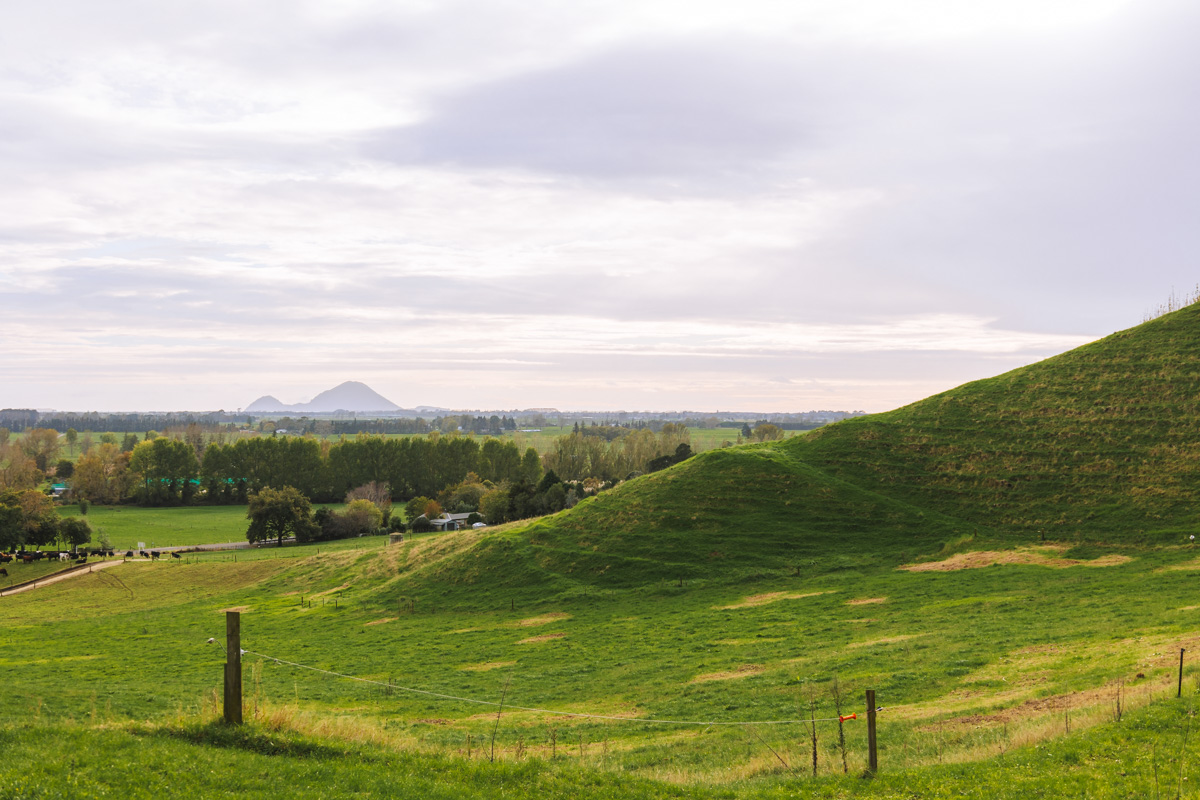
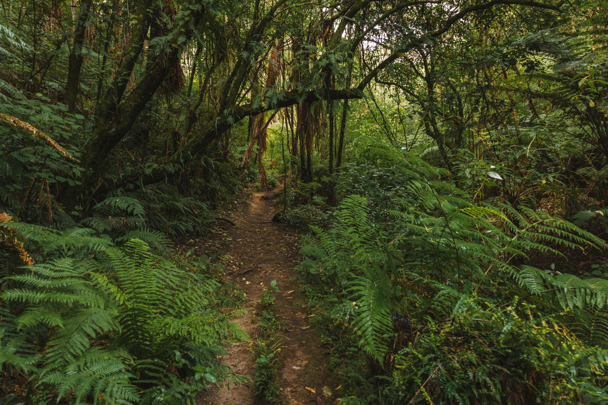
I started the Latham Track from the Awakeri Hot Pools and took the loop clockwise. It meant knocking out the roadside section of State Highway 30 first. It’s not the most scenic start and does feel quite unnatural, but it’s short and over with in about 10–15 minutes. Once you start onto farmland and shortly after forest, it’s a complete shift in mood: birdsong, and blissfully quiet.
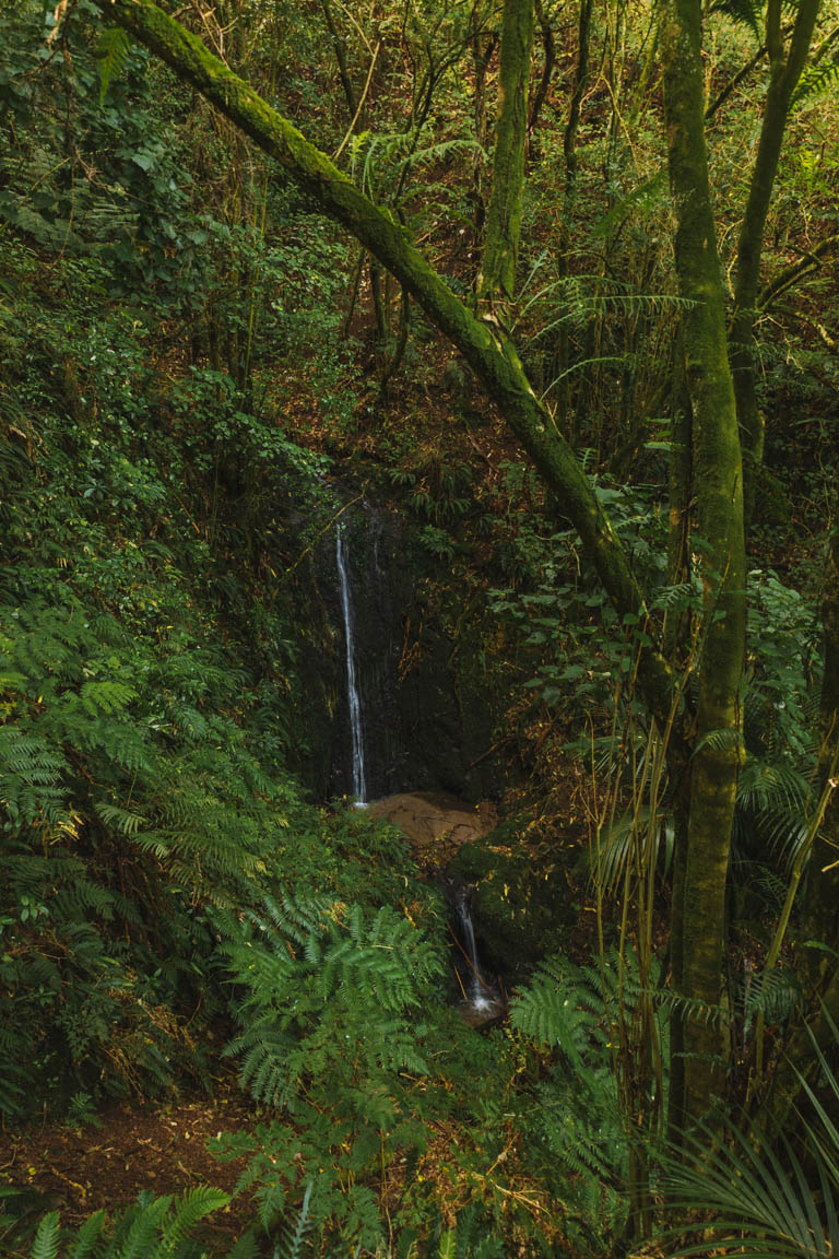
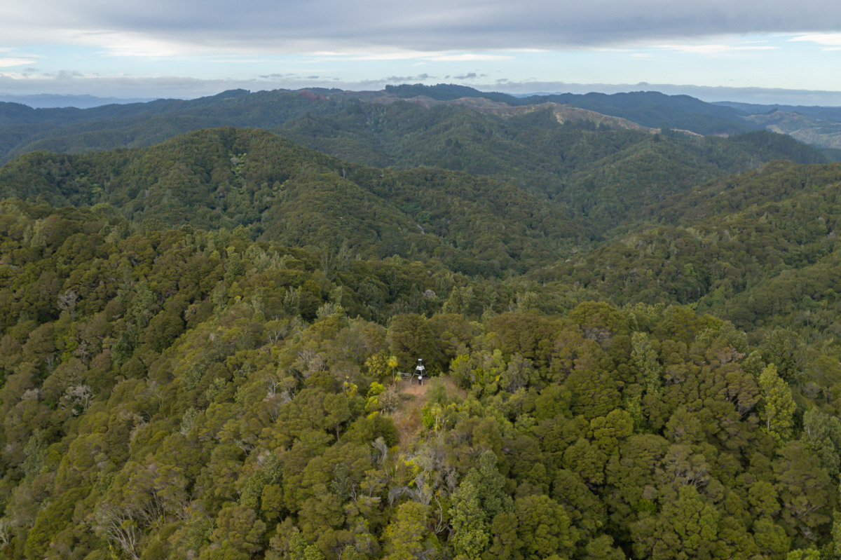
The track itself is easy to follow. Most of the climb is steady and shaded, with native bush keeping things cool even on a warm day. When you get close to the summit of Te Tiringa, the views start creeping in.
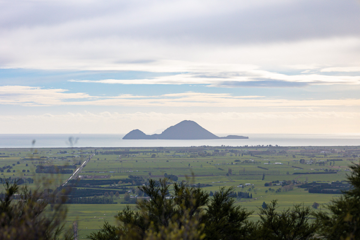
The summit of the loop sits just over 240 metres, offering sweeping views across the Bay of Plenty. From here you’ll see Whale Island front and centre and if you’re lucky and you get a clear day, you’ll even see Whakaari (White Island).
The descent from the summit although steep and little rough on the knees was manageable. I imagine doing the loop in reverse (anti-clockwise) would be even tougher.
In all honesty, if I was to do this hike again, I would skip the loop entirely and do the alternative–the Te Tiringa Peak Walk. Starting from the small lay-by on SH30 that I mentioned earlier, it’s a there-and-back trail to the summit with the same destination and no highway walking. If you’d like to compare, you can view the Te Tiringa Peak Walk on All Trails here.

BEST TIME TO VISIT
I hiked the Latham Track in early May, and while the temperature was perfect, the sky was slightly overcast which unfortunately meant the views weren’t as good as I’d hoped.
So if you’re after stunning blue skies, I’d highly suggest doing this track in summer. A large majority of the path is shaded, so even on a warm day, you’ll stay relatively cool.
HOW CROWDED IS THE LATHAM TRACK
In short–it’s not. This is one of the quietest tracks I’ve done on the North Island.
Even on a weekend morning. I set off around 8 am didn’t pass another soul. So if you’re craving a solo nature fix without going off-grid, this track hits the mark.
IS IT SAFE TO TRAVEL LATHAM TRACK SOLO
I hiked this trail solo and felt completely safe.
The path is well-marked and not technical. Just follow basic solo hiking tips–let someone know where you’re going, pack the essentials, and stay alert for weather changes.
I found that my signal was patchy in places, so just in case consider downloading a map offline beforehand.
PHOTOGRAPHING THE TRAIL
The Latham Track offers a few different photography opportunities, especially if you enjoy forest shots or macro detail. In autumn, I spotted several clusters of mushrooms and interesting foliage.
The bush in parts is dense and shaded, which means you’ll be working with low light. The summit of Te Tiringa speaks for itself – you’ll get that wide-angle landscape goodness. If you have a drone I’d definitely recommend bringing it along. It’s an easy space to launch and land and this way you can capture a little more of the surroundings.
SUMMARY
In this post, we’ve explored everything you need to know about hiking the Latham Track in the Bay of Plenty. From parking tips and walking directions to solo travel safety, this trail offers native bush, sweeping summit views, and barely another soul around, it’s a rare find.
Whether you take the full loop or opt for the Te Tiringa Peak Walk, the views are absolutely worth it.
Want more trails like this? Dive into some New Zealand’s ultimate destinations for more hidden gems. Or for a more broader reach, check out our comprehensive travel guides.