Hiking the North Island of New Zealand is something that everyone should get to experience. Undeniably, it’s a pretty stunning place, one that I am lucky enough to have as my own backyard.
If you’re looking to travel to New Zealand, you already know that we are extremely famous for our incredible scenery. The many hikes we have available in the North Island give us the ability to get amongst these beautiful landscapes and ultimately experience our outdoors first hand.
Below I share 10 of the incredible hikes the North Island has to offer (with a bonus at the end).
* Updated September 2025
This post may contain affiliate links, which means I’ll receive a commission if you purchase through my link, at no extra cost to you.

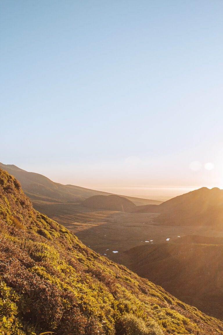
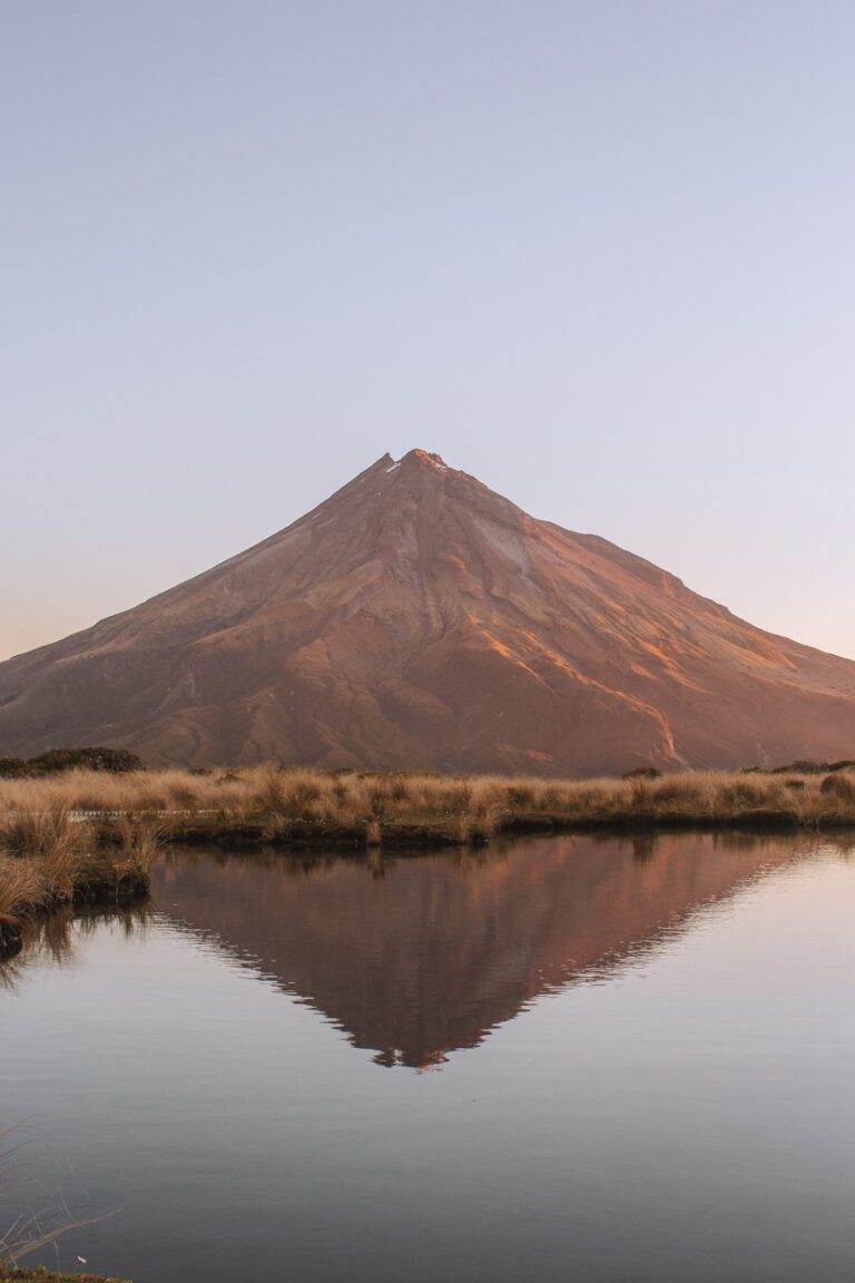
POUAKAI TARNS
Location: Taranaki, New Zealand
Distance: 12.4 km | 7.7 miles
Elevation: 777m
Duration: 6 hours
Difficulty: Moderate
Trail Type: There-and-back
Open: Year-round but be wary as this track can become impassable in winter conditions due to snow and ice.
Need to have: Water, food and sun protection. If staying overnight in the hut, you will then need an overnight pack with all the essentials and spare clothes.
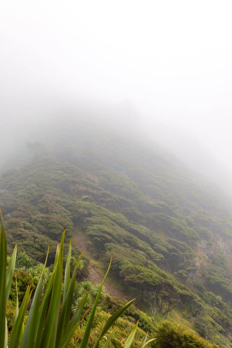
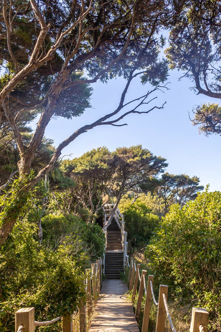
When hiking the North Island, New Zealand, Pouakai Tarns should definitely be on your list.
Firstly, to begin your adventure, you will need to head to the base of the Mangorei Track. From New Plymouth it is roughly a 20 minute drive.
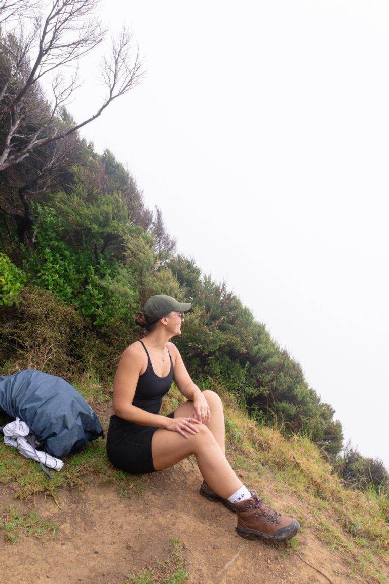
When it comes to experiencing the Pouakai Tarns, timing is everything. You’ll find that Mount Taranaki does like to hide even if there are no other clouds in the sky. To give yourself a few more options, just in case the weather isn’t on your side stay in the Pouakai Hut. It will allow you flexibility to witness the Tarns in different lights—during sunset, sunrise, and throughout the day, and is a back up just in case the weather is unpredictable.
As you explore don’t miss the opportunity to visit Henry Peak Lookout, an additional 30 minutes from the Tarns. It is a challenge with almost vertical stairs and ladders, but it’s well worth every step. You’ll be significantly rewarded with panoramic views of Mount Taranaki, the Pouakai Ranges, and the Tasman Sea. On a clear day, the view stretch as far as Mount Ruapehu.
For more info on this hike and what other great lookouts there are I’ve got you covered in this post which shares 8 must visit destinations in Taranaki.
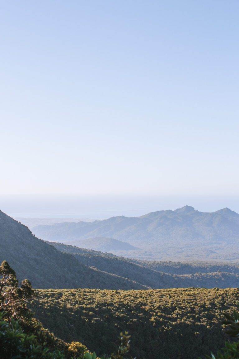
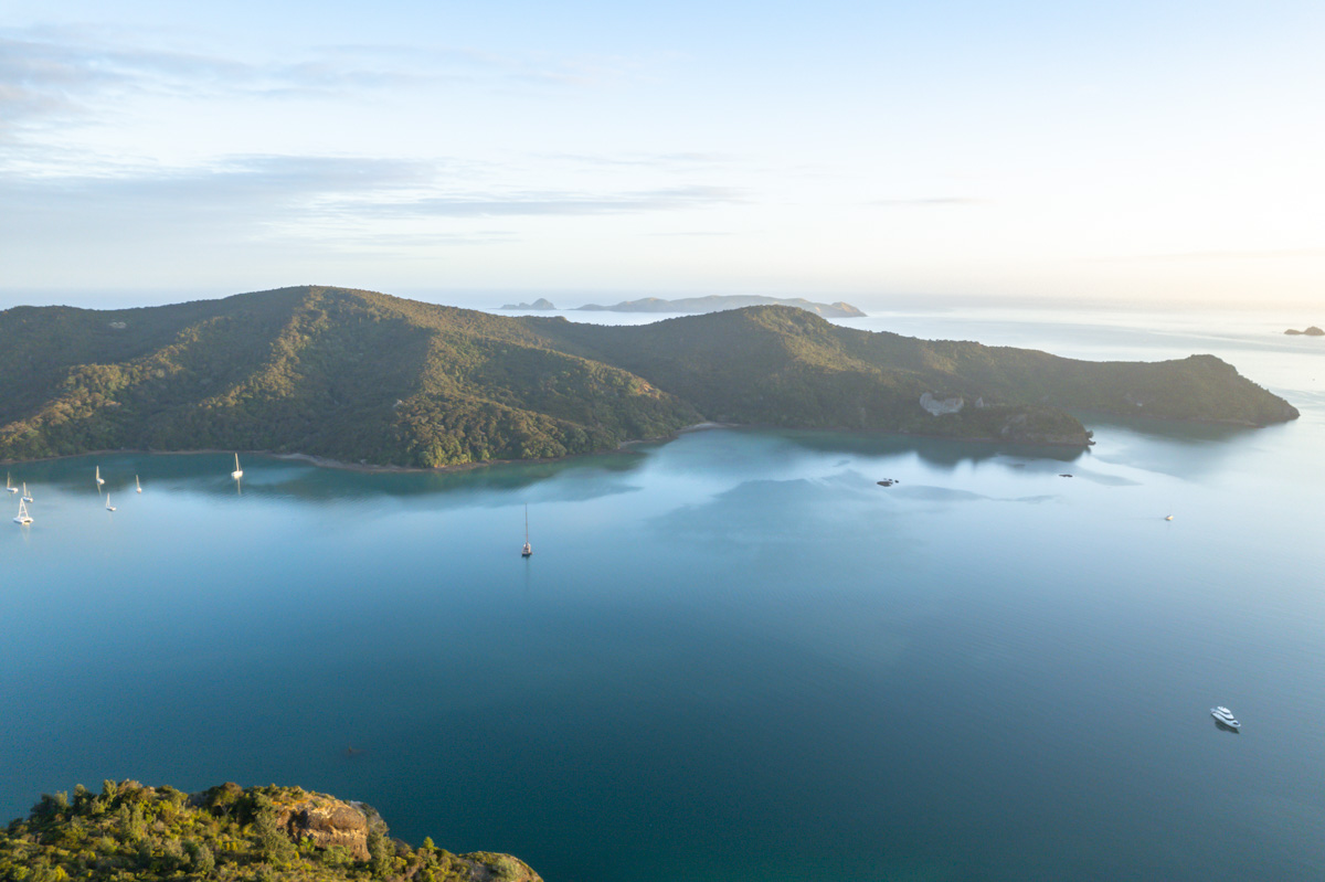
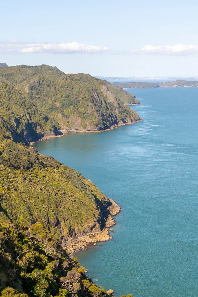
CAPE BRETT
Location: Bay of Islands, New Zealand
Distance: 30.3km | 18.8 miles
Elevation: 1791m
Duration: 11-12 hours
Difficulty: Difficult
Trail Type: There-and-back
Open: Year-round
Need to have: An overnight pack with all of your essentials. Water, food, sun protection, spare clothes and a walking permit (explained below).
Located in the picturesque Bay of Islands, Cape Brett stands proudly at the head of Cape Brett Peninsula in Northland. If you’re traveling from Auckland, expect a journey of approximately 3 and a half hours. If you’re planning on staying close by, Paihia is the closest township.
Straightaway as you are hiking this North Island, New Zealand trail, you’ll find yourself immersed in lush native forest, insane lookouts across the Bay of Islands and as cliché as it sounds, the incredible sounds of nature.
In terms of the track itself, Cape Brett is considered ‘advanced’ and in my experience, this isn’t due to its length but for its challenging terrain. There are significant stretches of both up-and-downhill sections.
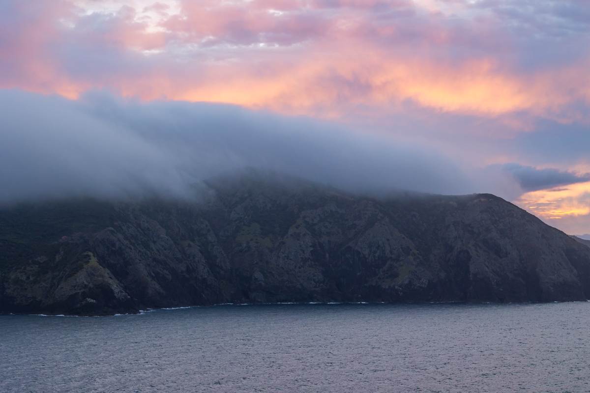
Also make sure you obtain a walkway permit before hiking Cape Brett and book your accommodation at Cape Brett Hut in advance if you plan on staying overnight here. The sunset from here it was undoubtedly the highlight of our hike, as the location offers breathtaking views extending north into the Pacific Ocean.
For more information on this hike check out everything you need to know in my Cape Brett blog post.
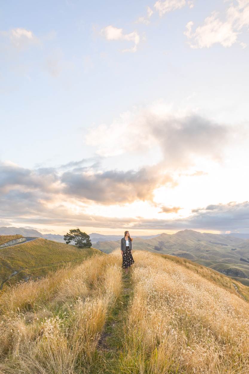
TE MATA PEAK
Location: Hawkes Bay, New Zealand
Distance: 4.3km | 2.7 miles (From Te Mata Peak Road Carpark)
Elevation: 206m
Duration: 1 hour 30 minutes
Difficulty: Moderate
Trail Type: There-and-back
Open: Year-round
Need to have: Water and sun protection.
Te Mata Peak is located in the Hawkes Bay, East Coast of New Zealand.
There are few different ways to get up to Te Mata Peak for sunset, including driving, biking and walking. If you do decide to drive just be wary that there are limited parking spaces so try get there early.
The walk is great as you get more time to soak in all the views as you slowly progress up the mountain. There are different options but I would suggest the walk from Te Mata Peak Road Carpark.
Whenever I have been to visit Te Mata Peak it’s been at sunset. I’ve heard sunrise is equally beautiful but there is something about that afternoon glow. I absolutely love sunrises for the quiet and getting up early helps to avoid the crowds but there is a certain ‘vibe’ about being at Te Mata Peak at sunset. And with many different spaces to roam there is plenty of room for everyone.
If you’re keen for all the info, you’ll find it in my Te Mata Peak blog post.
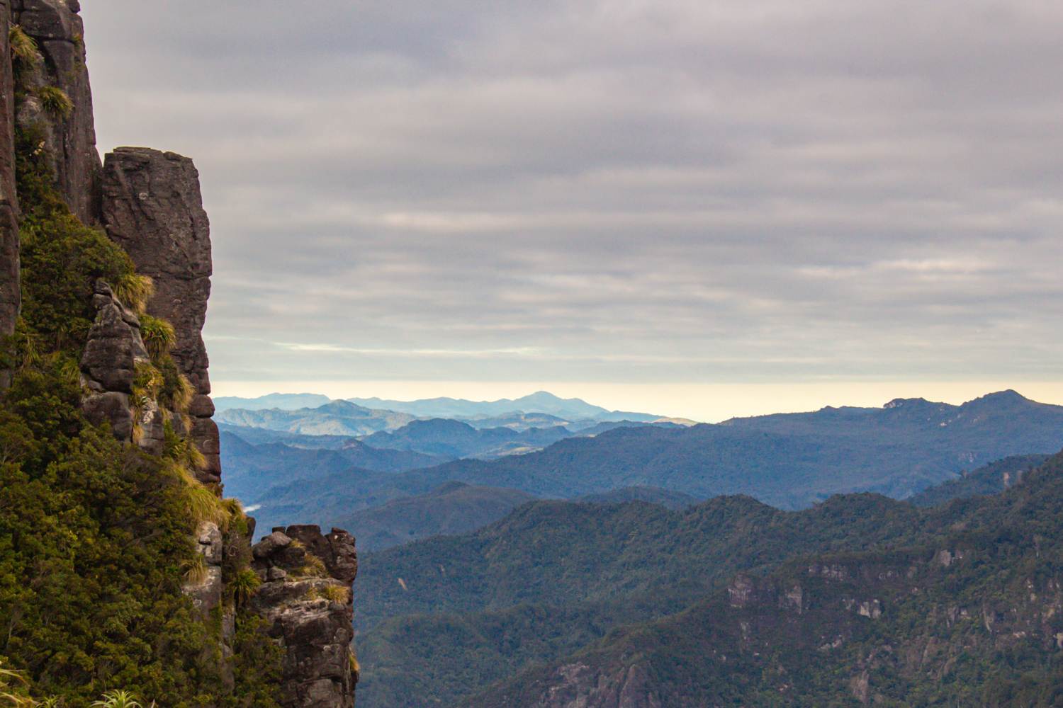
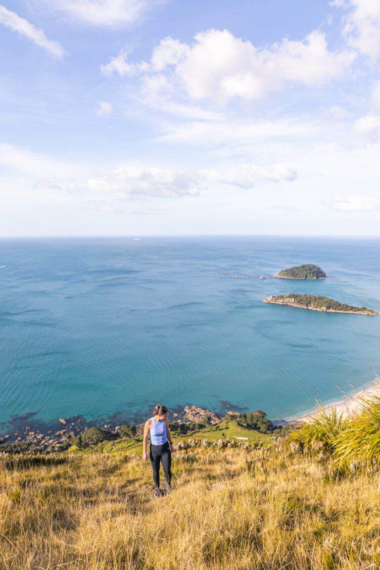
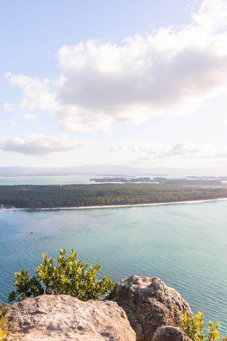
THE PINNACLES (KAUAERANGA KAURI TRAIL)
Location: Coromandel, New Zealand
Distance: 14.2 km | 8.8 miles
Elevation: 826m
Duration: 4 – 5 hours
Difficulty: Moderate
Trail Type: There-and-back
Open: Year-round
Need to have: Water, food and sun protection. If staying overnight in the hut, you will then need an overnight pack with all the essentials and spare clothes.
The Pinnacles Summit hike is challenging, but the views make it well worth it.
The majority of the hike will take you through lush forest, punctuated by occasional clearings and swing bridges. There are a lot of uneven steps on this trail and as you will be ascending to 759 meters a large amount of this is uphill (not forgetting the ladders towards to the end of the hike). It can be jarring for the legs but the payoff at the summit is undeniable, with sweeping panoramic views spanning Coromandel Forest Park and the Waikato region.
I hiked the Pinnacles at sunrise and I can imagine golden hour and sunset would be stunning here, too. For me, it was worth the early start but no matter what time you are hiking expect some company along the trail.
Whilst it is normal to complete within a day, there’s also the option of spending the night at a nearby hut nestled near the peak. For those considering an overnight stay, booking the hut in advance is recommended to secure a spot.
I’ve written about the Pinnacles hike in more detail which you can check out over here.
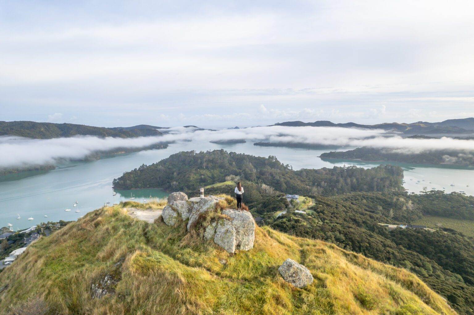
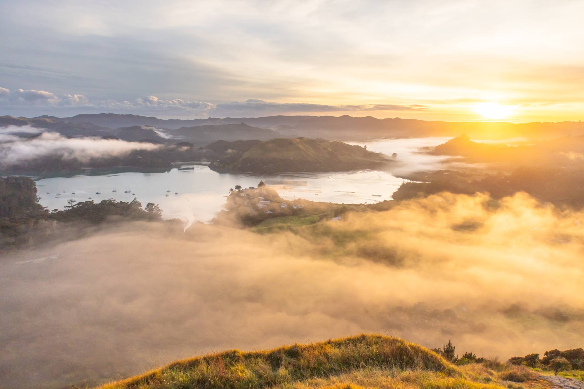
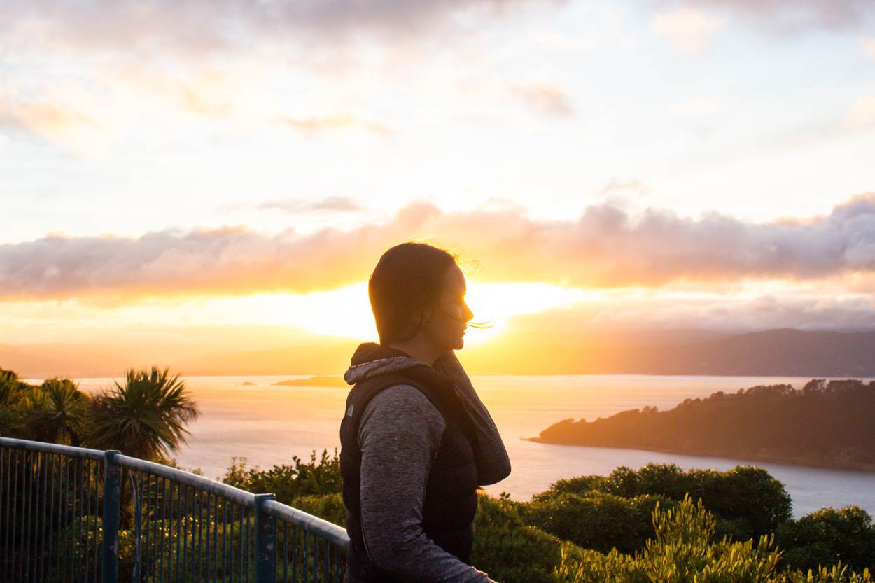
DUKES NOSE LOOKOUT
Location: Bay of Islands, New Zealand
Distance: 10.8km | 6.7 miles
Elevation: 518m
Duration: 5-6 hours
Difficulty: Moderate
Trail Type: There-and-back
Open: Year-round
Need to have: Water, food and sun protection. If staying overnight in the hut, you will then need an overnight pack with all the essentials and spare clothes.
Dukes Nose is a challenging but amazing hike that offers stunning 360 views of Waitepipi, Te Were, Pekapeka Bays and beyond. The trail is located just a short drive from Whangarei and takes around 5-6 hours to complete.
Most of the trail winds its way through the native bush, climbing steadily till you have roughly half an hour of the hike left. From there it is quite a steep ascent to the summit.
I’ve completed this hike twice now, both for sunrise and the timing was perfect. We had the entire summit to ourselves both times, only coming across others on our descent but make sure to bring a headlamp if you plan to do this. There are parts which are a little tricky to navigate with swamplands and stream crossings.
Want more info on this hike? Click here for everything you need to know on the Dukes Nose Hike in 2025.
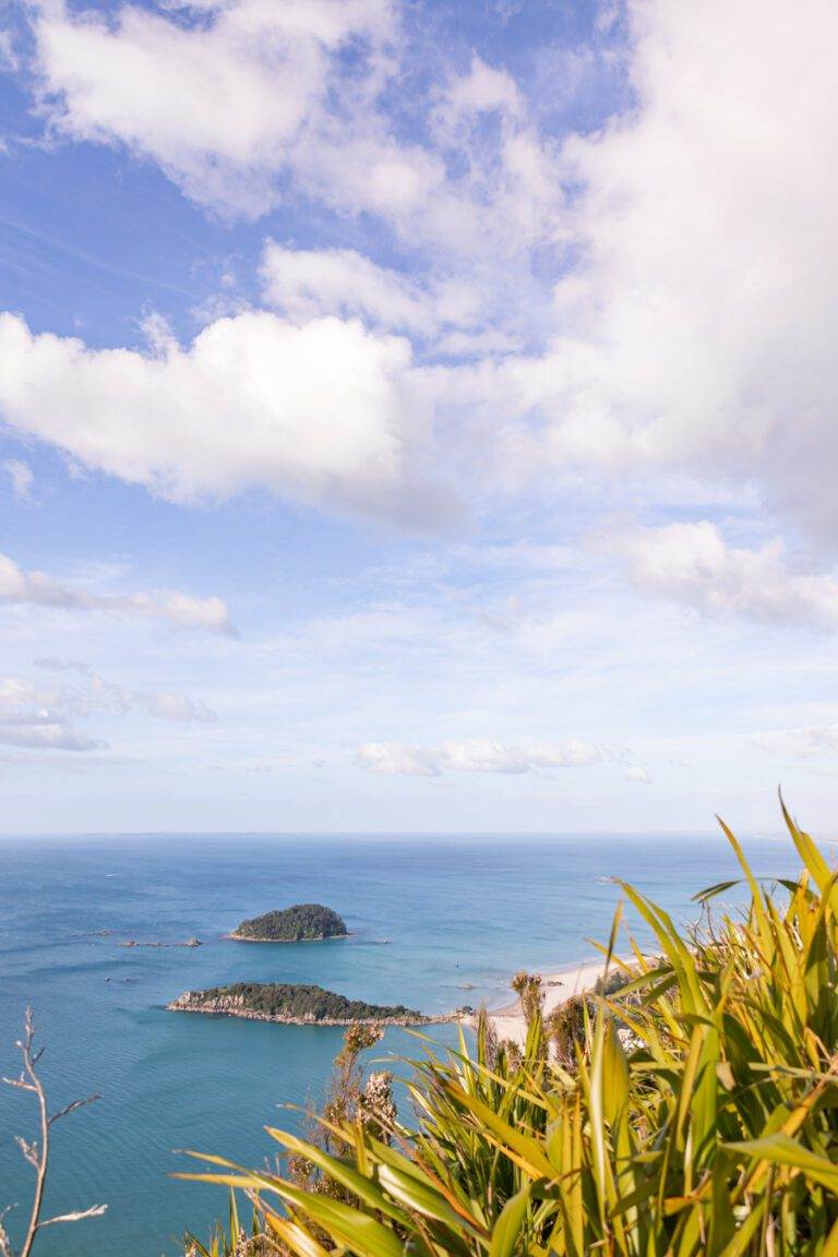
MOUNT MAUNGANUI
Location: Bay of Plenty, New Zealand
Distance: 3.9 km | 2.4 miles
Elevation: 207m
Duration: 1 hour
Difficulty: Easy
Trail Type: There-and-back
Open: Year-round
Need to have: Water and sun protection.
Mount Maunganui is one of the more popular hiking spots in the North Island, New Zealand, especially when visiting the Bay of Plenty, but for good reason. Once at the top it’s 360 views across the Eastern Coast, Matakana Island and the Pacific which are pretty incredible.
Similar to Te Mata Peak, no matter what time you go (even for sunrise, although parking is much more convenient at this time), it’s busy. However, with plenty of lookout points along the way you’ll easily get a variety of landscapes that avoid the crowds.
It’s also a fairly quick walk there and back so its perfect for a morning hike and once back at the base you can enjoy one of the great cafes for breakfast and coffee or a dip at the beach.
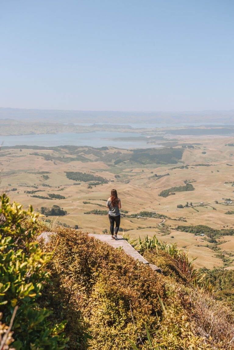
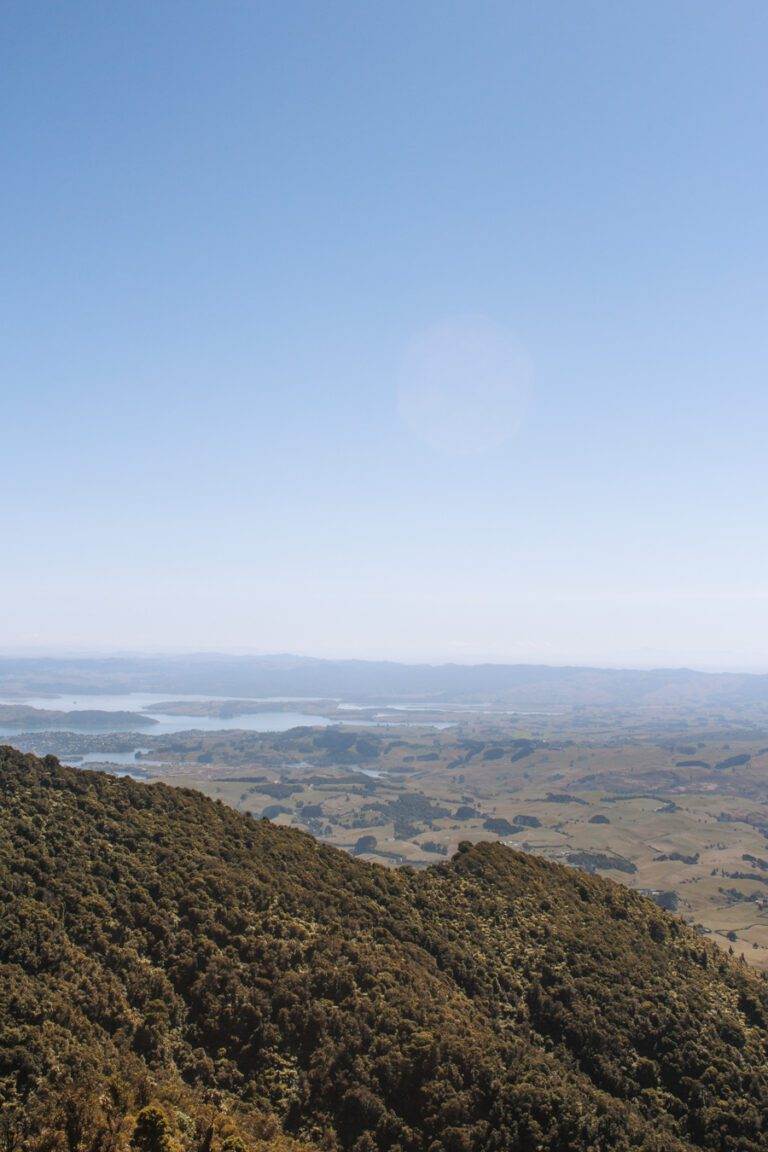
MOUNT KARIOI
Location: Raglan, New Zealand
Distance: 7.9 km | 4.9 miles
Elevation: 640m
Duration: 3 hours 30 minutes
Difficulty: Medium – Difficult
Trail Type: There-and-back
Open: Year-round
Need to have: Water, food and sun protection.
When I think about hiking in the North Island of New Zealand, Mount Karioi is one that immediately comes to mind.
It’s undoubtedly one of the more challenging day hikes I’ve done. Walking this in the peak of summer and in dry conditions posed their own set of obstacles, mainly at the start/end of the trail. This led us through stretches of hip-height grass and sandy, slippery terrain, before heading into native forest where you will need to use chains to negotiate certain sections. A ladder to the summit is also included, too.
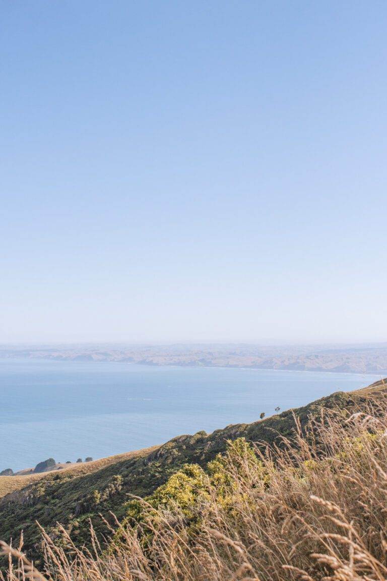
Muddy conditions are more likely in colder months making the hike that bit more challenging. However, the views across the Tasman Sea, the western coastline of the North Island and through native New Zealand bush definitely makes all of the scrambling worthwhile.
When it comes to hiking Mount Karioi, there are a few options. You can opt for a there-and-back journey, choosing either side of the mountain to explore, or venture across from one side to the other.
During our excursion, we opted for the there-and-back approach, tackling the North trail. This decision spared us the logistical hassle of arranging transport at both ends of the trail. Additionally, this route allowed us to incorporate the cliff view walk.
If you’re wondering what you’re in for in full, my Mount Karioi Hiking Guide, has everything you need.
ST PAULS ROCK
Location: Bay of Islands, New Zealand
Distance: 1.1 km | 0.7 miles
Elevation: 100m
Duration: 30 minutes
Difficulty: Easy
Trail Type: There-and-back
Open: Year-round
Need to have: Water and sun protection.
St Paul’s Rock (Ohakiri Pa) is a rock formation made up of ancient volcano in Northland, New Zealand.
The ascent to the summit is straightforward, taking approximately 20-30 minutes and provides breathtaking views of the Whangaroa Harbour and the picturesque surroundings. When we visited at sunrise, we had the entire place to ourselves, experiencing a remarkable cloud inversion. Since this is a relatively short hike it’s one that’s possible to fit in with any other activities you have planned, so ideal if you have a jam packed itinerary.
For more detailed information about St Paul’s Rock, you can check out my blog post which explains everything you need to know.
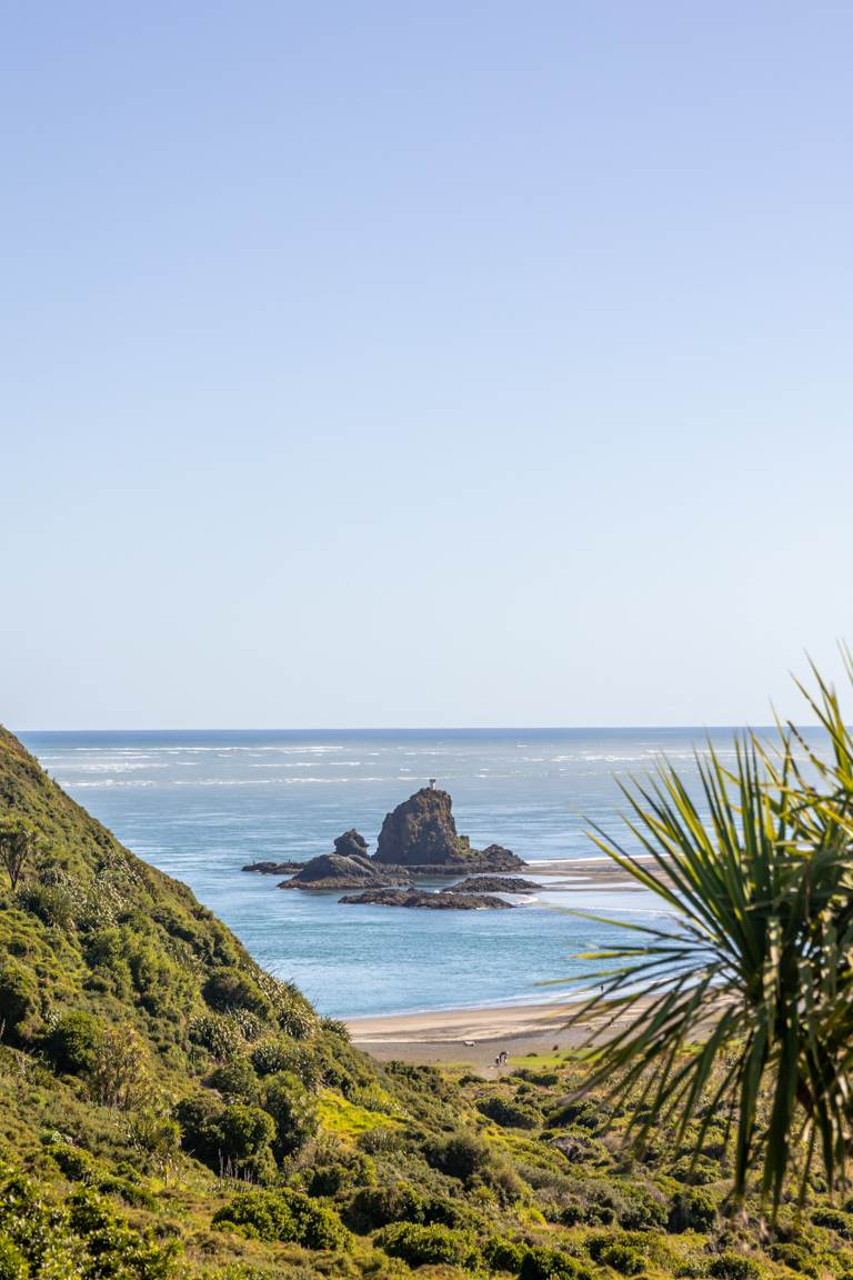
OMANAWANUI
Location: Auckland, New Zealand
Distance: 7.7 km | 4.8 miles
Elevation: 347m
Duration: 2 – 3 hours
Difficulty: Moderate
Trail Type: There-and-back
Open: Year-round
Need to have: Water, food and sun protection.
Omanawanui is one of the best day hiking spots in the North Island of New Zealand. Due to its southern location in the Waitākere Ranges, Omanawanui may take longer to reach than other Auckland walks. From central Auckland, it’s about 42km away, requiring approximately an hour and a quarter to get to. Though I’m 100% in the belief that it’s worth the hassle to get t0.
Venture out in the last hours of the day and from the summit you’ll be able to enjoy golden hour with some stunning views 360-degree views of Manukau Harbour, Auckland, Omanawanui, and Whatipu Beach. Just be warned that it is a bit of a challenge with over 2400 stairs. To finish off your evening visit Whatipu Beach for an incredible sunset.
There are a couple of entrances to the track, which splits on AllTrails. For the full track, follow both Omanawanui Track to Signal House Track and Omanawanui Track to Omanawanui. The Signal House Track leads from the beach entrance to the highest point, while the Omanawanui Track heads from the other entrance, with a smaller carpark on Whatipū Road. Note that the small carpark has limited space, fitting only about four cars. From here, you can also access the Puriri Ridge walk and the entrance to Don McClean.
Alternatively, if you don’t want to do the track there and back you can park two cars, one at either end or walk the track one way and the road the other. However, I must caution against the latter option as it’s not as safe. Also the views are minimal in comparison to walking the track.
I’ve written about this post in a little more detail in my Omanawanui walking guide for more of those extra details you may need.
MOUNT VICTORIA
Location: Wellington, New Zealand
Distance: 4.8 km | 3 miles
Elevation: 217m
Duration: 1 hour 40 minutes
Difficulty: Easy
Trail Type: There-and-back
Open: Year-round
Need to have: Water and sun protection.
Lastly (but not least), on our list is the The Mount Victoria Loop, a scenic walk that begins at Oriental Parade along the Wellington waterfront. The walk offers a diverse range of pathways, both on the mountain itself and in the surrounding area, making it easy to tailor the walk experience to your preference.
One of my highlights of doing this walk was experiencing sunrise from the top of Mount Victoria. Setting out early in the morning allowed me to witness the city awakening and the sun rising. With minimal crowds it was a peaceful way to start the morning.
I also found that while the ascent involves some uphill sections, the overall difficulty level is easy. With a moderate level of fitness, most people will find the trail manageable and enjoyable. The gradual incline provides a good workout too without being overly strenuous, ultimately making it accessible to a wide range of fitness levels.
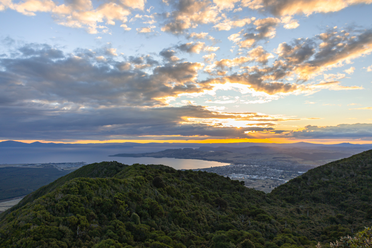
MOUNT TAUHARA
Location: Taupo, North Island
Distance: 7.3 km | 4.5 miles
Elevation: 520 meters
Duration: 2 hours
Difficulty: Medium
Trail Type: There-and-back
Open: Year-round
Need to have: Water and sun protection.
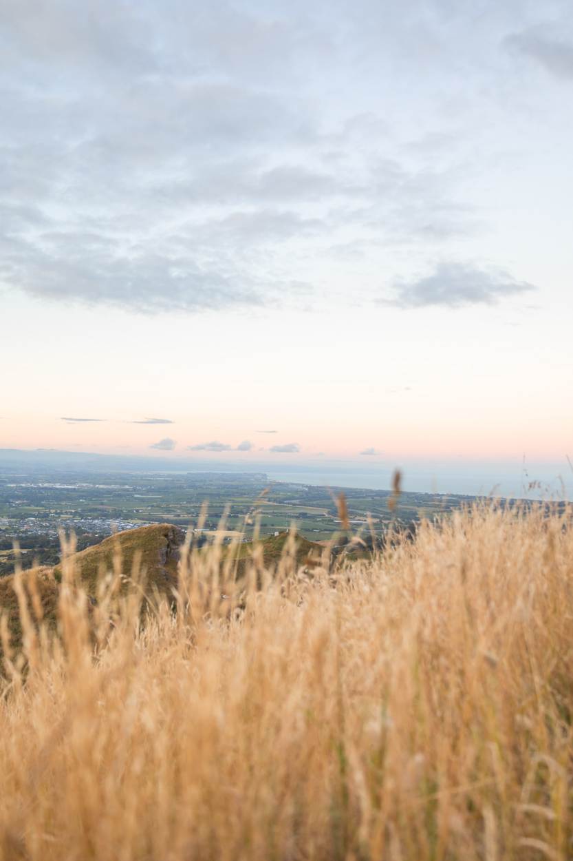
Just 10 minutes from Taupō in New Zealand’s Central North Island, Mount Tauhara is an extinct stratovolcano offering a rewarding 7.3 km hike. The trailhead at Mountain Road is easily accessible by car and has plenty of parking.
This there-and-back trail starts by winding through farmland. But once past here you’ll enjoy a bit more shade in native New Zealand forest with nature sounds, like those of the tūī and fantail.
Once at the summit you’ll get 360° views of Lake Taupō and Mount Ruapehu. It’s especially stunning at golden hour.
Taupo also boasts some other incredible activities like Huka Falls, Taupō Waterfront, or Māori Rock Carvings so make sure to make the most of your visit.
For more details, read the full Mount Tauhara guide here.
In summary, I hope this post has provided you with a glimpse into the diverse and breathtaking hiking experiences awaiting you in the North Island of New Zealand. From the challenging ascents of Mount Karioi to the serene pathways of St Paul’s Rock, each trail unquestionably offers its own unique adventure amidst the stunning landscapes of New Zealand’s wilderness.
Looking for more epic hikes? Explore my guides to New Zealand’s ultimate destinations or if you’re looking for even more adventures feel free to browse my comprehensive travel destination guides.
Top Travel Resources to Plan Your Next Trip
Finding the Best Flights
Skyscanner: A great platform for comparing flight prices across airlines and routes.
Omio: Perfect for comparing not just flights but also trains and buses, especially for European travel.
Booking Your Stay
Hostelworld: Ideal for budget travellers seeking hostels, guesthouses, or shared accommodations.
Booking.com: With a massive selection of hotels, apartments, and unique stays, this platform often has deals for frequent travellers.
Discovering Amazing Activities
GetYourGuide: My go-to for booking tours, tickets, and activities worldwide.
Everything New Zealand: A must for anyone traveling to New Zealand. This platform offers a curated selection of tours, activities, and adventures to make your Kiwi trip epic.
G Adventures: For small-group tours with a focus on sustainable and authentic travel, G Adventures is unbeatable.
Capturing Your Memories
MILK Books: Create stunning photo books to preserve your travel memories. Expect high-quality prints and customisable designs.
These links are affiliate links. If you book through them, I earn a small commission at no extra cost to you. Your support helps me keep sharing guides like this. Thanks for helping fuel the next adventure!