Coastal Walks in the North Island deliver everything from dramatic cliffs and black-sand beaches to historic pā sites and volcanic views.
Whether you’re after a peaceful sunrise stroll or a full-day challenge with sweeping sea views, the North Island has a track to match. Some trails hug iconic coastlines, while others lead to lookout points you’ll have all to yourself.
This post rounds up some of the best coastal walks I’ve personally walked in the North Island, including both well-known favourites and lesser-trodden gems.
This post may contain affiliate links. Your purchase through these links supports me with a commission, at no added expense to you.
TĀWHARANUI POINT VIA NORTH AND SOUTH COAST TRAILS, AUCKLAND
Location: Auckland
Distance: 9 km | 5.6 miles
Elevation: 360 meters
Duration: 2 hours 30 minutes
Difficulty: Easy
Trail Type: Loop
Open: Year-round
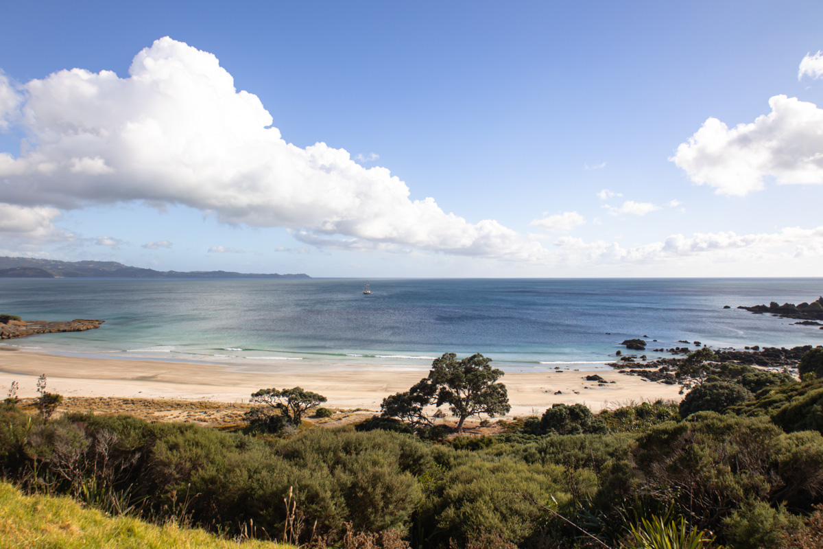
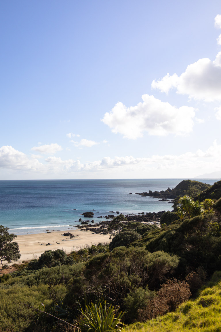
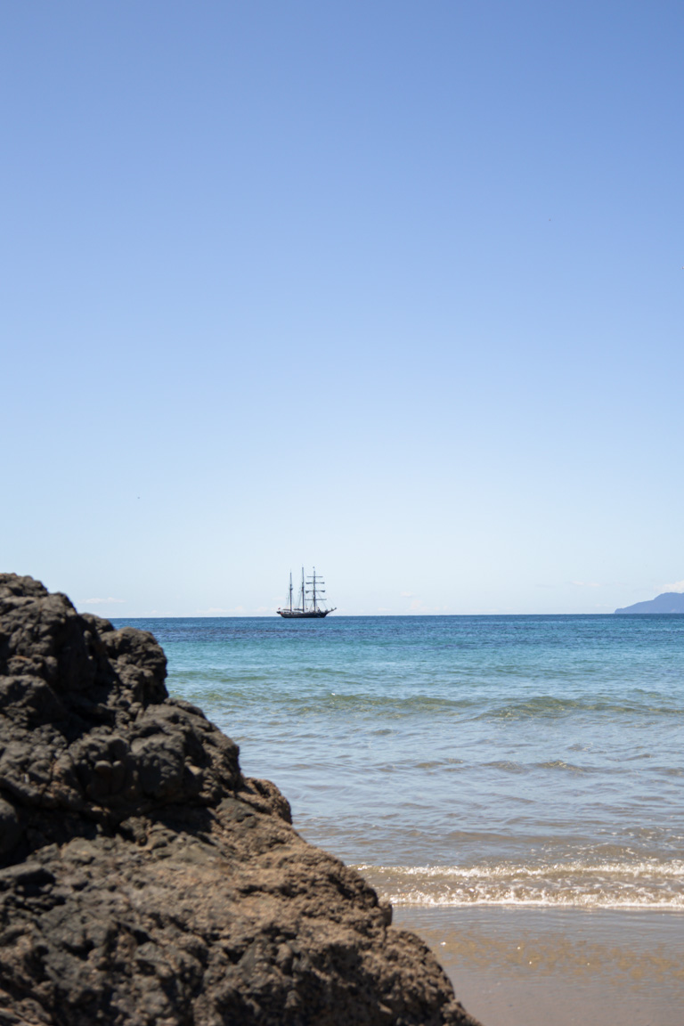
Looking for one of the most scenic coastal walks in the North Island that still flies under the radar? Start here.
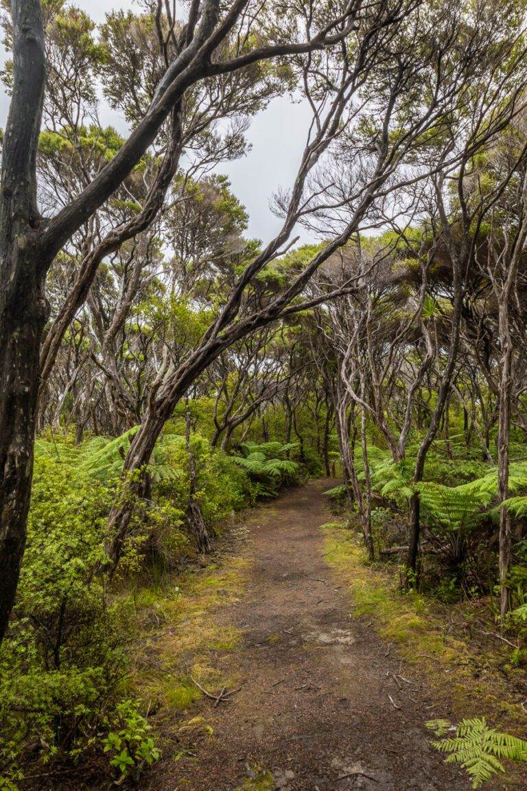
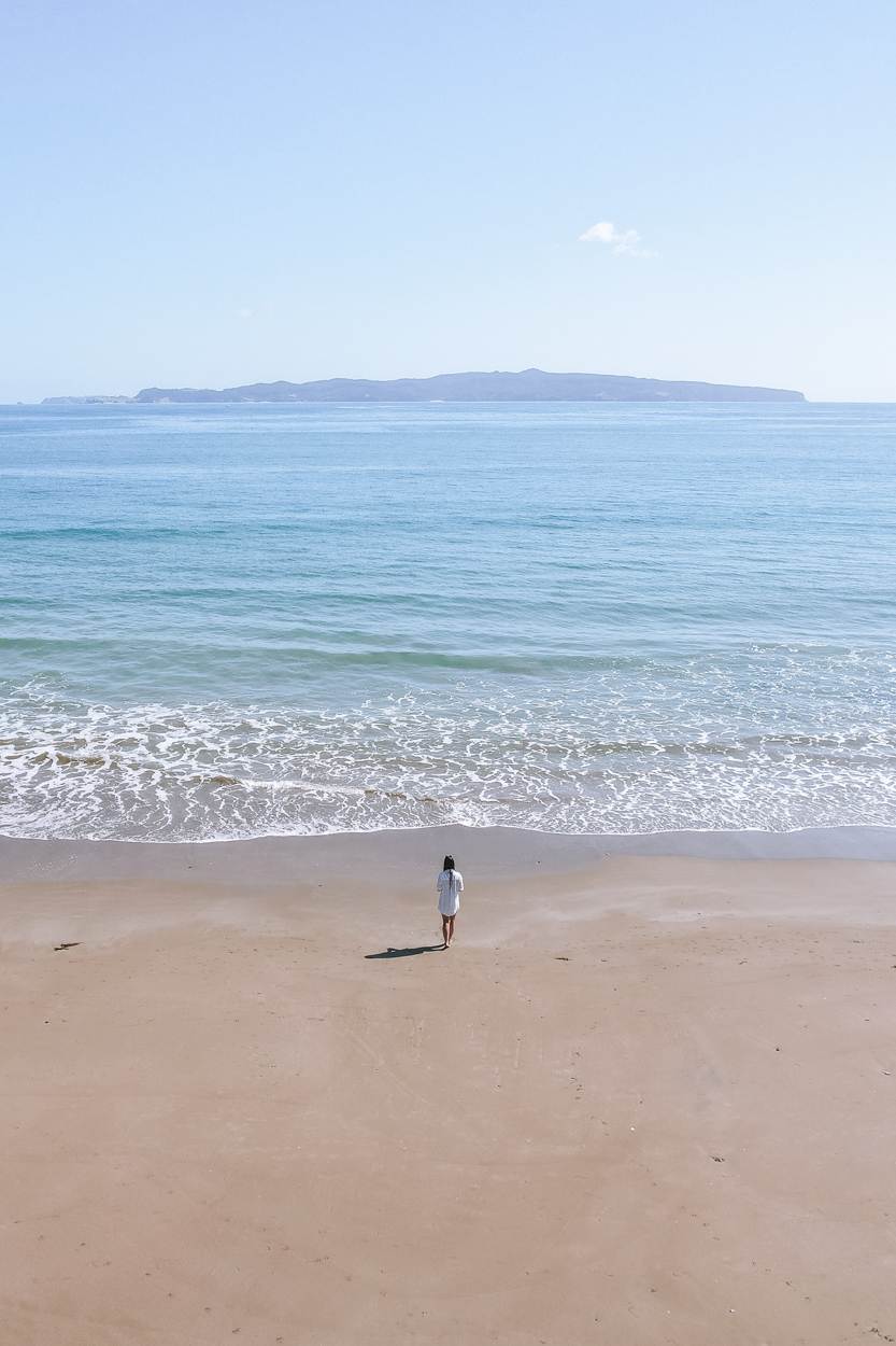
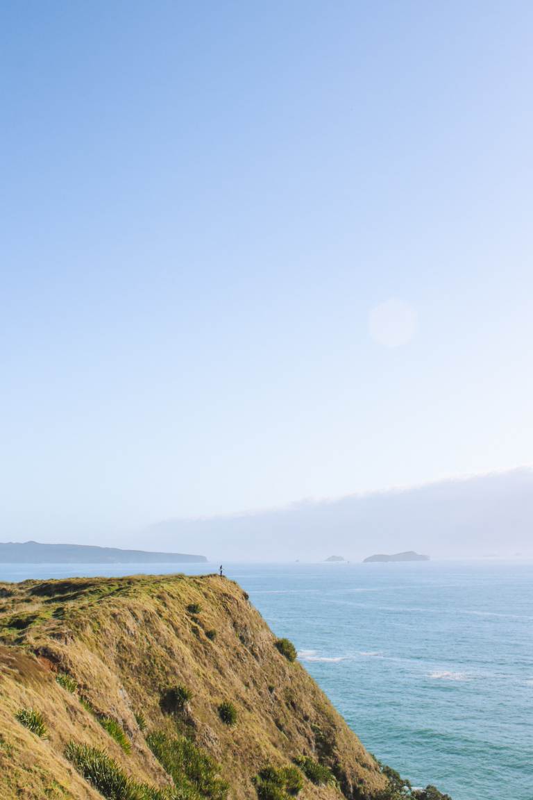
Just over an hour from Auckland, you’d think this spot would be more popular than it is. Especially because Tāwharanui Point blends a golden sand beach, rolling farmland, and native bush into one peaceful loop walk. It follows the North and South Coast Trails inside the Tāwharanui Regional Park, offering a quiet alternative to more crowded coastal tracks.
While this will take you a couple of hours, the coast will be in full view the entire trail. You can also expect birdlife, meandering sheep, and wide open landscapes through out the walk. The 9km loop is relatively easy (there are a few hills here and there) but it’s worth giving yourself the time to enjoy it.
Weekdays or early starts are best if you’re chasing a more peaceful experience. An early morning paired with this hike, followed up with a swim at Tāwharanui Beach is the perfect way to spend a day.
To learn everything you need to know about this incredible walk, I’ve got a full outline here on the Tāwharanui Point walk.
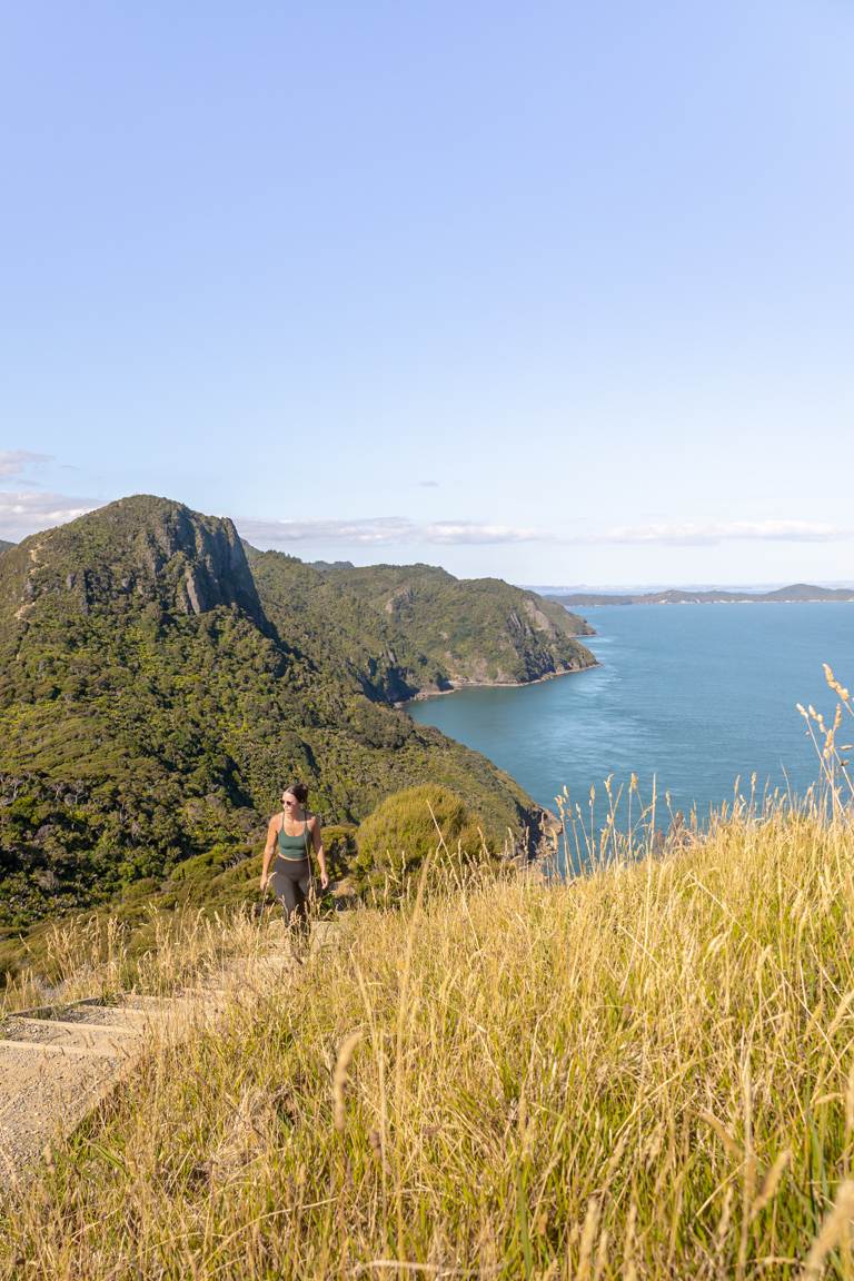
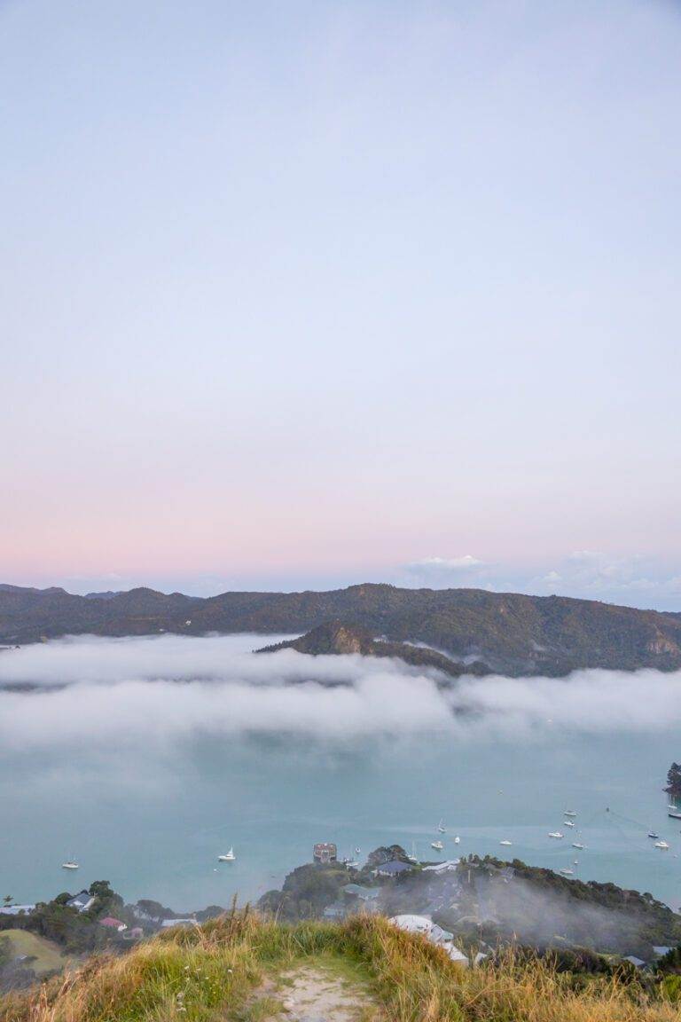
CAPE BRETT, NORTHLAND
Location: Northland
Distance: 30.3km | 18.8 miles
Elevation: 1791m
Duration: 11-12 hours (one night, two days)
Difficulty: Difficult
Trail Type: There-and-back
Open: Year-round
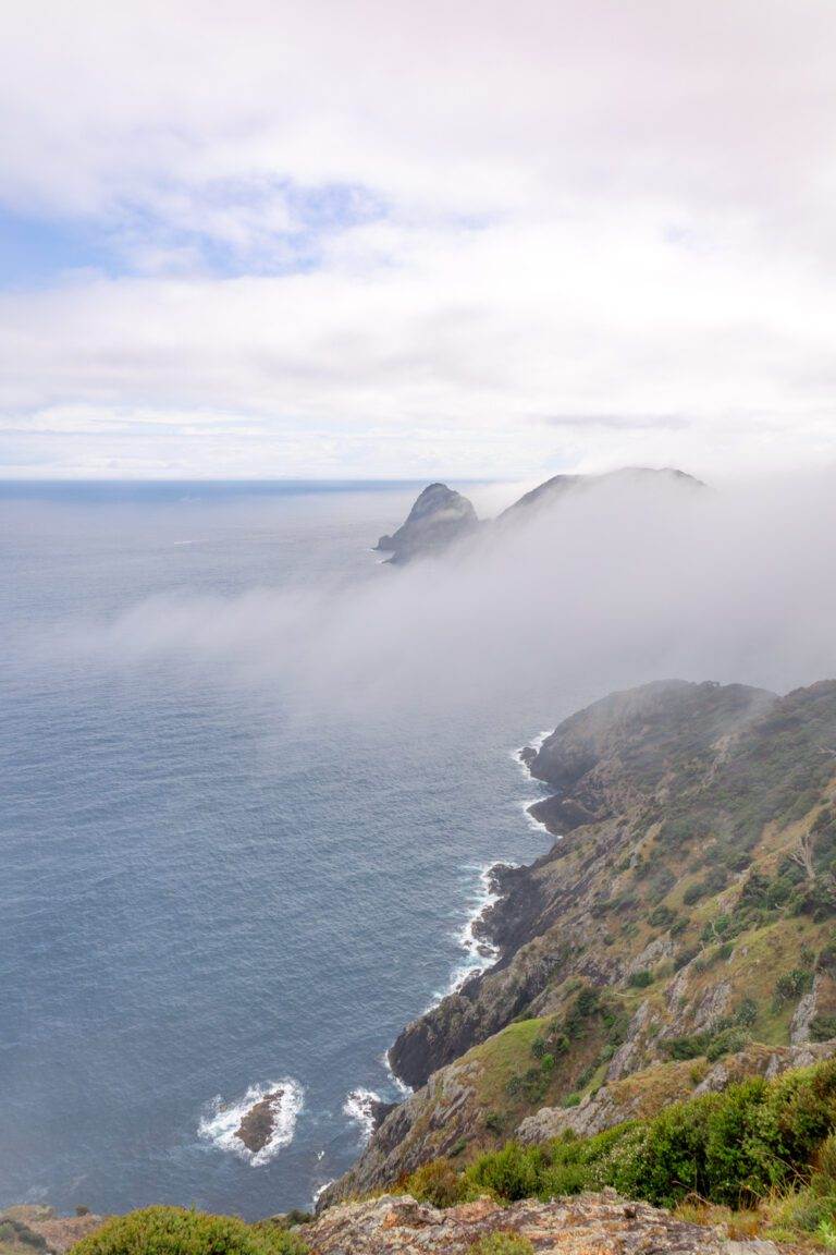
If you’re after a multi-day coastal challenge with big rewards, the Cape Brett Track delivers in spades.
This rugged trail winds through native bush and along dramatic clifftops in the Bay of Islands, finishing at the iconic Cape Brett Lighthouse. Or, if staying overnight, at the Cape Brett DOC Hut.
The views are wild. Think jagged coastlines, New Zealand forest, and sweeping ocean panoramas. But make no mistake: this is a tough walk and definitely considered ‘advanced’. There are steep ascents, exposed ridgelines, and as we also hiked this shortly after rain, many sections were quite muddy. A permit is also required, and bookings for the DOC hut are essential.
You’ll need to be prepared, but for those ready to commit, Cape Brett is easily one of the most rewarding coastal walks in the North Island. There’s also the option to water taxi from Deepwater Cove if you’d prefer to reduce the length of your walk.
For more tips I’ve written all about my Cape Brett experience here.
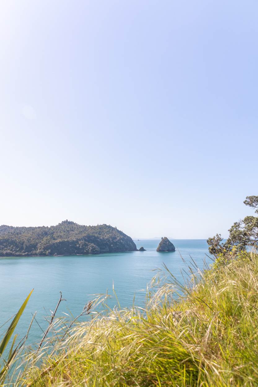
OPITO BAY PA, COROMANDEL
Location: Coromandel
Distance: 2.7 km | 1.7 miles
Elevation: 120 meters
Duration: 1 hours
Difficulty: Easy
Trail Type: There-and-back
Open: Year-round
This short loop track blends history, views, and coastline into one easygoing trail.
Located on the eastern side of the Coromandel Peninsula, the Opito Bay Pā Walk is located on an ancient Māori pā site. As a result, it offers stunning outlooks over to Mercury Islands and the Pacific.
The track itself starts on the beach, following a staircase that then leads to the grassy headland. My suggestion is to walk Opito Bay Beach, Pā and Crayfish Bay all in one go. Opito Bay Pā for sunrise, followed by photos at Crayfish Bay then back to the beach for a swim. This was the perfect summer day itinerary that I could never regret.
If you want a scenic walk with a story, Opito Bay is a fantastic, low-effort option with high payoff. If you’re curious to know more, I’ve covered it in this blog post.
POUAKAI TARNS, TARANAKI
Location: Taranaki
Distance: 12.4 km | 7.7 miles
Elevation: 777m
Duration: 6 hours
Difficulty: Moderate
Trail Type: There-and-back
Open: Year-round but be wary as this track can become impassable in winter.
Okay, this one isn’t strictly coastal, but the views of the coast are too good not to include.
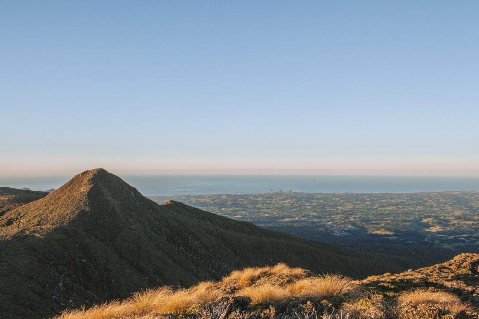
The Pouakai Tarns walk offers one of New Zealand’s most iconic reflections: Mount Taranaki mirrored perfectly in an alpine tarn. Surprisingly, the trailhead is only a 20 minute drive from New Plymouth too.
The Mangorei Track climbs steadily through lush forest before opening out into the Pouakai Ranges. From the viewpoint, you’ll see the coastline stretching toward town, with the volcano rising dramatically behind you. It’s especially magical at sunrise or sunset when the sky is changing colour and the reflection is crystal clear, with no wind.
Just to note that you’ll notice Mount Taranaki does like to hide even if there are no other clouds in the sky. To give yourself a few more options, just in case the weather isn’t on your side stay in the Pouakai Hut which you can book through DOC. This is just a short walk from the Tarns.
The track is well maintained, and while it’s a bit of a leg-burner, it’s achievable for most hikers. For a day adventure with massive payoff, this one’s unmissable. If you’d like a little more info on this hike I’ve got you covered.
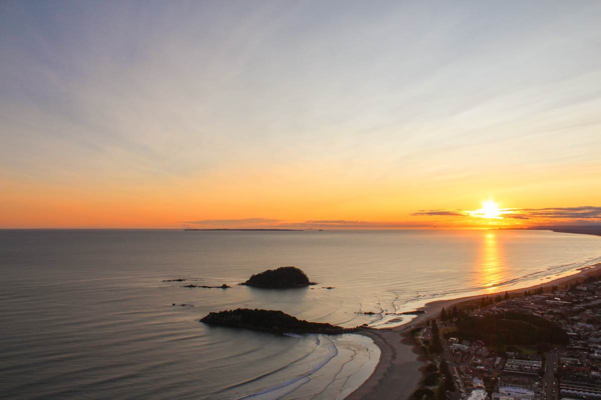
MOUNT MAUNGANUI SUMMIT TRACK, BAY OF PLENTY
Location: Bay of Plenty
Distance: 3.9 km | 2.4 miles
Elevation: 207m
Duration: 1 hour
Difficulty: Easy – Moderate
Trail Type: Loop
Open: Year-round
This popular Bay of Plenty track is a local favourite for a reason. In fact, the Mount Maunganui Summit Track is one of the standout coastal walks in the North Island, looping around and climbing up to reveal panoramic coastal views.
For the most part, the trail follows the ridge-line of the mountain but you will pass through shaded bush and open scrub. Once you’ve winded your way up to a summit you’ll have undoubtedly the best views overlooking Tauranga Harbour, Matakana Island, and the endless Pacific Ocean.
I can’t guarantee fewer crowds when walking early in the morning since many others know this spot is stunning at sunrise–it’s still worth it. The view here in the morning makes it all worthwhile, crowds or not.
While the trail is short, the climb can get your heart pumping. Take the steeper stairs up and loop back via the more gradual 4WD road if you prefer a gentler descent. Mount Maunganui is perfect for a sunrise mission, quick morning workout, or pre-beach stroll.
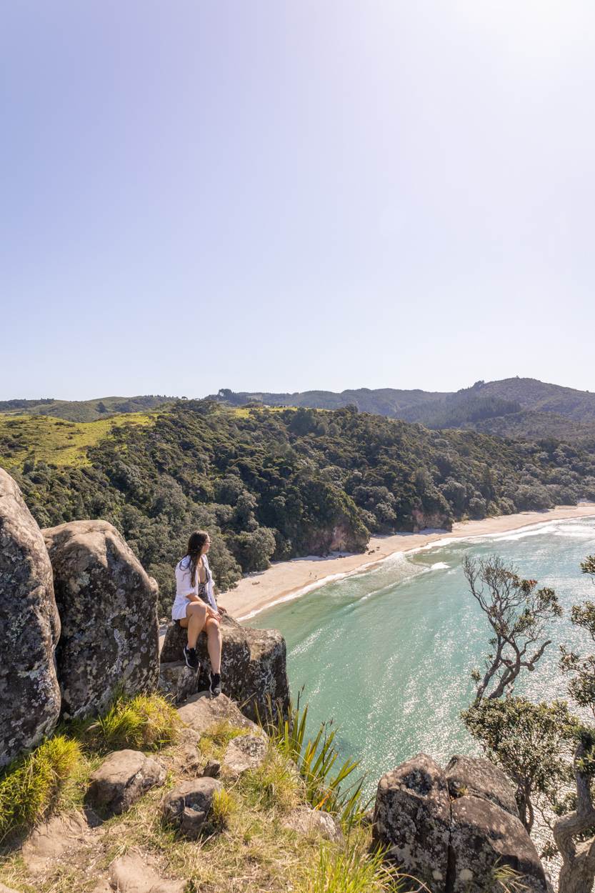
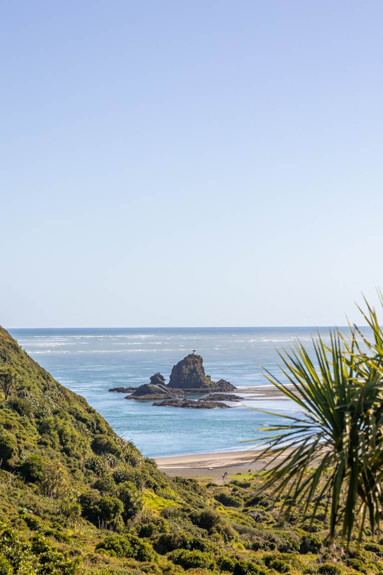
NEW CHUMS, COROMANDEL
Location: Coromandel
Distance: 5.1km | 3.1 miles
Elevation: 112m
Duration: 30 minutes
Difficulty: Easy
Trail Type: There-and-back
Open: Year-round
Tucked away on the Coromandel Peninsula, New Chums Beach is a postcard-perfect spot that still feels like a secret.
The short walk starts at Whangapoua Beach and follows a rocky track and bush path to a pristine stretch of golden sand with zero development. Therefore there are no roads, cafes, or cell signal–just native forest, turquoise water, and pure isolation. The walk is easy but can be slippery and tidal, so check conditions before you go.
This is definitely a summer recommendation. It’s when you’ll be able to enjoy the golden sands and incredible, blue waters at its best.
Bonus round: There’s also a short (but steep) side trail that leads to a viewpoint overlooking the beach. It’s a bit of a scramble, so bring sturdy shoes but if you’re up for it, the coastal views are incredible. I’ve shared more details about that lookout here.
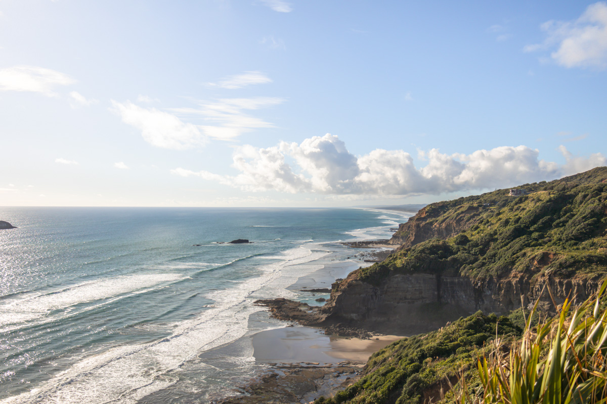
OMANAWANUI, AUCKLAND
Location: West Coast, Auckland
Distance: 7.7 km | 4.8 miles
Elevation: 347m
Duration: 2–3 hours
Difficulty: Moderate
Trail Type: There-and-back
Open: Year-round
If your legs are ready for a challenge, this is another Auckland based walk that should be on your list.
Omanawanui Track is a little different to the other coastal walks in the North Island as it features over 2,400 stairs. Yep, you read that right.. Expect an especially good leg workout. But the payoff is well worth it.
This is what I would consider a “type 2 fun” hike with the track being steep and exposed in parts. However, as you climb, you’ll get uninterrupted views over Manukau Harbour, Whatipū Beach, and the dramatic Waitākere coastline. The views are easily among the best in the Waitākere Ranges.
I’ve hiked this track multiple times, and trust me, it doesn’t get easier, but it never disappoints. If you’re ready to take it on, my Omanawanui Track guide has everything you need to know.
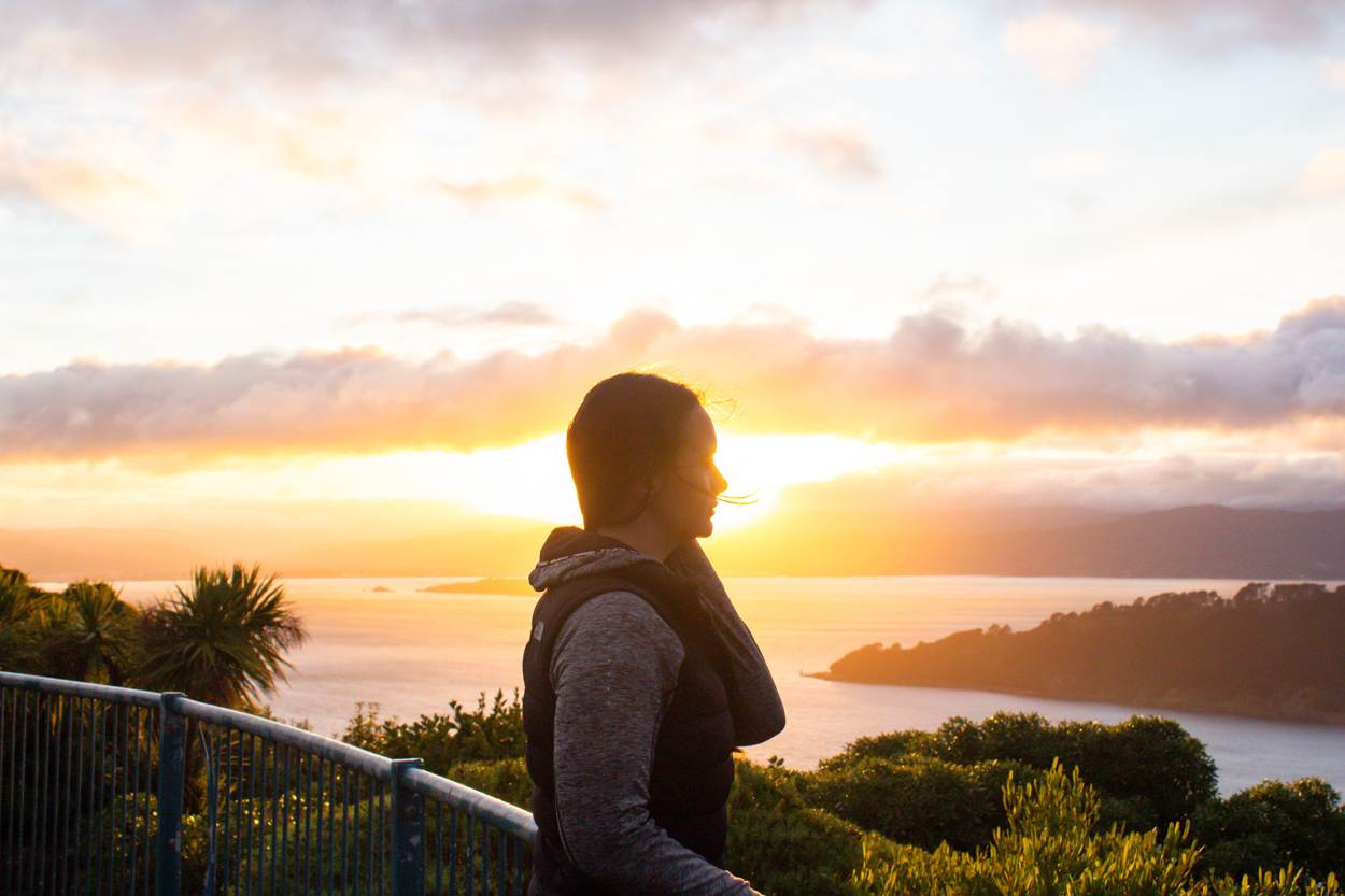
MOUNT VICTORIA, WELLINGTON
Location: Wellington
Distance: 4.8 km | 3 miles
Elevation: 217m
Duration: 1 hour 40 minutes
Difficulty: Easy
Trail Type: There-and-back
Open: Year-round
For a quick hit of Wellington’s coastline, skyline, and greenery, the Mount Victoria Loop is a solid pick.
Starting from Oriental Parade, the trail weaves its way up through quiet bush tracks to the Mount Victoria Lookout. You can tailor the route depending on time and fitness, as the walk offers a diverse range of pathways to choose from.
Also, early mornings are magic here. I caught sunrise from the top and watched the city slowly light up–with minimal crowds, just soft golden light and wide open views.
I also found that while the ascent involves some uphill sections, the overall difficulty level I would consider to be easy. With a moderate level of fitness, most people will find the trail manageable and enjoyable.
Mount Victoria feels a little different from the other coastal walks in the North Island–it’s right in the heart of the city, which definitely feels unexpected. This is why Wellington has such a great vibe and is well worth visiting.
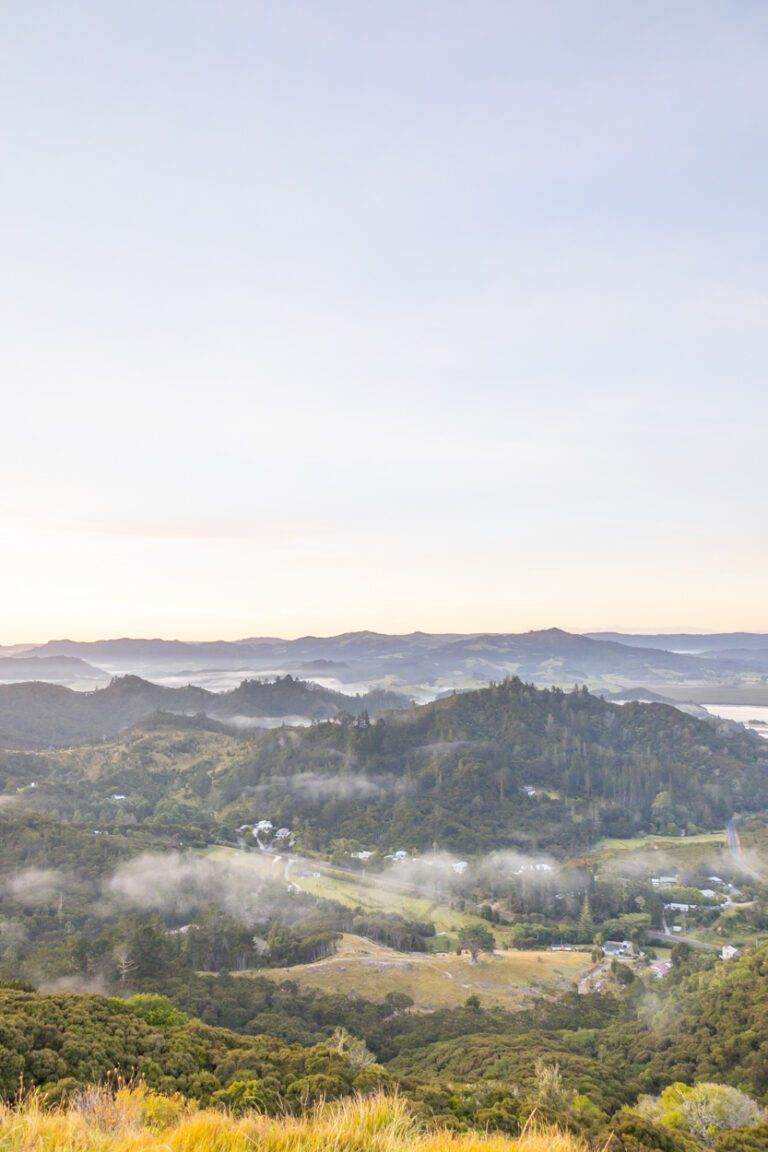
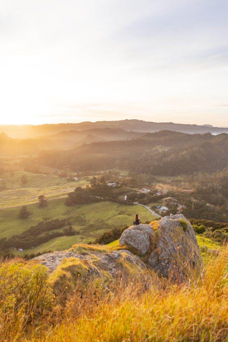
ST PAULS ROCK, NORTHLAND
Location: Bay of Islands
Duration: 30 minutes
Length: 1.1 km | 0.7 miles
Elevation: 100m
Difficulty: Easy
Open: Year-round
Need to have: Water and sun protection.
Okay, I may get in trouble for this one as it technically isn’t along a coastline. HOWEVER, it’s very close, and a hidden gem in Northland. Being one of the best short hikes with a view, it would be silly not to include it.
The track starts just outside the town of Whangaroa and climbs quickly to a lookout that towers above the harbour.
The ascent to the summit is straightforward, taking approximately 20-30 minutes. It is steep and short, but the last section does involve a scramble and chain-assisted climb. It sounds daunting but if I can do it, so can you.
At the top, you’re rewarded with 360° views over the inlet, forest-covered hills, and along the coast.
Even though we did this hike at sunrise the early start was definitely worth it. We had the lookout to ourselves and the best light, making it a morning to remember.
TE HENGA WALKWAY, AUCKLAND
Location: West Coast, Auckland
Distance: 3.7 km | 2.2 miles
Elevation: 170 meters
Duration: 1 hour 20 minutes
Difficulty: Easy
Trail Type: There-and-back
Open: Year-round
Want a shorter walk that’s an easy win? This is one of the coastal walks in the North Island that’s a great all-rounder.
Located an hour from Auckland, the Te Henga Walkway connects Bethells and Muriwai Beaches, forming a key section of the iconic Hillary Trail. While the full track remains closed after the large slips in 2023, the reopened section of Te Henga Walkway remains a short but picturesque walk in the Waitākere Ranges.
Begin your journey at Constable Road near Bethells Beach. Wander through lush farmland and vibrant native bush. The trail eventually leads to two spectacular spots: Cliff Viewpoint and Tirikohua Point. Both showcase sweeping vistas from Muriwai in the north to Bethells in the south.
If you’d like to stay informed about track conditions, check the Department of Conservation (DOC) website for the latest. Also rather than cram it all in here, I’ve unpacked everything in another post you can dive into.
SUMMARY
In this post, I’ve shared some of the best coastal walks in the North Island. Each of these walks are different, but all worth lacing up for. From dramatic ridge trails to hidden bays and volcanic summits, these trails highlight the diverse beauty of New Zealand’s coastline.
Whether you’re road-tripping the Coromandel, day-tripping from Auckland, or planning a longer North Island adventure, there’s a coastal walk here to match your plans and pace.
Have a favourite coastal track I missed? Let me know– unquestionably, I’m always keen to explore more.
If this guide has you ready to explore more of NZ, dive into my full collection of New Zealand travel. Or, for adventures beyond Aotearoa, check out my global travel destinations.
FAQ's
What are the best coastal walks in the North Island for beginners?
Easy options include Tāwharanui Point, Opito Bay Pā, Mount Maunganui Summit, New Chums, Mount Victoria, and Te Henga Walkway. These are year-round and under 2-3 hours.
Which North Island coastal hikes are the most challenging?
Cape Brett (30.3 km there-and-back, 11-12 hours over 2 days with steep, muddy sections and 1791m elevation) and Omanawanui (7.7 km there-and-back with over 2,400 stairs and exposed ridges) are the toughest. Both require good fitness, preparation, and permits/hut bookings for Cape Brett.
Are there any multi-day coastal walks in the North Island?
Yes, Cape Brett Track is the standout multi-day option (2 days/1 night at the DOC hut), with clifftop views in the Bay of Islands. For shorter overnights, consider staying at Pouakai Hut near the Tarns for flexible weather options.
What’s the best time of year for coastal walks in the North Island?
Most are open year-round, but summer (December-February) is ideal for beaches like New Chums and Opito Bay. Avoid winter for Pouakai Tarns (can be impassable) and check DOC for Te Henga (reopened post-2023 slips).
Do I need permits or bookings for these hikes?
Yes for Cape Brett (permit is required; book DOC hut in advance). Others are free and open, but check Auckland Council or DOC websites for updates on conditions.
Which walks offer the best ocean or coastal views?
All of the hikes in this blog post offer the best ocean and coastal views.
Are these coastal trails suitable for families or kids?
Yes for easier ones like Tāwharanui (flat with sheep and beaches), Opito Bay Pā (short and historic) and Mount Maunganui (loop with options). Avoid advanced trails like Cape Brett or Omanawanui for young children due to steepness and exposure.
How do I get to these North Island coastal walks from Auckland?
Tāwharanui (1+ hour drive north), Omanawanui and Te Henga (1 hour west in Waitākere), Mount Victoria (fly/drive to Wellington, ~1 hour flight). Others require longer drives: Northland (2-3 hours), Coromandel (2-3 hours), Taranaki/Bay of Plenty (3-5 hours).
What should I pack for a North Island coastal hike?
Sturdy shoes (essential for scrambles like St Pauls Rock or slippery New Chums), water, sun protection, layers (weather changes fast), snacks, and a tide chart for beach accesses. For Cape Brett: full overnight gear and permit.
Are there any non-strictly coastal walks worth adding for views?
Pouakai Tarns (alpine with coastal vistas and Mt Taranaki mirror) and St Pauls Rock (harbour overlook near the coast) aren’t beachside but deliver epic sea panoramas–both rewarding additions to a North Island itinerary.
Top Travel Resources to Plan Your Next Trip
Finding the Best Flights
Skyscanner: A great platform for comparing flight prices across airlines and routes.
Omio: Perfect for comparing not just flights but also trains and buses, especially for European travel.
Booking Your Stay
Hostelworld: Ideal for those specifically looking to budget on their travels and seeking hostels, guesthouses, or shared accommodations.
Booking.com: With a massive selection of hotels, apartments, and unique stays, this platform additionally has deals for frequent travellers.
Trivago: A powerful search engine for comparing hotel prices across multiple booking sites to find the best deals for your stay.
Discovering Amazing Activities
GetYourGuide: My go-to for booking tours, tickets, and activities in New Zealand and worldwide.
Everything New Zealand: A must for anyone traveling to New Zealand. This platform offers a curated selection of tours, activities, and adventures to make your Kiwi trip epic.
G Adventures: For small-group tours with a focus on sustainable and authentic travel, G Adventures is unbeatable.
Capturing Your Memories
MILK Books: Create stunning photo books to preserve your travel memories. Expect high-quality prints and customisable designs.
These links are affiliate links. If you book through them, I earn a small commission at no extra cost to you. Your support helps me keep sharing guides like this. Thanks for helping fuel the next adventure!
LATEST FROM THE BLOG
LIKE THIS POST? PIN IT HERE
QUICK SUMMARY OF 10 SCENIC COASTAL WALKS AND WHERE TO FIND THEM
- Best Coastal Walks North Island NZ: 10 personally tested trails from easy strolls to multi-day challenges
- Locations Covered: Auckland, Northland, Coromandel, Taranaki, Bay of Plenty, Wellington
- Highlights: Dramatic cliffs, black-sand beaches, historic Māori pā sites, volcanic reflections, panoramic ocean views
- Trail Variety: Sunrise hikes, family-friendly loops, hidden bays, clifftop ridges
- Key Details Included: Distance, elevation, duration, difficulty, trail type, year-round access
- Insider Tips: Best times, crowd avoidance, permits, side trips, nearby swims